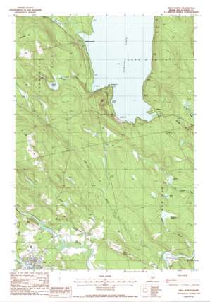
Milo North Topo Map Maine
To zoom in, hover over the map of Milo North
USGS Topo Quad 45068c8 - 1:24,000 scale
| Topo Map Name: | Milo North |
| USGS Topo Quad ID: | 45068c8 |
| Print Size: | ca. 21 1/4" wide x 27" high |
| Southeast Coordinates: | 45.25° N latitude / 68.875° W longitude |
| Map Center Coordinates: | 45.3125° N latitude / 68.9375° W longitude |
| U.S. State: | ME |
| Filename: | o45068c8.jpg |
| Download Map JPG Image: | Milo North topo map 1:24,000 scale |
| Map Type: | Topographic |
| Topo Series: | 7.5´ |
| Map Scale: | 1:24,000 |
| Source of Map Images: | United States Geological Survey (USGS) |
| Alternate Map Versions: |
Milo North ME 1978, updated 1981 Download PDF Buy paper map Milo North ME 1988, updated 1988 Download PDF Buy paper map Milo North ME 2011 Download PDF Buy paper map Milo North ME 2014 Download PDF Buy paper map |
1:24,000 Topo Quads surrounding Milo North
> Back to 45068a1 at 1:100,000 scale
> Back to 45068a1 at 1:250,000 scale
> Back to U.S. Topo Maps home
Milo North topo map: Gazetteer
Milo North: Bays
Berry Cove elevation 131m 429′Gerrish Cove elevation 131m 429′
Milo North: Capes
Norway Point elevation 131m 429′Milo North: Dams
Milo Dam elevation 82m 269′Schoodic Lake Dam elevation 129m 423′
Milo North: Lakes
Jaquith Pond elevation 156m 511′Mud Pond elevation 111m 364′
Norton Pond elevation 147m 482′
Milo North: Populated Places
Adams elevation 134m 439′Knights Landing elevation 133m 436′
Lake View elevation 138m 452′
Milo elevation 97m 318′
Milo North: Post Offices
Milo Post Office elevation 104m 341′Milo North: Reservoirs
Schoodic Lake elevation 129m 423′Sebec River Reservoir elevation 82m 269′
Milo North: Streams
Alder Brook elevation 78m 255′Rapid Brook elevation 79m 259′
Sucker Brook elevation 134m 439′
Milo North: Summits
Acorn Hill elevation 216m 708′Searles Hill elevation 238m 780′
Stickney Hill elevation 242m 793′
Milo North: Swamps
Hawthorne Meadow elevation 102m 334′Palmer Meadow elevation 102m 334′
Milo North digital topo map on disk
Buy this Milo North topo map showing relief, roads, GPS coordinates and other geographical features, as a high-resolution digital map file on DVD:
Maine, New Hampshire, Rhode Island & Eastern Massachusetts
Buy digital topo maps: Maine, New Hampshire, Rhode Island & Eastern Massachusetts


