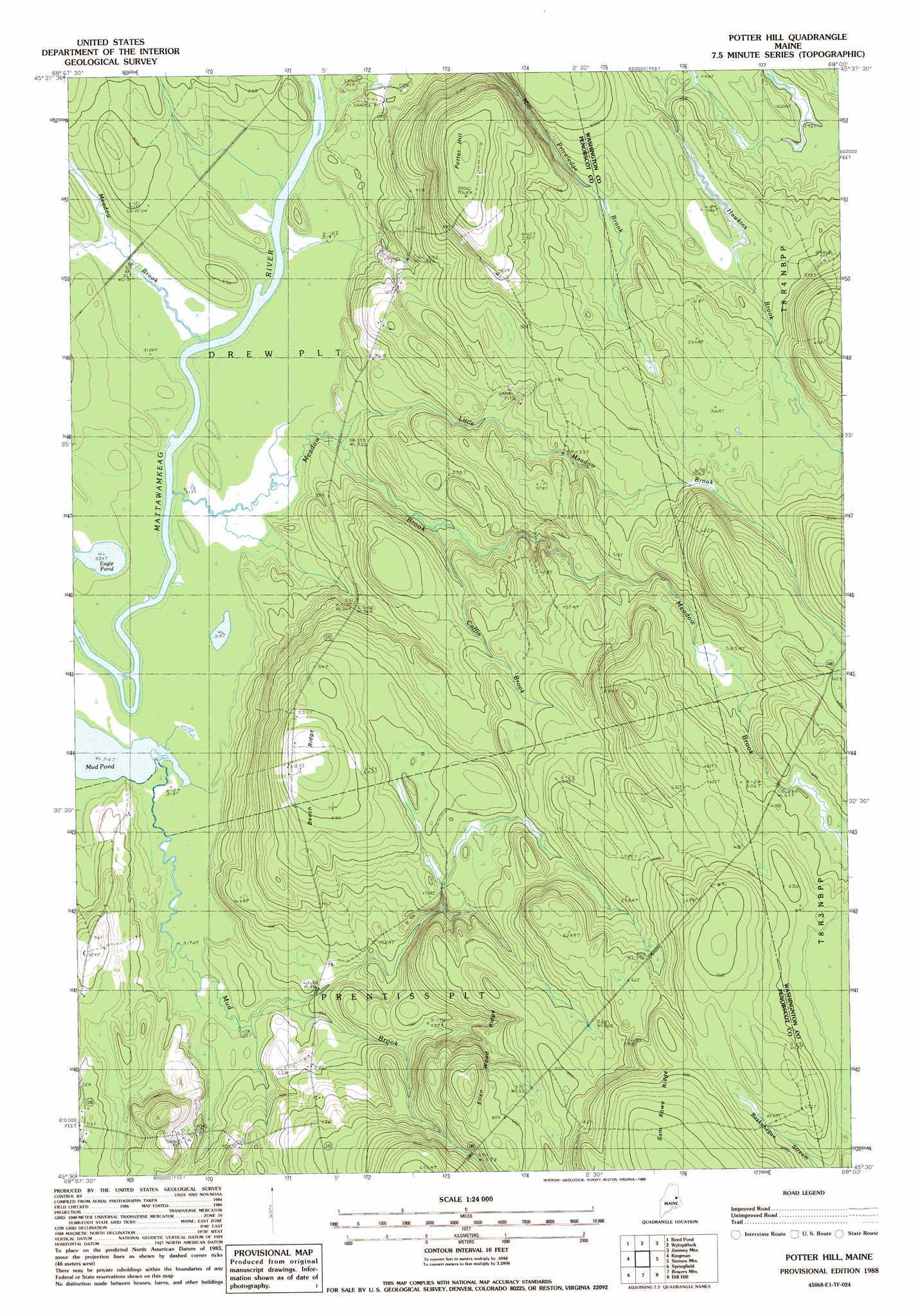
Potter Hill Topo Map Maine
To zoom in, hover over the map of Potter Hill
USGS Topo Quad 45068e1 - 1:24,000 scale
| Topo Map Name: | Potter Hill |
| USGS Topo Quad ID: | 45068e1 |
| Print Size: | ca. 21 1/4" wide x 27" high |
| Southeast Coordinates: | 45.5° N latitude / 68° W longitude |
| Map Center Coordinates: | 45.5625° N latitude / 68.0625° W longitude |
| U.S. State: | ME |
| Filename: | o45068e1.jpg |
| Download Map JPG Image: | Potter Hill topo map 1:24,000 scale |
| Map Type: | Topographic |
| Topo Series: | 7.5´ |
| Map Scale: | 1:24,000 |
| Source of Map Images: | United States Geological Survey (USGS) |
| Alternate Map Versions: |
Wytopitlock SE ME 1975, updated 1980 Download PDF Buy paper map Potter Hill ME 1988, updated 1988 Download PDF Buy paper map Potter Hill ME 2011 Download PDF Buy paper map Potter Hill ME 2014 Download PDF Buy paper map |
1:24,000 Topo Quads surrounding Potter Hill
Monarda |
Wytopitlock Lake |
Alder Brook |
Haynesville |
Orient |
Molunkid Lake |
Reed Pond |
Wytopitlock |
Jimmey Mountain |
Danforth |
Mattawamkeag |
Kingman |
Potter Hill |
Stetson Mountain |
Brookton |
East Winn |
Springfield |
Bowers Mountain |
Dill Hill |
Farrow Mountain |
Lee |
Weir Pond |
Bottle Lake |
Scraggly Lake |
Oxbrook Lakes |
> Back to 45068e1 at 1:100,000 scale
> Back to 45068a1 at 1:250,000 scale
> Back to U.S. Topo Maps home
Potter Hill topo map: Gazetteer
Potter Hill: Lakes
Eagle Pond elevation 98m 321′Mud Pond elevation 96m 314′
Potter Hill: Ridges
Beech Ridge elevation 178m 583′Ellen Wood Ridge elevation 193m 633′
Potter Hill: Streams
Coffin Brook elevation 106m 347′Little Meadow Brook elevation 94m 308′
Meadow Brook elevation 97m 318′
Meadow Brook elevation 97m 318′
Potter Hill: Summits
Potter Hill elevation 191m 626′Potter Hill digital topo map on disk
Buy this Potter Hill topo map showing relief, roads, GPS coordinates and other geographical features, as a high-resolution digital map file on DVD:
Maine, New Hampshire, Rhode Island & Eastern Massachusetts
Buy digital topo maps: Maine, New Hampshire, Rhode Island & Eastern Massachusetts