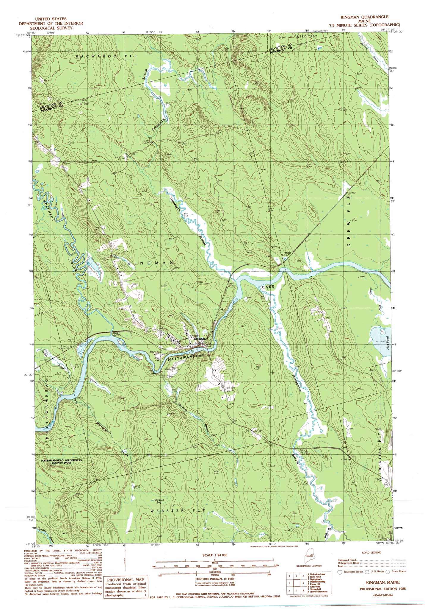
Kingman Topo Map Maine
To zoom in, hover over the map of Kingman
USGS Topo Quad 45068e2 - 1:24,000 scale
| Topo Map Name: | Kingman |
| USGS Topo Quad ID: | 45068e2 |
| Print Size: | ca. 21 1/4" wide x 27" high |
| Southeast Coordinates: | 45.5° N latitude / 68.125° W longitude |
| Map Center Coordinates: | 45.5625° N latitude / 68.1875° W longitude |
| U.S. State: | ME |
| Filename: | o45068e2.jpg |
| Download Map JPG Image: | Kingman topo map 1:24,000 scale |
| Map Type: | Topographic |
| Topo Series: | 7.5´ |
| Map Scale: | 1:24,000 |
| Source of Map Images: | United States Geological Survey (USGS) |
| Alternate Map Versions: |
Wytopitlock SW ME 1975, updated 1980 Download PDF Buy paper map Kingman ME 1988, updated 1988 Download PDF Buy paper map Kingman ME 2011 Download PDF Buy paper map Kingman ME 2014 Download PDF Buy paper map |
1:24,000 Topo Quads surrounding Kingman
Benedicta |
Monarda |
Wytopitlock Lake |
Alder Brook |
Haynesville |
Salmon Stream Lake |
Molunkid Lake |
Reed Pond |
Wytopitlock |
Jimmey Mountain |
Mattaseunk Lake |
Mattawamkeag |
Kingman |
Potter Hill |
Stetson Mountain |
Lincoln Center |
East Winn |
Springfield |
Bowers Mountain |
Dill Hill |
Lincoln East |
Lee |
Weir Pond |
Bottle Lake |
Scraggly Lake |
> Back to 45068e1 at 1:100,000 scale
> Back to 45068a1 at 1:250,000 scale
> Back to U.S. Topo Maps home
Kingman topo map: Gazetteer
Kingman: Populated Places
Kingman elevation 111m 364′Kingman: Streams
Carlisle Brook elevation 89m 291′Crossuntic Stream elevation 95m 311′
Mattagodus Stream elevation 94m 308′
Merriman Brook elevation 91m 298′
Molunkus Stream elevation 91m 298′
Mud Brook elevation 97m 318′
Spencer Brook elevation 91m 298′
West Branch Mattagodus Stream elevation 97m 318′
Whitten Brook elevation 88m 288′
Kingman: Swamps
Billy Doe Bog elevation 137m 449′Kingman digital topo map on disk
Buy this Kingman topo map showing relief, roads, GPS coordinates and other geographical features, as a high-resolution digital map file on DVD:
Maine, New Hampshire, Rhode Island & Eastern Massachusetts
Buy digital topo maps: Maine, New Hampshire, Rhode Island & Eastern Massachusetts