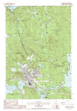
Millinocket Topo Map Maine
To zoom in, hover over the map of Millinocket
USGS Topo Quad 45068f6 - 1:24,000 scale
| Topo Map Name: | Millinocket |
| USGS Topo Quad ID: | 45068f6 |
| Print Size: | ca. 21 1/4" wide x 27" high |
| Southeast Coordinates: | 45.625° N latitude / 68.625° W longitude |
| Map Center Coordinates: | 45.6875° N latitude / 68.6875° W longitude |
| U.S. State: | ME |
| Filename: | o45068f6.jpg |
| Download Map JPG Image: | Millinocket topo map 1:24,000 scale |
| Map Type: | Topographic |
| Topo Series: | 7.5´ |
| Map Scale: | 1:24,000 |
| Source of Map Images: | United States Geological Survey (USGS) |
| Alternate Map Versions: |
Millinocket ME 1988, updated 1988 Download PDF Buy paper map Millinocket ME 2011 Download PDF Buy paper map Millinocket ME 2014 Download PDF Buy paper map |
1:24,000 Topo Quads surrounding Millinocket
> Back to 45068e1 at 1:100,000 scale
> Back to 45068a1 at 1:250,000 scale
> Back to U.S. Topo Maps home
Millinocket topo map: Gazetteer
Millinocket: Airports
Millinocket Municipal Airport elevation 122m 400′Millinocket: Dams
Millinocket Lake Dam elevation 154m 505′Quakish Dam elevation 139m 456′
Millinocket: Islands
Pond Falls Island elevation 103m 337′Millinocket: Lakes
Ferguson Lake elevation 139m 456′Jerry Pond elevation 124m 406′
Little Smith Pond elevation 148m 485′
Schoodic Deadwater elevation 139m 456′
Millinocket: Populated Places
Bowden (historical) elevation 125m 410′Little Italy elevation 126m 413′
Millinocket elevation 113m 370′
Millinocket: Post Offices
Millinocket Post Office elevation 111m 364′Millinocket: Reservoirs
Millinocket Lake elevation 154m 505′Quakish Lake elevation 139m 456′
Millinocket: Ridges
Schoodic Ridge elevation 175m 574′Millinocket: Streams
Jerry Brook elevation 103m 337′Ledge Cut Brook elevation 107m 351′
Little Smith Brook elevation 109m 357′
Millinocket Stream elevation 109m 357′
Schoodic Stream elevation 108m 354′
Smith Brook elevation 131m 429′
Smith Brook Deadwater elevation 148m 485′
Millinocket: Summits
Shack Hill elevation 183m 600′Millinocket digital topo map on disk
Buy this Millinocket topo map showing relief, roads, GPS coordinates and other geographical features, as a high-resolution digital map file on DVD:
Maine, New Hampshire, Rhode Island & Eastern Massachusetts
Buy digital topo maps: Maine, New Hampshire, Rhode Island & Eastern Massachusetts


