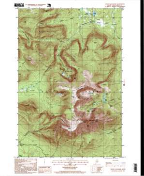
Mount Katahdin Topo Map Maine
To zoom in, hover over the map of Mount Katahdin
USGS Topo Quad 45068h8 - 1:24,000 scale
| Topo Map Name: | Mount Katahdin |
| USGS Topo Quad ID: | 45068h8 |
| Print Size: | ca. 21 1/4" wide x 27" high |
| Southeast Coordinates: | 45.875° N latitude / 68.875° W longitude |
| Map Center Coordinates: | 45.9375° N latitude / 68.9375° W longitude |
| U.S. State: | ME |
| Filename: | o45068h8.jpg |
| Download Map JPG Image: | Mount Katahdin topo map 1:24,000 scale |
| Map Type: | Topographic |
| Topo Series: | 7.5´ |
| Map Scale: | 1:24,000 |
| Source of Map Images: | United States Geological Survey (USGS) |
| Alternate Map Versions: |
Mount Katahdin ME 1978, updated 1981 Download PDF Buy paper map Mount Katahdin ME 1988, updated 1988 Download PDF Buy paper map Mount Katahdin ME 1988, updated 1988 Download PDF Buy paper map Mount Katahdin ME 1997, updated 1999 Download PDF Buy paper map Mount Katahdin ME 2011 Download PDF Buy paper map Mount Katahdin ME 2014 Download PDF Buy paper map |
1:24,000 Topo Quads surrounding Mount Katahdin
> Back to 45068e1 at 1:100,000 scale
> Back to 45068a1 at 1:250,000 scale
> Back to U.S. Topo Maps home
Mount Katahdin topo map: Gazetteer
Mount Katahdin: Basins
Great Basin elevation 915m 3001′Little North Basin elevation 893m 2929′
North Basin elevation 991m 3251′
Northwest Basin elevation 829m 2719′
South Basin elevation 932m 3057′
The Klondike elevation 870m 2854′
Mount Katahdin: Cliffs
Table Land elevation 1375m 4511′Mount Katahdin: Falls
Katahdin Falls elevation 967m 3172′Katahdin Stream Falls elevation 515m 1689′
Ledge Falls elevation 375m 1230′
Mount Katahdin: Lakes
Chunney Pond elevation 889m 2916′Davis Pond elevation 899m 2949′
Depot Pond elevation 763m 2503′
Dry Pond elevation 855m 2805′
Klondike Pond elevation 1034m 3392′
Lake Cowles elevation 891m 2923′
Pamola Pond elevation 778m 2552′
Russell Pond elevation 404m 1325′
Turner Deadwater elevation 408m 1338′
Mount Katahdin: Parks
Baxter Game Preserve elevation 1008m 3307′Mount Katahdin: Populated Places
New City elevation 402m 1318′Mount Katahdin: Ridges
Hamlin Ridge elevation 1211m 3973′Harvey Ridge elevation 939m 3080′
Keep Ridge elevation 1254m 4114′
Knife Edge elevation 1462m 4796′
Mount Katahdin: Springs
Caribou Spring elevation 1405m 4609′Saddle Spring elevation 1308m 4291′
Thoreau Spring elevation 1410m 4625′
Mount Katahdin: Streams
Annis Brook elevation 526m 1725′Mullen Brook elevation 408m 1338′
South Branch Wassataquoik Stream elevation 390m 1279′
Turner Brook elevation 383m 1256′
Mount Katahdin: Summits
Bald Mountain elevation 847m 2778′Barren Mountain elevation 1115m 3658′
Baxter Peak elevation 1594m 5229′
Chimney Peak elevation 1441m 4727′
Fort Mountain elevation 1172m 3845′
Hamlin Peak elevation 1446m 4744′
Howe Peaks elevation 1415m 4642′
Hunts Peak elevation 1131m 3710′
Mount Katahdin elevation 1600m 5249′
Mullen Mountain elevation 1039m 3408′
North Brother elevation 1233m 4045′
Pamola elevation 1194m 3917′
Rum Mountain elevation 1028m 3372′
Russell Mountain elevation 816m 2677′
South Peak elevation 1555m 5101′
The Brothers elevation 1048m 3438′
The Owl elevation 1106m 3628′
Wassataquoik Mountain elevation 908m 2979′
Mount Katahdin: Trails
Abol Trail elevation 634m 2080′Abol Trail elevation 873m 2864′
Abot Trail elevation 971m 3185′
Cathedral Trail elevation 1190m 3904′
Chimney Pond Trail elevation 666m 2185′
Dudley Trail elevation 1191m 3907′
Howe elevation 951m 3120′
Northwest Basin Trail elevation 1118m 3667′
Saddle Trail elevation 1052m 3451′
South Branch Trail elevation 525m 1722′
Mount Katahdin: Valleys
Witherle Ravine elevation 912m 2992′York Valley elevation 1427m 4681′
Mount Katahdin digital topo map on disk
Buy this Mount Katahdin topo map showing relief, roads, GPS coordinates and other geographical features, as a high-resolution digital map file on DVD:
Maine, New Hampshire, Rhode Island & Eastern Massachusetts
Buy digital topo maps: Maine, New Hampshire, Rhode Island & Eastern Massachusetts


