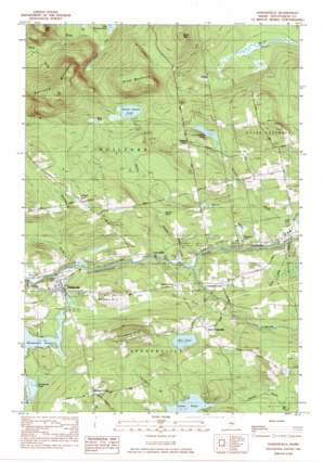
Sangerville Topo Map Maine
To zoom in, hover over the map of Sangerville
USGS Topo Quad 45069b3 - 1:24,000 scale
| Topo Map Name: | Sangerville |
| USGS Topo Quad ID: | 45069b3 |
| Print Size: | ca. 21 1/4" wide x 27" high |
| Southeast Coordinates: | 45.125° N latitude / 69.25° W longitude |
| Map Center Coordinates: | 45.1875° N latitude / 69.3125° W longitude |
| U.S. State: | ME |
| Filename: | o45069b3.jpg |
| Download Map JPG Image: | Sangerville topo map 1:24,000 scale |
| Map Type: | Topographic |
| Topo Series: | 7.5´ |
| Map Scale: | 1:24,000 |
| Source of Map Images: | United States Geological Survey (USGS) |
| Alternate Map Versions: |
Guilford NE ME 1975, updated 1980 Download PDF Buy paper map Sangerville ME 1984, updated 1984 Download PDF Buy paper map Sangerville ME 2011 Download PDF Buy paper map Sangerville ME 2014 Download PDF Buy paper map |
1:24,000 Topo Quads surrounding Sangerville
> Back to 45069a1 at 1:100,000 scale
> Back to 45068a1 at 1:250,000 scale
> Back to U.S. Topo Maps home
Sangerville topo map: Gazetteer
Sangerville: Bridges
Lows Bridge elevation 110m 360′Sangerville: Dams
Carlton Stream Dam elevation 123m 403′Manhanock Pond Dam elevation 136m 446′
Manhanock Pond Dam elevation 135m 442′
Sangerville: Lakes
Dunham Pond elevation 196m 643′Marr Pond elevation 166m 544′
Minnow Pond elevation 139m 456′
Salmon Stream Pond elevation 190m 623′
Thompson Pond elevation 124m 406′
Sangerville: Populated Places
Dunham Corner elevation 225m 738′East Sangerville elevation 164m 538′
Guilford Center elevation 210m 688′
Howard Corner elevation 142m 465′
Sangerville elevation 133m 436′
Sangerville: Reservoirs
Carlton Stream Reservoir elevation 123m 403′Manhanock Pond elevation 135m 442′
Sangerville: Streams
Black Stream elevation 107m 351′Brown Brook elevation 117m 383′
Carlton Stream elevation 111m 364′
Flanders Brook elevation 110m 360′
Maxfield Brook elevation 116m 380′
Merrill Brook elevation 109m 357′
Oak Brook elevation 123m 403′
Salmon Stream elevation 107m 351′
Schoolhouse Brook elevation 118m 387′
South Inlet elevation 110m 360′
Sucker Brook elevation 137m 449′
Townhouse Brook elevation 153m 501′
Sangerville: Summits
Birch Mountain elevation 286m 938′Buker Mountain elevation 311m 1020′
Flanders Hill elevation 258m 846′
Guilford Mountain elevation 387m 1269′
Watson Hill elevation 206m 675′
Sangerville digital topo map on disk
Buy this Sangerville topo map showing relief, roads, GPS coordinates and other geographical features, as a high-resolution digital map file on DVD:
Maine, New Hampshire, Rhode Island & Eastern Massachusetts
Buy digital topo maps: Maine, New Hampshire, Rhode Island & Eastern Massachusetts


