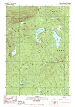
Whetstone Pond Topo Map Maine
To zoom in, hover over the map of Whetstone Pond
USGS Topo Quad 45069b5 - 1:24,000 scale
| Topo Map Name: | Whetstone Pond |
| USGS Topo Quad ID: | 45069b5 |
| Print Size: | ca. 21 1/4" wide x 27" high |
| Southeast Coordinates: | 45.125° N latitude / 69.5° W longitude |
| Map Center Coordinates: | 45.1875° N latitude / 69.5625° W longitude |
| U.S. State: | ME |
| Filename: | o45069b5.jpg |
| Download Map JPG Image: | Whetstone Pond topo map 1:24,000 scale |
| Map Type: | Topographic |
| Topo Series: | 7.5´ |
| Map Scale: | 1:24,000 |
| Source of Map Images: | United States Geological Survey (USGS) |
| Alternate Map Versions: |
Kingsbury NE ME 1975, updated 1980 Download PDF Buy paper map Whetstone Pond ME 1989, updated 1989 Download PDF Buy paper map Whetstone Pond ME 2011 Download PDF Buy paper map Whetstone Pond ME 2014 Download PDF Buy paper map |
1:24,000 Topo Quads surrounding Whetstone Pond
> Back to 45069a1 at 1:100,000 scale
> Back to 45068a1 at 1:250,000 scale
> Back to U.S. Topo Maps home
Whetstone Pond topo map: Gazetteer
Whetstone Pond: Lakes
Foss Pond elevation 279m 915′Mud Pond elevation 178m 583′
Piper Pond elevation 189m 620′
Punchbowl Pond elevation 303m 994′
Whetstone Pond elevation 214m 702′
Whetstone Pond: Populated Places
Cole Corner elevation 236m 774′Happy Corner elevation 273m 895′
Whetstone Pond: Streams
Bear Brook elevation 232m 761′Bennett Brook elevation 189m 620′
Bolt Brook elevation 248m 813′
Bottle Brook elevation 258m 846′
Punchbowl Brook elevation 259m 849′
Thorn Brook elevation 180m 590′
Witham Brook elevation 158m 518′
Whetstone Pond: Summits
Foss Mountain elevation 467m 1532′Little Russell Mountain elevation 337m 1105′
Oak Hill elevation 317m 1040′
Russell Mountain elevation 596m 1955′
Whetstone Pond: Swamps
Cook Bog elevation 232m 761′Whetstone Pond digital topo map on disk
Buy this Whetstone Pond topo map showing relief, roads, GPS coordinates and other geographical features, as a high-resolution digital map file on DVD:
Maine, New Hampshire, Rhode Island & Eastern Massachusetts
Buy digital topo maps: Maine, New Hampshire, Rhode Island & Eastern Massachusetts


