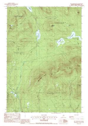
Hay Mountain Topo Map Maine
To zoom in, hover over the map of Hay Mountain
USGS Topo Quad 45069e3 - 1:24,000 scale
| Topo Map Name: | Hay Mountain |
| USGS Topo Quad ID: | 45069e3 |
| Print Size: | ca. 21 1/4" wide x 27" high |
| Southeast Coordinates: | 45.5° N latitude / 69.25° W longitude |
| Map Center Coordinates: | 45.5625° N latitude / 69.3125° W longitude |
| U.S. State: | ME |
| Filename: | o45069e3.jpg |
| Download Map JPG Image: | Hay Mountain topo map 1:24,000 scale |
| Map Type: | Topographic |
| Topo Series: | 7.5´ |
| Map Scale: | 1:24,000 |
| Source of Map Images: | United States Geological Survey (USGS) |
| Alternate Map Versions: |
Hay Mountain ME 1978, updated 1981 Download PDF Buy paper map Hay Mountain ME 1988, updated 1988 Download PDF Buy paper map Hay Mountain ME 2011 Download PDF Buy paper map Hay Mountain ME 2014 Download PDF Buy paper map |
1:24,000 Topo Quads surrounding Hay Mountain
> Back to 45069e1 at 1:100,000 scale
> Back to 45068a1 at 1:250,000 scale
> Back to U.S. Topo Maps home
Hay Mountain topo map: Gazetteer
Hay Mountain: Lakes
Bluff Pond elevation 659m 2162′First West Branch Pond elevation 445m 1459′
Fourth West Branch Pond elevation 489m 1604′
Little Lyford Ponds elevation 363m 1190′
Lloyd Pond elevation 347m 1138′
Second West Branch Pond elevation 459m 1505′
Third West Branch Pond elevation 459m 1505′
Hay Mountain: Reservoirs
Big Lyford Pond elevation 402m 1318′Hay Mountain: Streams
Baker Mountain Brook elevation 383m 1256′Duran Brook elevation 377m 1236′
Greenwood Brook elevation 292m 958′
Inlet Brook elevation 374m 1227′
Mountain Brook elevation 364m 1194′
Slaughter Brook elevation 459m 1505′
Hay Mountain: Summits
Black Pinnacle elevation 598m 1961′Bluff Mountain elevation 769m 2522′
Gulf Hagas Mountain elevation 813m 2667′
Hay Mountain elevation 990m 3248′
Hedgehog Mountain elevation 648m 2125′
West Peak elevation 964m 3162′
Hay Mountain digital topo map on disk
Buy this Hay Mountain topo map showing relief, roads, GPS coordinates and other geographical features, as a high-resolution digital map file on DVD:
Maine, New Hampshire, Rhode Island & Eastern Massachusetts
Buy digital topo maps: Maine, New Hampshire, Rhode Island & Eastern Massachusetts


