Brassua Lake West Topo Map Maine
To zoom in, hover over the map of Brassua Lake West
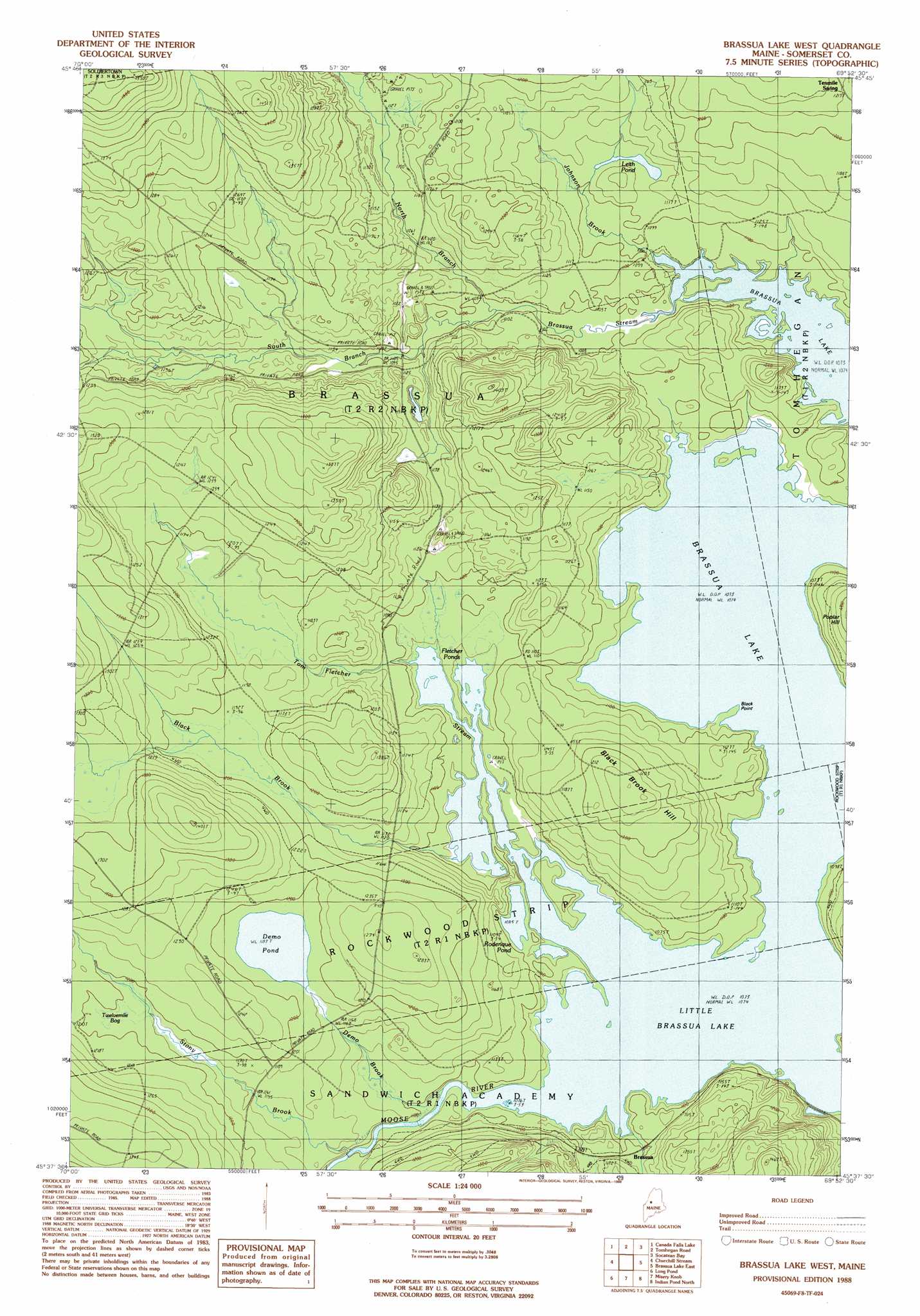
USGS Topo Quad 45069f8 - 1:24,000 scale
| Topo Map Name: | Brassua Lake West |
| USGS Topo Quad ID: | 45069f8 |
| Print Size: | ca. 21 1/4" wide x 27" high |
| Southeast Coordinates: | 45.625° N latitude / 69.875° W longitude |
| Map Center Coordinates: | 45.6875° N latitude / 69.9375° W longitude |
| U.S. State: | ME |
| Filename: | o45069f8.jpg |
| Download Map JPG Image: | Brassua Lake West topo map 1:24,000 scale |
| Map Type: | Topographic |
| Topo Series: | 7.5´ |
| Map Scale: | 1:24,000 |
| Source of Map Images: | United States Geological Survey (USGS) |
| Alternate Map Versions: |
Brassua Lake West ME 1977, updated 1981 Download PDF Buy paper map Brassua Lake West ME 1988, updated 1988 Download PDF Buy paper map Brassua Lake West ME 2011 Download PDF Buy paper map Brassua Lake West ME 2014 Download PDF Buy paper map |
1:24,000 Topo Quads surrounding Brassua Lake West
Penobscot Lake |
Foley Pond |
Seboomook Lake West |
Seboomook Lake East |
Seboomook |
Boundary Bald Mountain |
Canada Falls Lake |
Tomhegan Pond |
Socatean Bay |
North East Carry |
Heald Pond |
Churchill Stream |
Brassua Lake West |
Brassua Lake East |
Mount Kineo |
Catheart Mountain |
Long Pond |
Misery Knob |
Indian Pond North |
Moosehead |
Enchanted Pond |
Johnson Mountain |
Black Brook Pond |
Indian Pond South |
Big Squaw Pond |
> Back to 45069e1 at 1:100,000 scale
> Back to 45068a1 at 1:250,000 scale
> Back to U.S. Topo Maps home
Brassua Lake West topo map: Gazetteer
Brassua Lake West: Capes
Black Point elevation 327m 1072′Brassua Lake West: Lakes
Demo Pond elevation 361m 1184′Fletcher Ponds elevation 327m 1072′
Leith Pond elevation 339m 1112′
Little Brassua Lake elevation 327m 1072′
Roderique Pond elevation 330m 1082′
Brassua Lake West: Populated Places
Brassua elevation 342m 1122′Brassua Lake West: Streams
Black Brook elevation 335m 1099′Brassua Stream elevation 327m 1072′
Demo Brook elevation 328m 1076′
Johnson Brook elevation 347m 1138′
Johnson Brook elevation 335m 1099′
North Branch Brassau Stream elevation 333m 1092′
South Branch Brassua Stream elevation 333m 1092′
Stony Brook elevation 346m 1135′
Tom Fletcher Stream elevation 327m 1072′
Brassua Lake West: Summits
Black Brook Hill elevation 371m 1217′Brassua Lake West digital topo map on disk
Buy this Brassua Lake West topo map showing relief, roads, GPS coordinates and other geographical features, as a high-resolution digital map file on DVD:
Maine, New Hampshire, Rhode Island & Eastern Massachusetts
Buy digital topo maps: Maine, New Hampshire, Rhode Island & Eastern Massachusetts