Pine Stream Flowage Topo Map Maine
To zoom in, hover over the map of Pine Stream Flowage
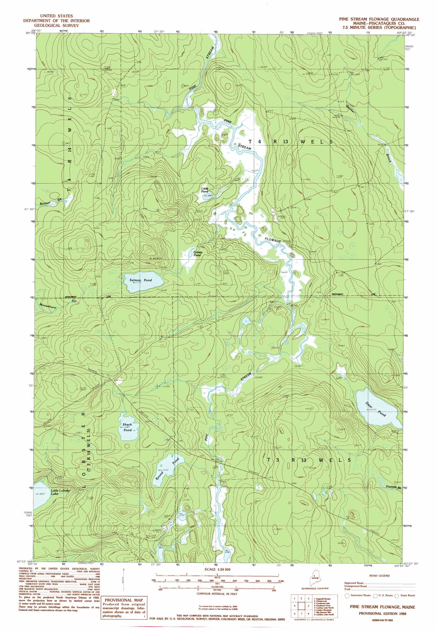
USGS Topo Quad 45069h4 - 1:24,000 scale
| Topo Map Name: | Pine Stream Flowage |
| USGS Topo Quad ID: | 45069h4 |
| Print Size: | ca. 21 1/4" wide x 27" high |
| Southeast Coordinates: | 45.875° N latitude / 69.375° W longitude |
| Map Center Coordinates: | 45.9375° N latitude / 69.4375° W longitude |
| U.S. State: | ME |
| Filename: | o45069h4.jpg |
| Download Map JPG Image: | Pine Stream Flowage topo map 1:24,000 scale |
| Map Type: | Topographic |
| Topo Series: | 7.5´ |
| Map Scale: | 1:24,000 |
| Source of Map Images: | United States Geological Survey (USGS) |
| Alternate Map Versions: |
Pine Stream Flowage ME 1977, updated 1981 Download PDF Buy paper map Pine Stream Flowage ME 1988 Download PDF Buy paper map Pine Stream Flowage ME 2011 Download PDF Buy paper map Pine Stream Flowage ME 2014 Download PDF Buy paper map |
1:24,000 Topo Quads surrounding Pine Stream Flowage
Caucomgomoc Lake West |
Caucomgomoc Lake East |
Longley Pond |
Mud Pond |
Telos Lake |
Bean Pot Pond |
Ragmuff Stream |
Chesuncook |
Cuxabexis Lake |
Telos Brook |
Seboomook |
Penobscot Farm |
Pine Stream Flowage |
Caribou Lake North |
Harrington Lake |
North East Carry |
Lobster Mountain |
Big Spencer Mountain |
Caribou Lake South |
Rainbow Lake West |
Mount Kineo |
Spencer Bay |
Kokadjo |
Farrar Mountain |
Wadleigh Mountain |
> Back to 45069e1 at 1:100,000 scale
> Back to 45068a1 at 1:250,000 scale
> Back to U.S. Topo Maps home
Pine Stream Flowage topo map: Gazetteer
Pine Stream Flowage: Lakes
Deer Pond elevation 297m 974′Grassy Pond elevation 336m 1102′
Little Pond elevation 304m 997′
Pine Stream Flowage elevation 298m 977′
Round Pond elevation 348m 1141′
Salmon Pond elevation 340m 1115′
Shack Pond elevation 356m 1167′
Pine Stream Flowage digital topo map on disk
Buy this Pine Stream Flowage topo map showing relief, roads, GPS coordinates and other geographical features, as a high-resolution digital map file on DVD:
Maine, New Hampshire, Rhode Island & Eastern Massachusetts
Buy digital topo maps: Maine, New Hampshire, Rhode Island & Eastern Massachusetts