Little Bigelow Mountain Topo Map Maine
To zoom in, hover over the map of Little Bigelow Mountain
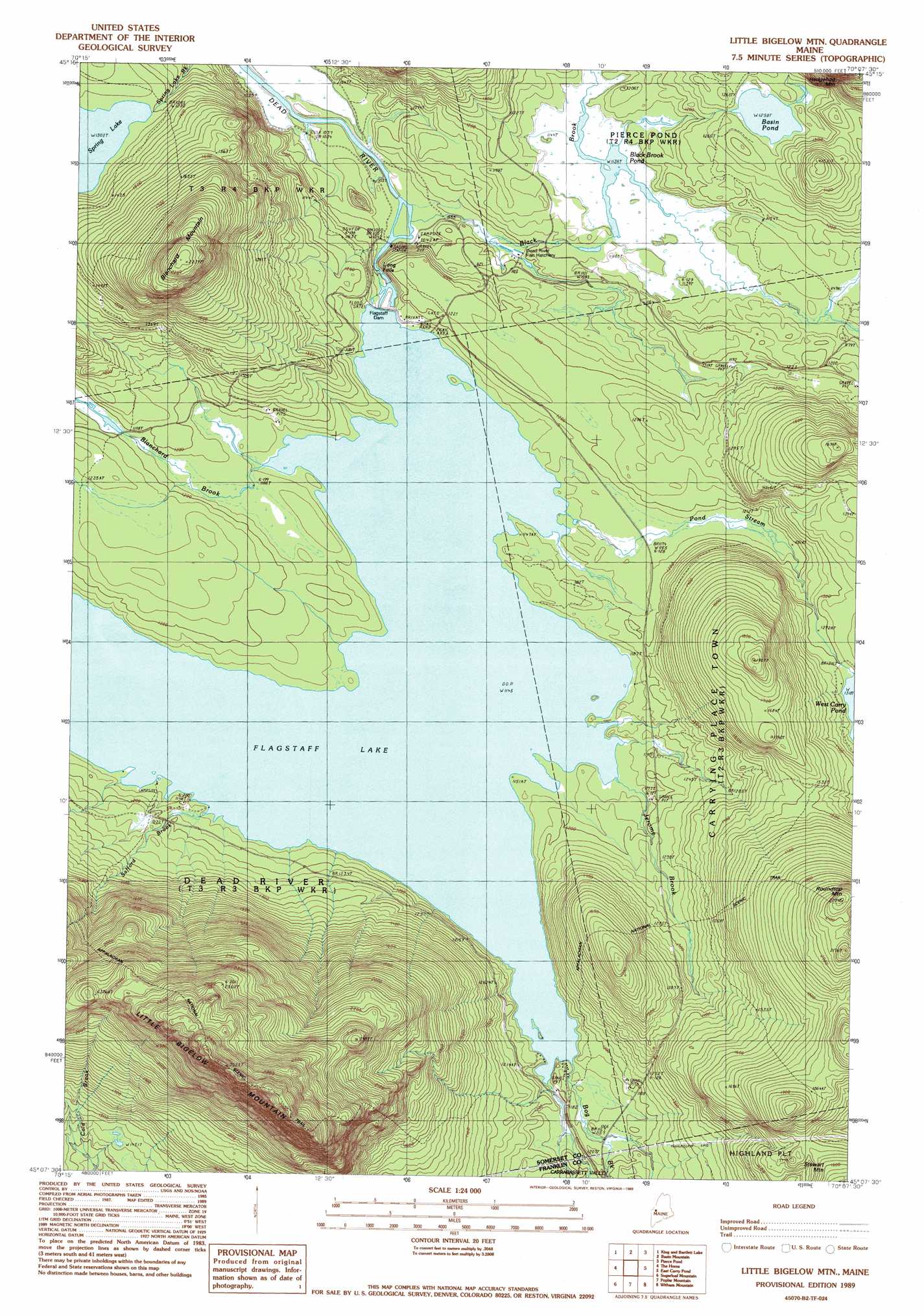
USGS Topo Quad 45070b2 - 1:24,000 scale
| Topo Map Name: | Little Bigelow Mountain |
| USGS Topo Quad ID: | 45070b2 |
| Print Size: | ca. 21 1/4" wide x 27" high |
| Southeast Coordinates: | 45.125° N latitude / 70.125° W longitude |
| Map Center Coordinates: | 45.1875° N latitude / 70.1875° W longitude |
| U.S. State: | ME |
| Filename: | o45070b2.jpg |
| Download Map JPG Image: | Little Bigelow Mountain topo map 1:24,000 scale |
| Map Type: | Topographic |
| Topo Series: | 7.5´ |
| Map Scale: | 1:24,000 |
| Source of Map Images: | United States Geological Survey (USGS) |
| Alternate Map Versions: |
Little Bigelow Mountain ME 1977, updated 1983 Download PDF Buy paper map Little Bigelow Mtn ME 1989, updated 1989 Download PDF Buy paper map Little Bigelow Mtn ME 1989, updated 1989 Download PDF Buy paper map Little Bigelow Mountain ME 2011 Download PDF Buy paper map Little Bigelow Mountain ME 2014 Download PDF Buy paper map |
1:24,000 Topo Quads surrounding Little Bigelow Mountain
Tumbledown Mountain |
Spencer Lake |
Enchanted Pond |
Johnson Mountain |
Black Brook Pond |
King And Bartlett Mountain |
King And Bartlett Lake |
Basin Mountain |
Pierce Pond |
The Forks |
Stratton |
The Horns |
Little Bigelow Mountain |
East Carry Pond |
Caratunk |
Black Nubble |
Sugarloaf Mountain |
Poplar Mountain |
Witham Mountain |
Bingham |
Redington |
Mount Abraham |
Kingfield |
New Portland |
Embden Pond |
> Back to 45070a1 at 1:100,000 scale
> Back to 45070a1 at 1:250,000 scale
> Back to U.S. Topo Maps home
Little Bigelow Mountain topo map: Gazetteer
Little Bigelow Mountain: Dams
Black Brook Dam elevation 346m 1135′Longfalls Dam elevation 348m 1141′
Little Bigelow Mountain: Falls
Long Falls elevation 347m 1138′Little Bigelow Mountain: Lakes
Basin Pond elevation 384m 1259′Little Bigelow Mountain: Reservoirs
Black Brook Pond elevation 346m 1135′Flagstaff Lake elevation 348m 1141′
Little Bigelow Mountain: Streams
Black Brook elevation 319m 1046′Blanchard Brook elevation 351m 1151′
Bog Brook elevation 349m 1145′
Jerome Brook elevation 349m 1145′
Pond Stream elevation 349m 1145′
Safford Brook elevation 351m 1151′
Little Bigelow Mountain: Summits
Blanchard Mountain elevation 682m 2237′Little Bigelow Mountain elevation 912m 2992′
Roundtop Mountain elevation 624m 2047′
Little Bigelow Mountain digital topo map on disk
Buy this Little Bigelow Mountain topo map showing relief, roads, GPS coordinates and other geographical features, as a high-resolution digital map file on DVD:
Maine, New Hampshire, Rhode Island & Eastern Massachusetts
Buy digital topo maps: Maine, New Hampshire, Rhode Island & Eastern Massachusetts