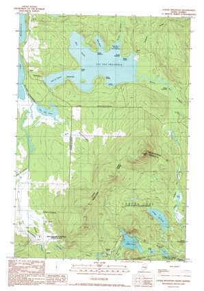
Louise Mountain Topo Map Maine
To zoom in, hover over the map of Louise Mountain
USGS Topo Quad 45070d7 - 1:24,000 scale
| Topo Map Name: | Louise Mountain |
| USGS Topo Quad ID: | 45070d7 |
| Print Size: | ca. 21 1/4" wide x 27" high |
| Southeast Coordinates: | 45.375° N latitude / 70.75° W longitude |
| Map Center Coordinates: | 45.4375° N latitude / 70.8125° W longitude |
| U.S. State: | ME |
| Filename: | o45070d7.jpg |
| Download Map JPG Image: | Louise Mountain topo map 1:24,000 scale |
| Map Type: | Topographic |
| Topo Series: | 7.5´ |
| Map Scale: | 1:24,000 |
| Source of Map Images: | United States Geological Survey (USGS) |
| Alternate Map Versions: |
Louise Mountain ME 1977, updated 1983 Download PDF Buy paper map Louise Mountain ME 1990, updated 1990 Download PDF Buy paper map Louise Mountain ME 2011 Download PDF Buy paper map Louise Mountain ME 2014 Download PDF Buy paper map |
1:24,000 Topo Quads surrounding Louise Mountain
> Back to 45070a1 at 1:100,000 scale
> Back to 45070a1 at 1:250,000 scale
> Back to U.S. Topo Maps home
Louise Mountain topo map: Gazetteer
Louise Mountain: Dams
Arnold Pond Dam elevation 420m 1377′Arnold Pond Inlet Dam elevation 420m 1377′
Louise Mountain: Lakes
Crosby Pond elevation 428m 1404′Horseshoe Pond elevation 406m 1332′
Mud Pond elevation 417m 1368′
Louise Mountain: Populated Places
Coburn Gore elevation 433m 1420′Moosehorn (historical) elevation 421m 1381′
Louise Mountain: Reservoirs
Arnold Pond elevation 420m 1377′Tr-Arnold Pond elevation 422m 1384′
Louise Mountain: Streams
Massachusetts Bog Stream elevation 421m 1381′Louise Mountain: Summits
Louise Mountain elevation 748m 2454′Louise Mountain: Swamps
Lower Hathan Bog elevation 399m 1309′Upper Hathan Bog elevation 418m 1371′
Louise Mountain: Trails
Arnold Trail elevation 425m 1394′Louise Mountain digital topo map on disk
Buy this Louise Mountain topo map showing relief, roads, GPS coordinates and other geographical features, as a high-resolution digital map file on DVD:
Maine, New Hampshire, Rhode Island & Eastern Massachusetts
Buy digital topo maps: Maine, New Hampshire, Rhode Island & Eastern Massachusetts


