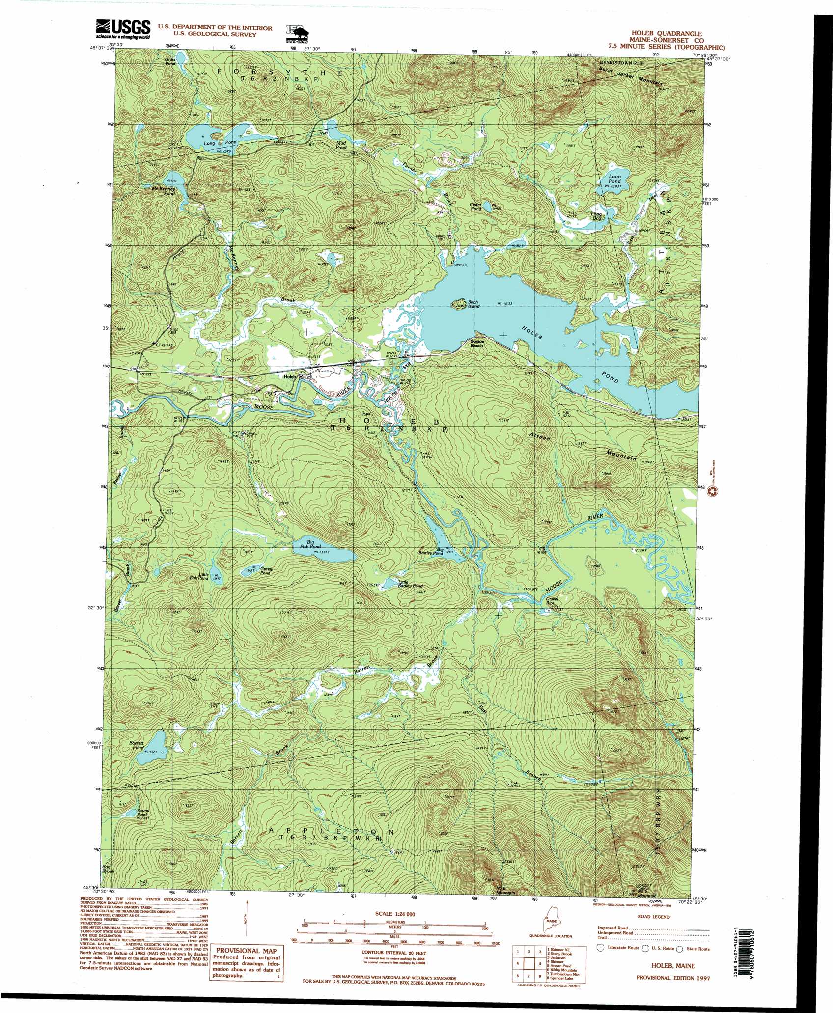
Holeb Topo Map Maine
To zoom in, hover over the map of Holeb
USGS Topo Quad 45070e4 - 1:24,000 scale
| Topo Map Name: | Holeb |
| USGS Topo Quad ID: | 45070e4 |
| Print Size: | ca. 21 1/4" wide x 27" high |
| Southeast Coordinates: | 45.5° N latitude / 70.375° W longitude |
| Map Center Coordinates: | 45.5625° N latitude / 70.4375° W longitude |
| U.S. State: | ME |
| Filename: | o45070e4.jpg |
| Download Map JPG Image: | Holeb topo map 1:24,000 scale |
| Map Type: | Topographic |
| Topo Series: | 7.5´ |
| Map Scale: | 1:24,000 |
| Source of Map Images: | United States Geological Survey (USGS) |
| Alternate Map Versions: |
Holeb ME 1977, updated 1983 Download PDF Buy paper map Holeb ME 1989, updated 1989 Download PDF Buy paper map Holeb ME 1997, updated 1999 Download PDF Buy paper map Holeb ME 2011 Download PDF Buy paper map Holeb ME 2014 Download PDF Buy paper map |
1:24,000 Topo Quads surrounding Holeb
Sandy Bay Mountain |
Campbell Brook |
Boundary Bald Mountain |
||
Skinner Ne |
Stony Brook |
Jackman |
Heald Pond |
|
Boundary Pond |
Skinner |
Holeb |
Attean Pond |
Catheart Mountain |
Merrill Mountain |
Kibby Mountain |
Tumbledown Mountain |
Spencer Lake |
Enchanted Pond |
Chain Of Ponds |
Jim Pond |
King And Bartlett Mountain |
King And Bartlett Lake |
Basin Mountain |
> Back to 45070e1 at 1:100,000 scale
> Back to 45070a1 at 1:250,000 scale
> Back to U.S. Topo Maps home
Holeb topo map: Gazetteer
Holeb: Islands
Birch Island elevation 390m 1279′Holeb: Lakes
Barrett Pond elevation 442m 1450′Big Bartley Pond elevation 379m 1243′
Big Fish Pond elevation 407m 1335′
Cedar Pond elevation 392m 1286′
Grass Pond elevation 453m 1486′
Grassy Pond elevation 411m 1348′
Holeb Pond elevation 376m 1233′
Little Bartley Pond elevation 416m 1364′
Little Fish Pond elevation 411m 1348′
Long Bog elevation 381m 1250′
Long Pond elevation 422m 1384′
Loon Pond elevation 391m 1282′
McKenney Pond elevation 409m 1341′
Mud Pond elevation 402m 1318′
Round Pond elevation 459m 1505′
Holeb: Populated Places
Holeb elevation 382m 1253′Holeb: Rapids
Camel Rips elevation 378m 1240′Holeb: Streams
Barrett Brook elevation 378m 1240′Beaver Brook elevation 378m 1240′
East Branch Barrett Brook elevation 376m 1233′
East Inlet elevation 376m 1233′
Holeb Stream elevation 378m 1240′
McKenney Brook elevation 378m 1240′
Turner Brook elevation 378m 1240′
Holeb: Summits
Number Five Mountain elevation 934m 3064′Holeb digital topo map on disk
Buy this Holeb topo map showing relief, roads, GPS coordinates and other geographical features, as a high-resolution digital map file on DVD:
Maine, New Hampshire, Rhode Island & Eastern Massachusetts
Buy digital topo maps: Maine, New Hampshire, Rhode Island & Eastern Massachusetts