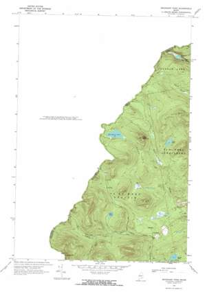
Boundary Pond Topo Map Maine
To zoom in, hover over the map of Boundary Pond
USGS Topo Quad 45070e6 - 1:24,000 scale
| Topo Map Name: | Boundary Pond |
| USGS Topo Quad ID: | 45070e6 |
| Print Size: | ca. 21 1/4" wide x 27" high |
| Southeast Coordinates: | 45.5° N latitude / 70.625° W longitude |
| Map Center Coordinates: | 45.5625° N latitude / 70.6875° W longitude |
| U.S. State: | ME |
| Filename: | o45070e6.jpg |
| Download Map JPG Image: | Boundary Pond topo map 1:24,000 scale |
| Map Type: | Topographic |
| Topo Series: | 7.5´ |
| Map Scale: | 1:24,000 |
| Source of Map Images: | United States Geological Survey (USGS) |
| Alternate Map Versions: |
Boundary Pond ME 1970, updated 1973 Download PDF Buy paper map Boundary Pond ME 1977, updated 1983 Download PDF Buy paper map Boundary Pond ME 2011 Download PDF Buy paper map Boundary Pond ME 2014 Download PDF Buy paper map |
1:24,000 Topo Quads surrounding Boundary Pond
> Back to 45070e1 at 1:100,000 scale
> Back to 45070a1 at 1:250,000 scale
> Back to U.S. Topo Maps home
Boundary Pond topo map: Gazetteer
Boundary Pond: Lakes
Beattie Pond elevation 549m 1801′Boundary Pond elevation 604m 1981′
Clear Pond elevation 570m 1870′
Mud Pond elevation 545m 1788′
Unknown Pond elevation 489m 1604′
Boundary Pond: Populated Places
Lowelltown elevation 487m 1597′Boundary Pond: Streams
Boundary Brook elevation 470m 1541′Hogans Brook elevation 457m 1499′
Mill Brook elevation 480m 1574′
Number One Brook elevation 476m 1561′
West Branch Mill Brook elevation 556m 1824′
Boundary Pond: Summits
Clear Pond Mountain elevation 769m 2522′Dome Mountain elevation 701m 2299′
Lowell Hill elevation 649m 2129′
Moose Hill elevation 884m 2900′
Boundary Pond digital topo map on disk
Buy this Boundary Pond topo map showing relief, roads, GPS coordinates and other geographical features, as a high-resolution digital map file on DVD:
Maine, New Hampshire, Rhode Island & Eastern Massachusetts
Buy digital topo maps: Maine, New Hampshire, Rhode Island & Eastern Massachusetts


