Churchill Stream Topo Map Maine
To zoom in, hover over the map of Churchill Stream
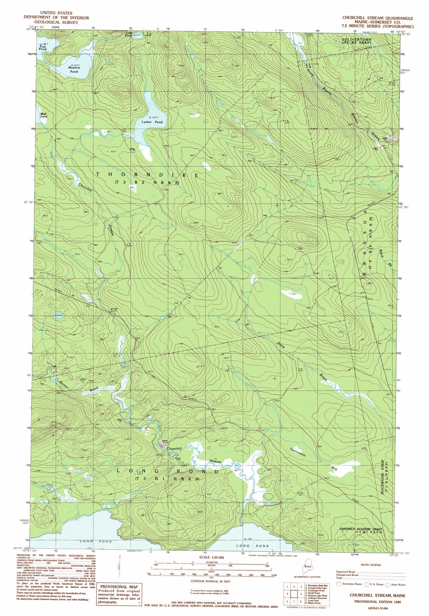
USGS Topo Quad 45070f1 - 1:24,000 scale
| Topo Map Name: | Churchill Stream |
| USGS Topo Quad ID: | 45070f1 |
| Print Size: | ca. 21 1/4" wide x 27" high |
| Southeast Coordinates: | 45.625° N latitude / 70° W longitude |
| Map Center Coordinates: | 45.6875° N latitude / 70.0625° W longitude |
| U.S. State: | ME |
| Filename: | o45070f1.jpg |
| Download Map JPG Image: | Churchill Stream topo map 1:24,000 scale |
| Map Type: | Topographic |
| Topo Series: | 7.5´ |
| Map Scale: | 1:24,000 |
| Source of Map Images: | United States Geological Survey (USGS) |
| Alternate Map Versions: |
Churchill Stream ME 1979, updated 1983 Download PDF Buy paper map Churchill Stream ME 1989, updated 1989 Download PDF Buy paper map Churchill Stream ME 2011 Download PDF Buy paper map Churchill Stream ME 2014 Download PDF Buy paper map |
1:24,000 Topo Quads surrounding Churchill Stream
Lac Portage |
Penobscot Lake |
Foley Pond |
Seboomook Lake West |
Seboomook Lake East |
Campbell Brook |
Boundary Bald Mountain |
Canada Falls Lake |
Tomhegan Pond |
Socatean Bay |
Jackman |
Heald Pond |
Churchill Stream |
Brassua Lake West |
Brassua Lake East |
Attean Pond |
Catheart Mountain |
Long Pond |
Misery Knob |
Indian Pond North |
Spencer Lake |
Enchanted Pond |
Johnson Mountain |
Black Brook Pond |
Indian Pond South |
> Back to 45070e1 at 1:100,000 scale
> Back to 45070a1 at 1:250,000 scale
> Back to U.S. Topo Maps home
Churchill Stream topo map: Gazetteer
Churchill Stream: Dams
Luther Pond Dam elevation 464m 1522′Churchill Stream: Lakes
Long Pond elevation 353m 1158′Lost Pond elevation 481m 1578′
Muskrat Pond elevation 461m 1512′
Churchill Stream: Reservoirs
Luther Pond elevation 464m 1522′Churchill Stream: Streams
Barton Brook elevation 374m 1227′Churchill Camp (historical) elevation 353m 1158′
Churchill Stream: Swamps
Twelvemile Bog elevation 381m 1250′Churchill Stream digital topo map on disk
Buy this Churchill Stream topo map showing relief, roads, GPS coordinates and other geographical features, as a high-resolution digital map file on DVD:
Maine, New Hampshire, Rhode Island & Eastern Massachusetts
Buy digital topo maps: Maine, New Hampshire, Rhode Island & Eastern Massachusetts