Heald Pond Topo Map Maine
To zoom in, hover over the map of Heald Pond
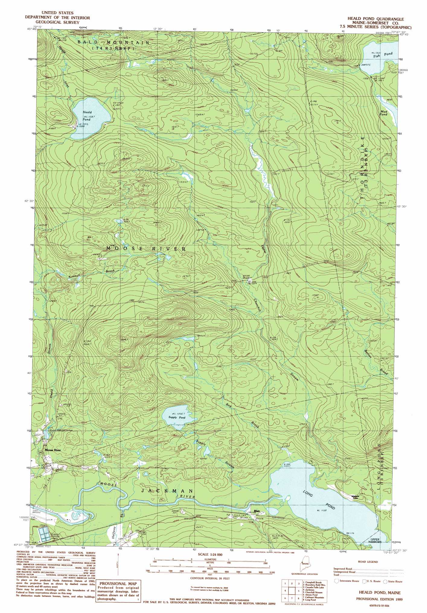
USGS Topo Quad 45070f2 - 1:24,000 scale
| Topo Map Name: | Heald Pond |
| USGS Topo Quad ID: | 45070f2 |
| Print Size: | ca. 21 1/4" wide x 27" high |
| Southeast Coordinates: | 45.625° N latitude / 70.125° W longitude |
| Map Center Coordinates: | 45.6875° N latitude / 70.1875° W longitude |
| U.S. State: | ME |
| Filename: | o45070f2.jpg |
| Download Map JPG Image: | Heald Pond topo map 1:24,000 scale |
| Map Type: | Topographic |
| Topo Series: | 7.5´ |
| Map Scale: | 1:24,000 |
| Source of Map Images: | United States Geological Survey (USGS) |
| Alternate Map Versions: |
Heald Pond ME 1977, updated 1983 Download PDF Buy paper map Heald Pond ME 1989, updated 1989 Download PDF Buy paper map Heald Pond ME 2011 Download PDF Buy paper map Heald Pond ME 2014 Download PDF Buy paper map |
1:24,000 Topo Quads surrounding Heald Pond
Lac Portage |
Penobscot Lake |
Foley Pond |
Seboomook Lake West |
|
Sandy Bay Mountain |
Campbell Brook |
Boundary Bald Mountain |
Canada Falls Lake |
Tomhegan Pond |
Stony Brook |
Jackman |
Heald Pond |
Churchill Stream |
Brassua Lake West |
Holeb |
Attean Pond |
Catheart Mountain |
Long Pond |
Misery Knob |
Tumbledown Mountain |
Spencer Lake |
Enchanted Pond |
Johnson Mountain |
Black Brook Pond |
> Back to 45070e1 at 1:100,000 scale
> Back to 45070a1 at 1:250,000 scale
> Back to U.S. Topo Maps home
Heald Pond topo map: Gazetteer
Heald Pond: Airports
Newton Field elevation 358m 1174′Heald Pond: Channels
Upper Narrows elevation 353m 1158′Heald Pond: Dams
Heald Stream Dam elevation 366m 1200′Heald Pond: Lakes
Fish Pond elevation 457m 1499′Heald Pond elevation 484m 1587′
Mud Pond elevation 455m 1492′
Supply Pond elevation 407m 1335′
Heald Pond: Populated Places
Blair elevation 355m 1164′Jackman Mill (historical) elevation 369m 1210′
Heald Pond: Streams
Bog Brook elevation 354m 1161′Halfway Brook elevation 353m 1158′
Heald Inlet elevation 486m 1594′
Kimball Brook elevation 394m 1292′
Supply Stream elevation 353m 1158′
Upper Churchill Stream elevation 353m 1158′
Heald Pond: Trails
Alder Brook Trail elevation 530m 1738′Heald Pond digital topo map on disk
Buy this Heald Pond topo map showing relief, roads, GPS coordinates and other geographical features, as a high-resolution digital map file on DVD:
Maine, New Hampshire, Rhode Island & Eastern Massachusetts
Buy digital topo maps: Maine, New Hampshire, Rhode Island & Eastern Massachusetts