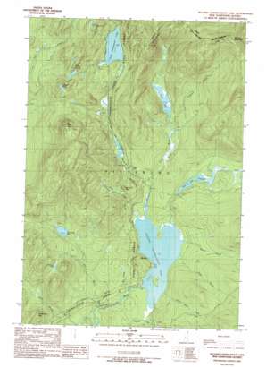
Second Connecticut Lake Topo Map New Hampshire
To zoom in, hover over the map of Second Connecticut Lake
USGS Topo Quad 45071b2 - 1:24,000 scale
| Topo Map Name: | Second Connecticut Lake |
| USGS Topo Quad ID: | 45071b2 |
| Print Size: | ca. 21 1/4" wide x 27" high |
| Southeast Coordinates: | 45.125° N latitude / 71.125° W longitude |
| Map Center Coordinates: | 45.1875° N latitude / 71.1875° W longitude |
| U.S. State: | NH |
| Filename: | o45071b2.jpg |
| Download Map JPG Image: | Second Connecticut Lake topo map 1:24,000 scale |
| Map Type: | Topographic |
| Topo Series: | 7.5´ |
| Map Scale: | 1:24,000 |
| Source of Map Images: | United States Geological Survey (USGS) |
| Alternate Map Versions: |
Second Connecticut Lake NH 1989, updated 1989 Download PDF Buy paper map Second Connecticut Lake NH 1997, updated 2000 Download PDF Buy paper map Second Connecticut Lake NH 2012 Download PDF Buy paper map Second Connecticut Lake NH 2015 Download PDF Buy paper map |
1:24,000 Topo Quads surrounding Second Connecticut Lake
> Back to 45071a1 at 1:100,000 scale
> Back to 45070a1 at 1:250,000 scale
> Back to U.S. Topo Maps home
Second Connecticut Lake topo map: Gazetteer
Second Connecticut Lake: Dams
Big Brook Bog Dam elevation 589m 1932′Coon Brook Bog Dam elevation 598m 1961′
East Inlet Dam elevation 613m 2011′
Moose Falls Dam elevation 597m 1958′
Scott Bog Dam elevation 600m 1968′
Second Connecticut Lake Dam elevation 569m 1866′
Second Connecticut Lake: Falls
Moose Falls elevation 601m 1971′Second Connecticut Lake: Forests
Connecticut Lakes State Forest elevation 612m 2007′Second Connecticut Lake: Lakes
East Inlet Flowage elevation 589m 1932′Fourth Connecticut Lake elevation 813m 2667′
Perry Ponds elevation 772m 2532′
Third Connecticut Lake elevation 667m 2188′
Unknown Pond elevation 662m 2171′
Wright Pond elevation 796m 2611′
Second Connecticut Lake: Parks
East Inlet Wildlife Management Area elevation 602m 1975′Scotts Bog Wildlife Management Area elevation 715m 2345′
Second Connecticut Lake: Populated Places
Idlewilde elevation 600m 1968′Second Connecticut Lake: Reservoirs
Big Brook Bog elevation 589m 1932′Connecticut River Reservoir elevation 597m 1958′
Coon Brook Bog elevation 598m 1961′
East Inlet Pond elevation 613m 2011′
Second Connecticut Lake elevation 569m 1866′
Second Connecticut Lake: Streams
Big Brook elevation 510m 1673′Dry Brook elevation 547m 1794′
East Inlet elevation 594m 1948′
Emery Allen Brook elevation 569m 1866′
Ingersoll Brook elevation 590m 1935′
Moose Brook elevation 572m 1876′
Robie Brook elevation 573m 1879′
Scott Brook elevation 577m 1893′
West Inlet elevation 571m 1873′
Second Connecticut Lake: Summits
Black Cat Spur elevation 577m 1893′Corkscrew Hill elevation 689m 2260′
Deer Mountain elevation 883m 2896′
Salmon Mountain elevation 987m 3238′
Second Connecticut Lake: Valleys
Desmond Valley elevation 581m 1906′Second Connecticut Lake digital topo map on disk
Buy this Second Connecticut Lake topo map showing relief, roads, GPS coordinates and other geographical features, as a high-resolution digital map file on DVD:
Maine, New Hampshire, Rhode Island & Eastern Massachusetts
Buy digital topo maps: Maine, New Hampshire, Rhode Island & Eastern Massachusetts


