Thunder Bay Island Topo Map Michigan
To zoom in, hover over the map of Thunder Bay Island
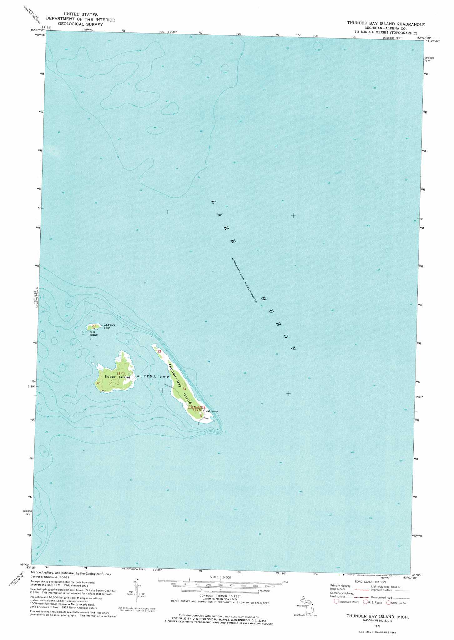
USGS Topo Quad 45083a2 - 1:24,000 scale
| Topo Map Name: | Thunder Bay Island |
| USGS Topo Quad ID: | 45083a2 |
| Print Size: | ca. 21 1/4" wide x 27" high |
| Southeast Coordinates: | 45° N latitude / 83.125° W longitude |
| Map Center Coordinates: | 45.0625° N latitude / 83.1875° W longitude |
| U.S. State: | MI |
| Filename: | o45083a2.jpg |
| Download Map JPG Image: | Thunder Bay Island topo map 1:24,000 scale |
| Map Type: | Topographic |
| Topo Series: | 7.5´ |
| Map Scale: | 1:24,000 |
| Source of Map Images: | United States Geological Survey (USGS) |
| Alternate Map Versions: |
Thunder Bay Island MI 1971, updated 1974 Download PDF Buy paper map Thunder Bay Island MI 1971, updated 1974 Download PDF Buy paper map Thunder Bay Island MI 2011 Download PDF Buy paper map Thunder Bay Island MI 2014 Download PDF Buy paper map Thunder Bay Island MI 2016 Download PDF Buy paper map |
1:24,000 Topo Quads surrounding Thunder Bay Island
Presque Isle |
||||
Long Lake East |
Middle Island |
|||
Alpena |
North Point |
Thunder Bay Island |
||
Ossineke |
South Point |
|||
Spruce |
Black River |
> Back to 45083a1 at 1:100,000 scale
> Back to 45082a1 at 1:250,000 scale
> Back to U.S. Topo Maps home
Thunder Bay Island topo map: Gazetteer
Thunder Bay Island: Islands
Gull Island elevation 179m 587′Sugar Island elevation 182m 597′
Thunder Bay Island elevation 179m 587′
Thunder Bay Island digital topo map on disk
Buy this Thunder Bay Island topo map showing relief, roads, GPS coordinates and other geographical features, as a high-resolution digital map file on DVD:
 map DVD")