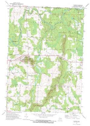
Lachine Topo Map Michigan
To zoom in, hover over the map of Lachine
USGS Topo Quad 45083a6 - 1:24,000 scale
| Topo Map Name: | Lachine |
| USGS Topo Quad ID: | 45083a6 |
| Print Size: | ca. 21 1/4" wide x 27" high |
| Southeast Coordinates: | 45° N latitude / 83.625° W longitude |
| Map Center Coordinates: | 45.0625° N latitude / 83.6875° W longitude |
| U.S. State: | MI |
| Filename: | o45083a6.jpg |
| Download Map JPG Image: | Lachine topo map 1:24,000 scale |
| Map Type: | Topographic |
| Topo Series: | 7.5´ |
| Map Scale: | 1:24,000 |
| Source of Map Images: | United States Geological Survey (USGS) |
| Alternate Map Versions: |
Lachine MI 1971, updated 1974 Download PDF Buy paper map Lachine MI 2011 Download PDF Buy paper map Lachine MI 2014 Download PDF Buy paper map Lachine MI 2017 Download PDF Buy paper map |
1:24,000 Topo Quads surrounding Lachine
> Back to 45083a1 at 1:100,000 scale
> Back to 45082a1 at 1:250,000 scale
> Back to U.S. Topo Maps home
Lachine topo map: Gazetteer
Lachine: Bridges
Orchard Hill Bridge elevation 205m 672′Lachine: Lakes
Blue Lake elevation 215m 705′Lachine: Parks
Manning Hill Park elevation 239m 784′Lachine: Populated Places
Emerson Station elevation 222m 728′Flanders elevation 232m 761′
Herron elevation 226m 741′
Lachine elevation 224m 734′
Spratt elevation 229m 751′
Lachine: Post Offices
Dafoe Post Office (historical) elevation 220m 721′Flanders Post Office (historical) elevation 232m 761′
Herron Post Office elevation 225m 738′
Lachine Post Office elevation 225m 738′
Spratt Post Office (historical) elevation 230m 754′
Lachine: Streams
Bean Creek elevation 208m 682′Gaffney Creek elevation 212m 695′
Morrison Creek elevation 212m 695′
Spratt Creek elevation 222m 728′
Lachine: Summits
Manning Hill elevation 281m 921′Lachine digital topo map on disk
Buy this Lachine topo map showing relief, roads, GPS coordinates and other geographical features, as a high-resolution digital map file on DVD:


