Royston Topo Map Michigan
To zoom in, hover over the map of Royston
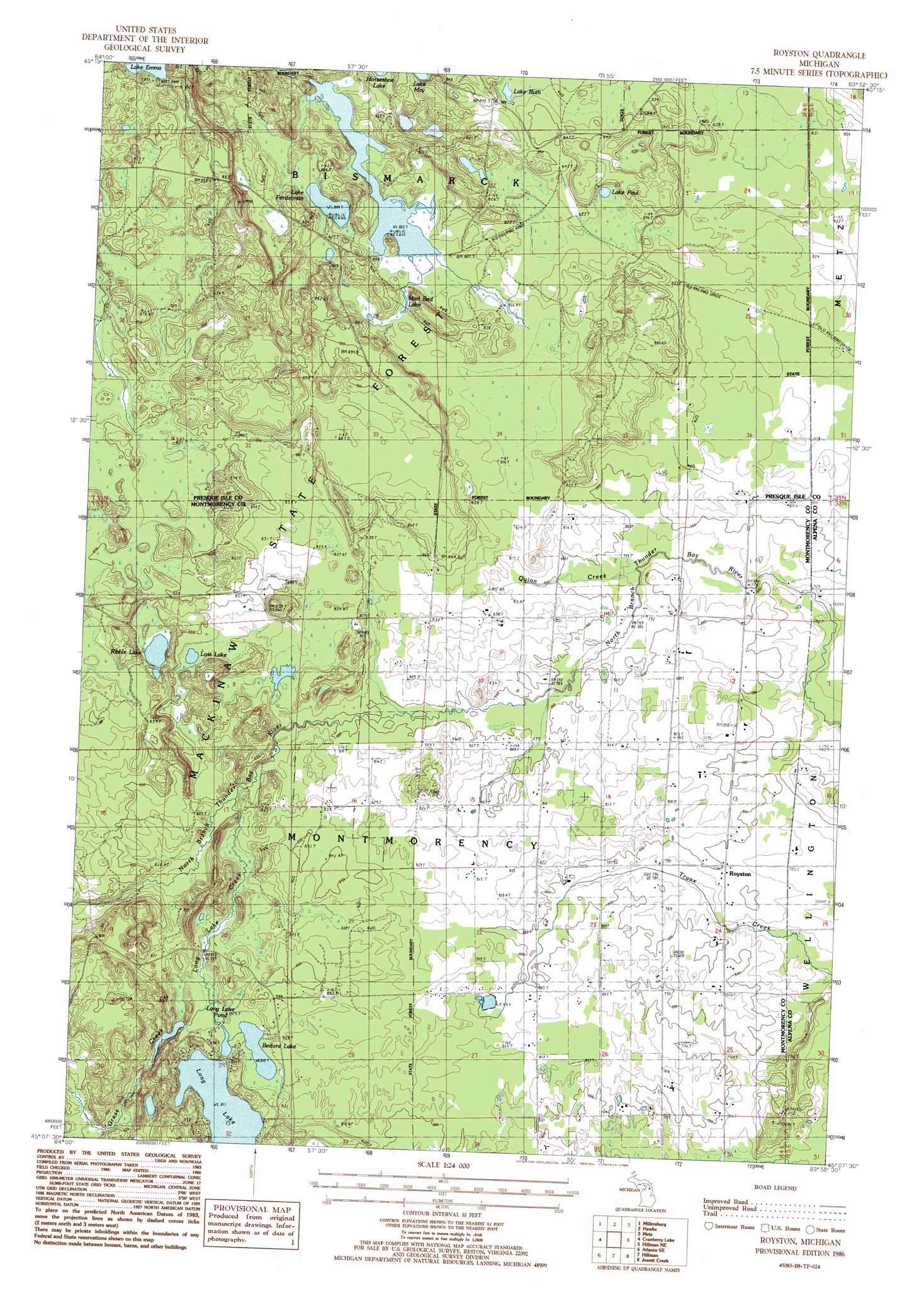
USGS Topo Quad 45083b8 - 1:24,000 scale
| Topo Map Name: | Royston |
| USGS Topo Quad ID: | 45083b8 |
| Print Size: | ca. 21 1/4" wide x 27" high |
| Southeast Coordinates: | 45.125° N latitude / 83.875° W longitude |
| Map Center Coordinates: | 45.1875° N latitude / 83.9375° W longitude |
| U.S. State: | MI |
| Filename: | o45083b8.jpg |
| Download Map JPG Image: | Royston topo map 1:24,000 scale |
| Map Type: | Topographic |
| Topo Series: | 7.5´ |
| Map Scale: | 1:24,000 |
| Source of Map Images: | United States Geological Survey (USGS) |
| Alternate Map Versions: |
Royston MI 1986, updated 1986 Download PDF Buy paper map Royston MI 2011 Download PDF Buy paper map Royston MI 2014 Download PDF Buy paper map Royston MI 2016 Download PDF Buy paper map |
1:24,000 Topo Quads surrounding Royston
Black Lake Bluffs |
Ocqueoc |
Moltke |
Rogers City |
Adams Point |
Onaway |
Millersburg |
Hawks |
Metz |
Posen |
Lake Geneva |
Cranberry Lake |
Royston |
Hillman Ne |
Polaski |
Atlanta |
Atlanta Se |
Hillman |
Jewett Creek |
Lachine |
Crooked Lake |
Avery |
Rust |
Beaver Lake |
Evans Creek |
> Back to 45083a1 at 1:100,000 scale
> Back to 45082a1 at 1:250,000 scale
> Back to U.S. Topo Maps home
Royston topo map: Gazetteer
Royston: Dams
Sportsmen Dam elevation 249m 816′Royston: Lakes
Bedore Lake elevation 247m 810′Lake Ferdelman elevation 245m 803′
Lake Paul elevation 256m 839′
Lake Ruth elevation 251m 823′
Long Lake elevation 247m 810′
Long Lake Pond elevation 249m 816′
Long Lake Pond elevation 249m 816′
Long Lake Pond elevation 249m 816′
Long Lake Pond elevation 249m 816′
Long Lake Pond elevation 249m 816′
Lost Lake elevation 254m 833′
Marl Bed Lake elevation 247m 810′
Ribble Lake elevation 257m 843′
Royston: Populated Places
Royston elevation 243m 797′Royston: Post Offices
Royston Post Office (historical) elevation 243m 797′Royston: Streams
Grass Creek elevation 249m 816′Long Lake Creek elevation 245m 803′
Quinn Creek elevation 238m 780′
Royston digital topo map on disk
Buy this Royston topo map showing relief, roads, GPS coordinates and other geographical features, as a high-resolution digital map file on DVD:
 map DVD")