Vanderbilt Topo Map Michigan
To zoom in, hover over the map of Vanderbilt
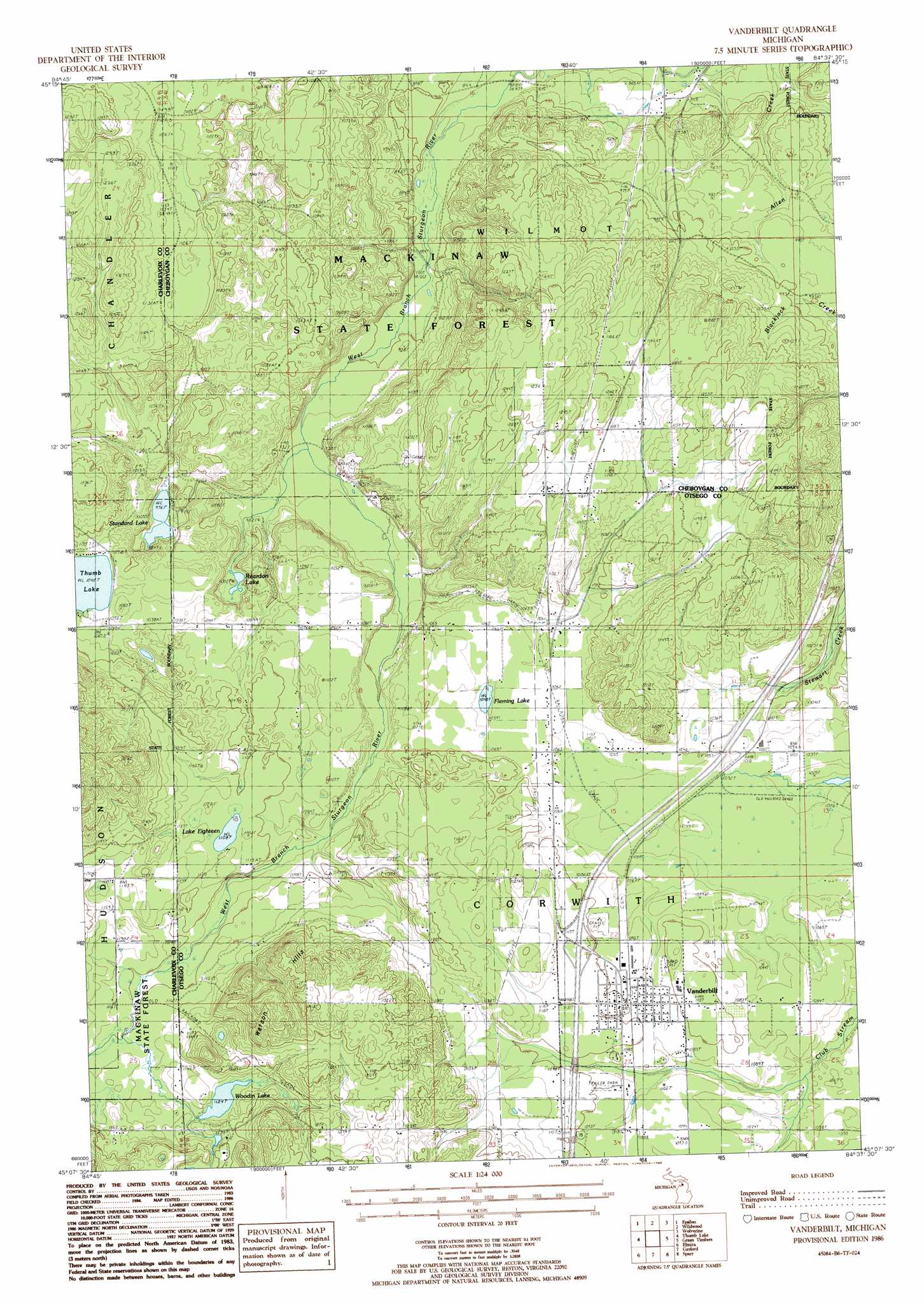
USGS Topo Quad 45084b6 - 1:24,000 scale
| Topo Map Name: | Vanderbilt |
| USGS Topo Quad ID: | 45084b6 |
| Print Size: | ca. 21 1/4" wide x 27" high |
| Southeast Coordinates: | 45.125° N latitude / 84.625° W longitude |
| Map Center Coordinates: | 45.1875° N latitude / 84.6875° W longitude |
| U.S. State: | MI |
| Filename: | o45084b6.jpg |
| Download Map JPG Image: | Vanderbilt topo map 1:24,000 scale |
| Map Type: | Topographic |
| Topo Series: | 7.5´ |
| Map Scale: | 1:24,000 |
| Source of Map Images: | United States Geological Survey (USGS) |
| Alternate Map Versions: |
Vanderbilt MI 1986, updated 1986 Download PDF Buy paper map Vanderbilt MI 2011 Download PDF Buy paper map Vanderbilt MI 2014 Download PDF Buy paper map Vanderbilt MI 2017 Download PDF Buy paper map |
1:24,000 Topo Quads surrounding Vanderbilt
Harbor Springs |
Alanson |
Burt Lake |
Indian River |
Legrand |
Petoskey |
Epsilon |
Wildwood |
Wolverine |
Afton |
Boyne Falls |
Thumb Lake |
Vanderbilt |
Green Timbers |
Hardwood Lake |
Deadmans Hill |
Elmira |
Gaylord |
Sparr |
Saunders Creek |
Alba |
Lake Arrowhead |
Otsego Lake |
Turtle Lake |
Johannesburg |
> Back to 45084a1 at 1:100,000 scale
> Back to 45084a1 at 1:250,000 scale
> Back to U.S. Topo Maps home
Vanderbilt topo map: Gazetteer
Vanderbilt: Crossings
Interchange 290 elevation 340m 1115′Vanderbilt: Lakes
Fleming Lake elevation 318m 1043′Lake Eighteen elevation 338m 1108′
Reardon Lake elevation 297m 974′
Standard Lake elevation 297m 974′
Woodin Lake elevation 343m 1125′
Vanderbilt: Populated Places
Mill Street Mobile Home Park elevation 334m 1095′Vanderbilt elevation 334m 1095′
Vanderbilt: Post Offices
Berryville Post Office (historical) elevation 361m 1184′Vanderbilt Post Office elevation 335m 1099′
Vanderbilt: Summits
Watson Hills elevation 438m 1437′Vanderbilt digital topo map on disk
Buy this Vanderbilt topo map showing relief, roads, GPS coordinates and other geographical features, as a high-resolution digital map file on DVD: