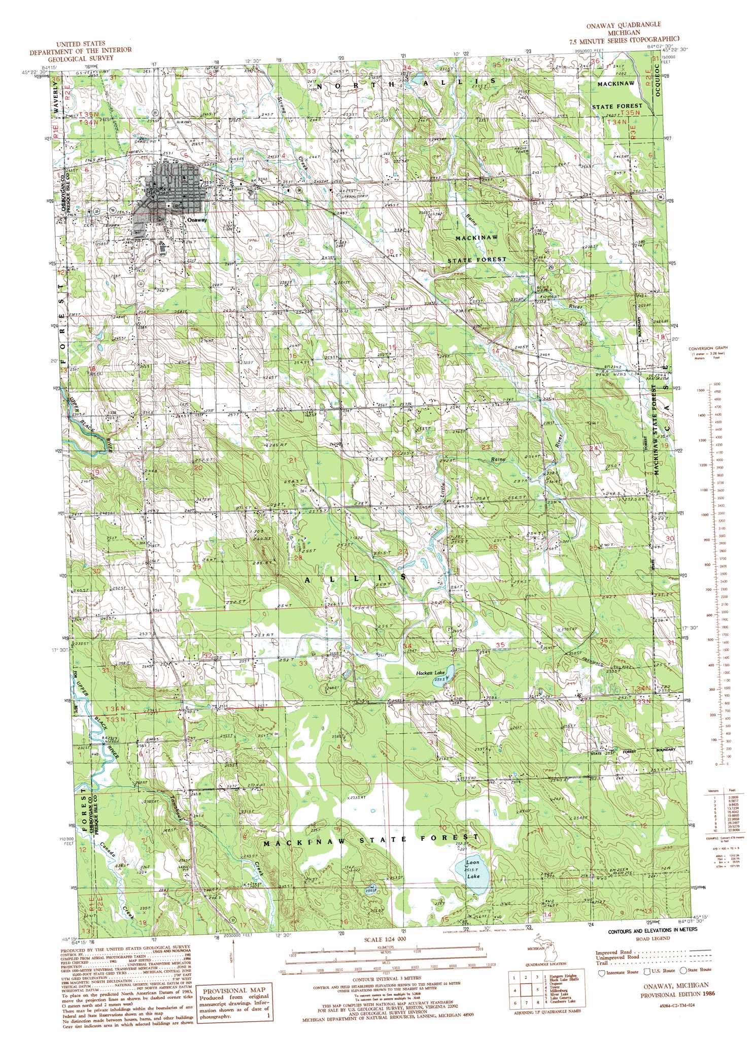
Onaway Topo Map Michigan
To zoom in, hover over the map of Onaway
USGS Topo Quad 45084c2 - 1:24,000 scale
| Topo Map Name: | Onaway |
| USGS Topo Quad ID: | 45084c2 |
| Print Size: | ca. 21 1/4" wide x 27" high |
| Southeast Coordinates: | 45.25° N latitude / 84.125° W longitude |
| Map Center Coordinates: | 45.3125° N latitude / 84.1875° W longitude |
| U.S. State: | MI |
| Filename: | o45084c2.jpg |
| Download Map JPG Image: | Onaway topo map 1:24,000 scale |
| Map Type: | Topographic |
| Topo Series: | 7.5´ |
| Map Scale: | 1:24,000 |
| Source of Map Images: | United States Geological Survey (USGS) |
| Alternate Map Versions: |
Onaway MI 1986, updated 1986 Download PDF Buy paper map Onaway MI 2011 Download PDF Buy paper map Onaway MI 2014 Download PDF Buy paper map Onaway MI 2017 Download PDF Buy paper map |
1:24,000 Topo Quads surrounding Onaway
Aloha |
Manning |
Grace |
||
Legrand |
Hangore Heights |
Black Lake Bluffs |
Ocqueoc |
Moltke |
Afton |
Tower |
Onaway |
Millersburg |
Hawks |
Hardwood Lake |
Silver Lake |
Lake Geneva |
Cranberry Lake |
Royston |
Saunders Creek |
Hetherton |
Atlanta |
Atlanta Se |
Hillman |
> Back to 45084a1 at 1:100,000 scale
> Back to 45084a1 at 1:250,000 scale
> Back to U.S. Topo Maps home
Onaway topo map: Gazetteer
Onaway: Airports
Leo E Goetz County Airport elevation 255m 836′Onaway: Lakes
Hackett Lake elevation 250m 820′Loon Lake elevation 251m 823′
Onaway: Parks
Edna Lound Recreational Park elevation 255m 836′Onaway: Populated Places
Onaway elevation 259m 849′Onaway: Post Offices
Case Post Office (historical) elevation 237m 777′Onaway Post Office (historical) elevation 258m 846′
Onaway: Streams
East Branch Rainy River elevation 233m 764′Little Rainy River elevation 231m 757′
Tomahawk Creek elevation 230m 754′
Onaway digital topo map on disk
Buy this Onaway topo map showing relief, roads, GPS coordinates and other geographical features, as a high-resolution digital map file on DVD: