Burt Lake Topo Map Michigan
To zoom in, hover over the map of Burt Lake
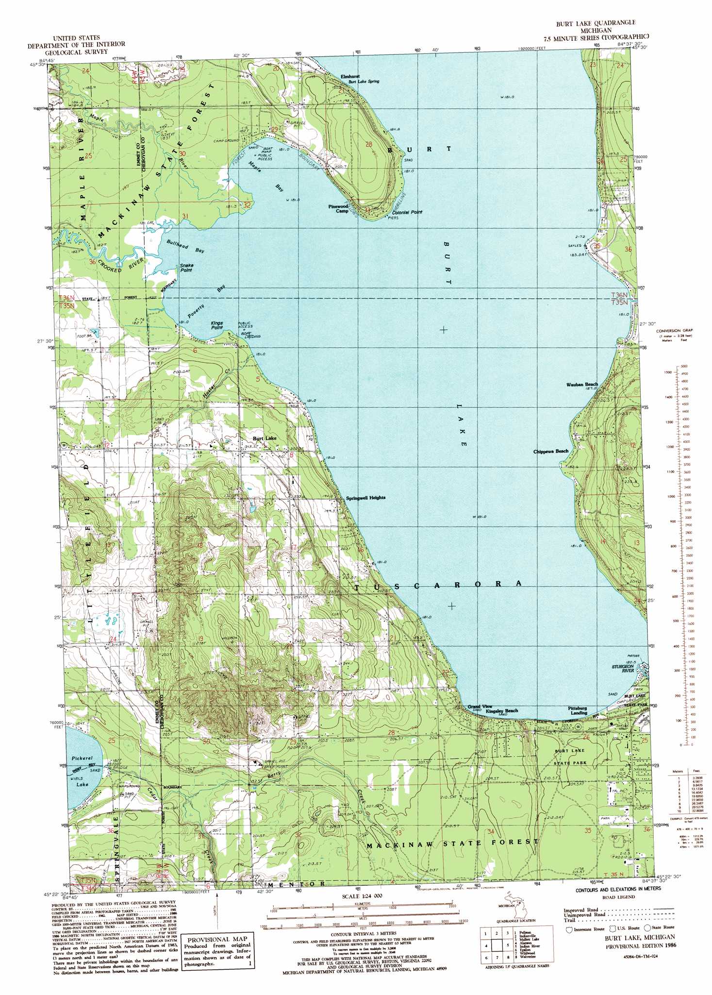
USGS Topo Quad 45084d6 - 1:24,000 scale
| Topo Map Name: | Burt Lake |
| USGS Topo Quad ID: | 45084d6 |
| Print Size: | ca. 21 1/4" wide x 27" high |
| Southeast Coordinates: | 45.375° N latitude / 84.625° W longitude |
| Map Center Coordinates: | 45.4375° N latitude / 84.6875° W longitude |
| U.S. State: | MI |
| Filename: | o45084d6.jpg |
| Download Map JPG Image: | Burt Lake topo map 1:24,000 scale |
| Map Type: | Topographic |
| Topo Series: | 7.5´ |
| Map Scale: | 1:24,000 |
| Source of Map Images: | United States Geological Survey (USGS) |
| Alternate Map Versions: |
Burt Lake MI 1986, updated 1986 Download PDF Buy paper map Burt Lake MI 2011 Download PDF Buy paper map Burt Lake MI 2014 Download PDF Buy paper map Burt Lake MI 2017 Download PDF Buy paper map |
1:24,000 Topo Quads surrounding Burt Lake
Bliss |
Levaring |
Freedom |
Point Nipigon |
Cheboygan |
Larks Lake |
Pellston |
Indian Village |
Mullett Lake |
Aloha |
Harbor Springs |
Alanson |
Burt Lake |
Indian River |
Legrand |
Petoskey |
Epsilon |
Wildwood |
Wolverine |
Afton |
Boyne Falls |
Thumb Lake |
Vanderbilt |
Green Timbers |
Hardwood Lake |
> Back to 45084a1 at 1:100,000 scale
> Back to 45084a1 at 1:250,000 scale
> Back to U.S. Topo Maps home
Burt Lake topo map: Gazetteer
Burt Lake: Bays
Bullhead Bay elevation 181m 593′Maple Bay elevation 181m 593′
Poverty Bay elevation 181m 593′
Burt Lake: Capes
Colonial Point elevation 185m 606′Kings Point elevation 181m 593′
Snake Point elevation 181m 593′
Burt Lake: Lakes
Burt Lake elevation 181m 593′Burt Lake: Parks
Burt Lake State Park elevation 208m 682′Cooperation Park elevation 213m 698′
Peter L Brisbine House Historical Marker elevation 184m 603′
Burt Lake: Populated Places
Burt Lake elevation 215m 705′Chippewa Beach elevation 183m 600′
Elmhurst elevation 188m 616′
Grand View elevation 202m 662′
Kingsley Beach elevation 203m 666′
Pittsburg Landing elevation 181m 593′
Springwell Heights elevation 185m 606′
Wauban Beach elevation 185m 606′
Burt Lake: Post Offices
Burt Lake Post Office (historical) elevation 215m 705′Burt Lake: Springs
Burt Lake Spring elevation 182m 597′Burt Lake: Streams
Berry Creek elevation 181m 593′Cedar Creek elevation 186m 610′
Crooked River elevation 181m 593′
Hasler Creek elevation 181m 593′
Maple River elevation 181m 593′
Burt Lake digital topo map on disk
Buy this Burt Lake topo map showing relief, roads, GPS coordinates and other geographical features, as a high-resolution digital map file on DVD: