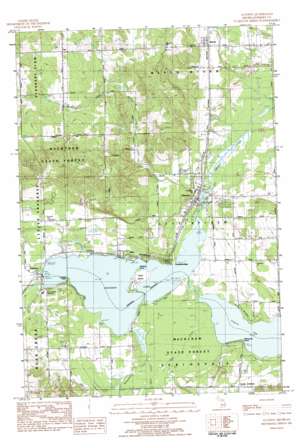
Alanson Topo Map Michigan
To zoom in, hover over the map of Alanson
USGS Topo Quad 45084d7 - 1:25,000 scale
| Topo Map Name: | Alanson |
| USGS Topo Quad ID: | 45084d7 |
| Print Size: | ca. 21 1/4" wide x 27" high |
| Southeast Coordinates: | 45.375° N latitude / 84.75° W longitude |
| Map Center Coordinates: | 45.4375° N latitude / 84.8125° W longitude |
| U.S. State: | MI |
| Filename: | l45084d7.jpg |
| Download Map JPG Image: | Alanson topo map 1:25,000 scale |
| Map Type: | Topographic |
| Topo Series: | 7.5´ |
| Map Scale: | 1:25,000 |
| Source of Map Images: | United States Geological Survey (USGS) |
| Alternate Map Versions: |
1:24,000 Topo Quads surrounding Alanson
> Back to 45084a1 at 1:100,000 scale
> Back to 45084a1 at 1:250,000 scale
> Back to U.S. Topo Maps home
Alanson topo map: Gazetteer
Alanson: Capes
Ellsworth Point elevation 182m 597′Graham Point elevation 183m 600′
Indiana Point elevation 183m 600′
Alanson: Islands
Oden Island elevation 183m 600′Alanson: Lakes
Crooked Lake elevation 182m 597′Pickerel Lake elevation 182m 597′
Alanson: Parks
Alanson Village Park elevation 185m 606′Passenger Pigeons Historical Marker elevation 185m 606′
W W Fairbairn Historical Marker elevation 187m 613′
Alanson: Populated Places
Alanson elevation 188m 616′Ayr elevation 305m 1000′
Brutus elevation 209m 685′
Chalet Estates elevation 205m 672′
Conway elevation 185m 606′
Oden elevation 188m 616′
Ponshewaing elevation 187m 613′
Alanson: Post Offices
Alanson Post Office elevation 185m 606′Ayr Post Office (historical) elevation 305m 1000′
Brutus Post Office elevation 209m 685′
Conway Post Office elevation 183m 600′
Oden Post Office (historical) elevation 188m 616′
Alanson: Streams
McPhee Creek elevation 183m 600′McPhee Creek elevation 190m 623′
Minnehaha Creek elevation 182m 597′
Mud Creek elevation 190m 623′
Silver Creek elevation 185m 606′
Whites Creek elevation 183m 600′
Alanson digital topo map on disk
Buy this Alanson topo map showing relief, roads, GPS coordinates and other geographical features, as a high-resolution digital map file on DVD:


