Ninemile Point Topo Map Michigan
To zoom in, hover over the map of Ninemile Point
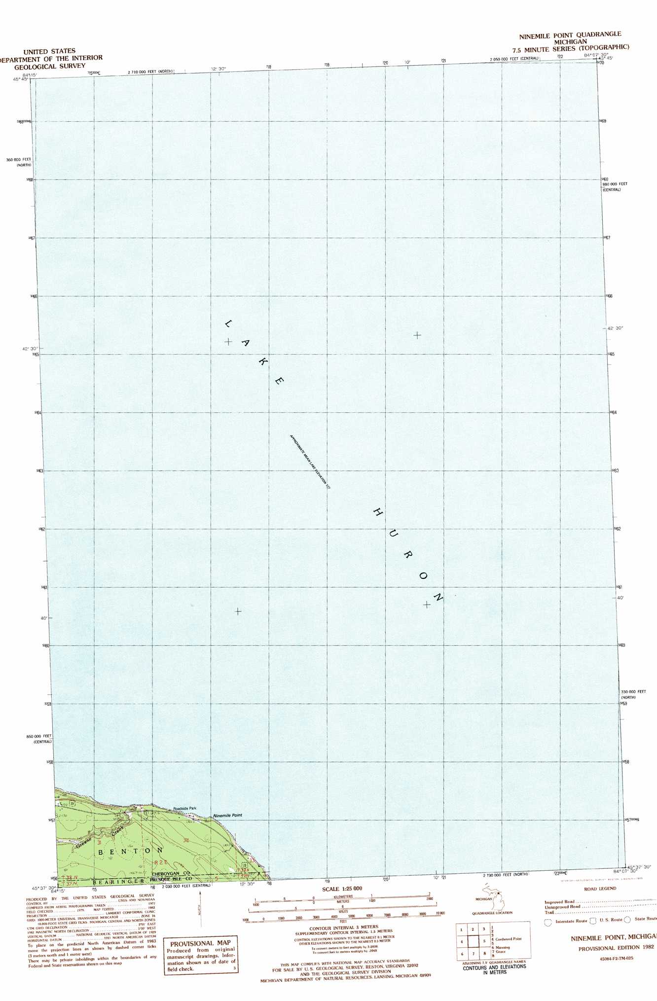
USGS Topo Quad 45084f2 - 1:25,000 scale
| Topo Map Name: | Ninemile Point |
| USGS Topo Quad ID: | 45084f2 |
| Print Size: | ca. 21 1/4" wide x 27" high |
| Southeast Coordinates: | 45.625° N latitude / 84.125° W longitude |
| Map Center Coordinates: | 45.6875° N latitude / 84.1875° W longitude |
| U.S. State: | MI |
| Filename: | l45084f2.jpg |
| Download Map JPG Image: | Ninemile Point topo map 1:25,000 scale |
| Map Type: | Topographic |
| Topo Series: | 7.5´ |
| Map Scale: | 1:25,000 |
| Source of Map Images: | United States Geological Survey (USGS) |
| Alternate Map Versions: |
Nilemile Point MI 1982, updated 1983 Download PDF Buy paper map |
1:24,000 Topo Quads surrounding Ninemile Point
Goose Island |
Cedarville |
Prentiss Bay |
Albany Island |
De Tour Village |
Mcrae Bay |
||||
Cheboygan |
Cordwood Point |
Ninemile Point |
||
Aloha |
Manning |
Grace |
||
Legrand |
Hangore Heights |
Black Lake Bluffs |
Ocqueoc |
Moltke |
> Back to 45084e1 at 1:100,000 scale
> Back to 45084a1 at 1:250,000 scale
> Back to U.S. Topo Maps home
Ninemile Point topo map: Gazetteer
Ninemile Point: Capes
Ninemile Point elevation 177m 580′Ninemile Point: Streams
Greene Creek elevation 184m 603′Ninemile Point digital topo map on disk
Buy this Ninemile Point topo map showing relief, roads, GPS coordinates and other geographical features, as a high-resolution digital map file on DVD: