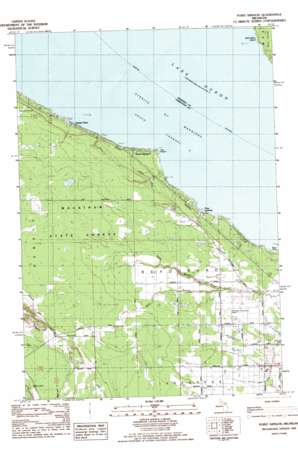
Point Nipigon Topo Map Michigan
To zoom in, hover over the map of Point Nipigon
USGS Topo Quad 45084f5 - 1:25,000 scale
| Topo Map Name: | Point Nipigon |
| USGS Topo Quad ID: | 45084f5 |
| Print Size: | ca. 21 1/4" wide x 27" high |
| Southeast Coordinates: | 45.625° N latitude / 84.5° W longitude |
| Map Center Coordinates: | 45.6875° N latitude / 84.5625° W longitude |
| U.S. State: | MI |
| Filename: | l45084f5.jpg |
| Download Map JPG Image: | Point Nipigon topo map 1:25,000 scale |
| Map Type: | Topographic |
| Topo Series: | 7.5´ |
| Map Scale: | 1:25,000 |
| Source of Map Images: | United States Geological Survey (USGS) |
| Alternate Map Versions: |
Point Nipigon MI 1982, updated 1983 Download PDF Buy paper map |
1:24,000 Topo Quads surrounding Point Nipigon
> Back to 45084e1 at 1:100,000 scale
> Back to 45084a1 at 1:250,000 scale
> Back to U.S. Topo Maps home
Point Nipigon topo map: Gazetteer
Point Nipigon: Airports
Cheboygan City-County Airport elevation 192m 629′Point Nipigon: Capes
Point Nipigon elevation 177m 580′Point Nipigon: Channels
South Channel elevation 177m 580′Point Nipigon: Populated Places
Grand View elevation 181m 593′Point Nipigon elevation 182m 597′
Pries Landing elevation 184m 603′
Point Nipigon: Streams
West Branch Little Black River elevation 190m 623′West Branch Little Black River elevation 191m 626′
Point Nipigon digital topo map on disk
Buy this Point Nipigon topo map showing relief, roads, GPS coordinates and other geographical features, as a high-resolution digital map file on DVD:


