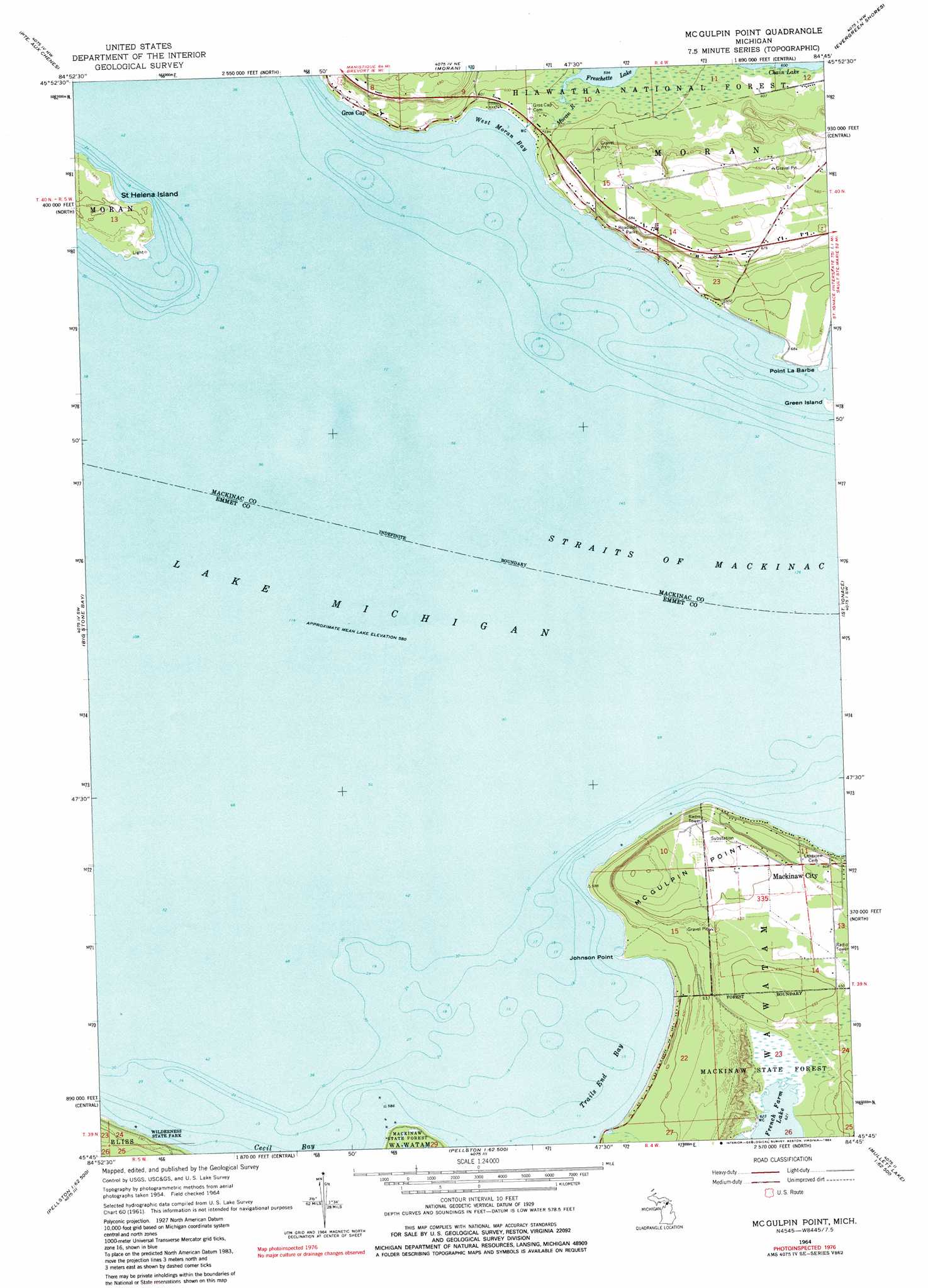
Mcgulpin Point Topo Map Michigan
To zoom in, hover over the map of Mcgulpin Point
USGS Topo Quad 45084g7 - 1:24,000 scale
| Topo Map Name: | Mcgulpin Point |
| USGS Topo Quad ID: | 45084g7 |
| Print Size: | ca. 21 1/4" wide x 27" high |
| Southeast Coordinates: | 45.75° N latitude / 84.75° W longitude |
| Map Center Coordinates: | 45.8125° N latitude / 84.8125° W longitude |
| U.S. State: | MI |
| Filename: | o45084g7.jpg |
| Download Map JPG Image: | Mcgulpin Point topo map 1:24,000 scale |
| Map Type: | Topographic |
| Topo Series: | 7.5´ |
| Map Scale: | 1:24,000 |
| Source of Map Images: | United States Geological Survey (USGS) |
| Alternate Map Versions: |
McGulpin Point MI 1964, updated 1966 Download PDF Buy paper map McGulpin Point MI 1964, updated 1984 Download PDF Buy paper map McGulpin Point MI 2011 Download PDF Buy paper map McGulpin Point MI 2014 Download PDF Buy paper map McGulpin Point MI 2017 Download PDF Buy paper map |
| FStopo: | US Forest Service topo McGulpin Point is available: Download FStopo PDF Download FStopo TIF |
1:24,000 Topo Quads surrounding Mcgulpin Point
Brevort |
Kenneth |
Ozark Se |
Charles |
Pontchartrain Shores |
Pnte Aux Chenes |
Moran |
Evergreen Shores |
Saint Martin Island |
|
Waugoshance Island |
Big Stone Bay |
Mcgulpin Point |
Saint Ignace |
Round Island |
Cross Village |
Bliss |
Levaring |
Freedom |
Point Nipigon |
Goodhart |
Larks Lake |
Pellston |
Indian Village |
Mullett Lake |
> Back to 45084e1 at 1:100,000 scale
> Back to 45084a1 at 1:250,000 scale
> Back to U.S. Topo Maps home
Mcgulpin Point topo map: Gazetteer
Mcgulpin Point: Bays
Trails End Bay elevation 177m 580′West Moran Bay elevation 177m 580′
Mcgulpin Point: Capes
Johnson Point elevation 181m 593′McGulpin Point elevation 180m 590′
Point La Barbe elevation 179m 587′
Mcgulpin Point: Channels
Straits of Mackinac elevation 177m 580′Mcgulpin Point: Islands
Saint Helena Island elevation 183m 600′Mcgulpin Point: Parks
Across the Peninsula Historical Marker elevation 209m 685′Gros Cap and Saint Helena Island Historical Marker elevation 177m 580′
Lake Michigan Historical Marker elevation 177m 580′
Mcgulpin Point: Populated Places
Gros Cap elevation 177m 580′Mcgulpin Point: Post Offices
Groscap Post Office (historical) elevation 177m 580′Mcgulpin Point: Streams
Moran River elevation 177m 580′Mcgulpin Point digital topo map on disk
Buy this Mcgulpin Point topo map showing relief, roads, GPS coordinates and other geographical features, as a high-resolution digital map file on DVD: