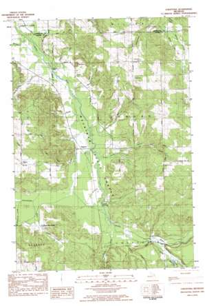
Chestonia Topo Map Michigan
To zoom in, hover over the map of Chestonia
USGS Topo Quad 45085a1 - 1:25,000 scale
| Topo Map Name: | Chestonia |
| USGS Topo Quad ID: | 45085a1 |
| Print Size: | ca. 21 1/4" wide x 27" high |
| Southeast Coordinates: | 45° N latitude / 85° W longitude |
| Map Center Coordinates: | 45.0625° N latitude / 85.0625° W longitude |
| U.S. State: | MI |
| Filename: | l45085a1.jpg |
| Download Map JPG Image: | Chestonia topo map 1:25,000 scale |
| Map Type: | Topographic |
| Topo Series: | 7.5´ |
| Map Scale: | 1:25,000 |
| Source of Map Images: | United States Geological Survey (USGS) |
| Alternate Map Versions: |
Chestonia MI 1983, updated 1984 Download PDF Buy paper map |
1:24,000 Topo Quads surrounding Chestonia
> Back to 45085a1 at 1:100,000 scale
> Back to 45084a1 at 1:250,000 scale
> Back to U.S. Topo Maps home
Chestonia topo map: Gazetteer
Chestonia: Bridges
Chestonia Bridge elevation 190m 623′Pinney Bridge elevation 220m 721′
Webster Bridge elevation 182m 597′
Chestonia: Crossings
Graves Crossing elevation 201m 659′Chestonia: Parks
Saint John Nepomucene Catholic Church Historical Marker elevation 285m 935′Chestonia: Populated Places
Chestonia elevation 195m 639′Finkton elevation 231m 757′
Chestonia: Post Offices
Chestonia Post Office (historical) elevation 195m 639′Finkton Post Office (historical) elevation 236m 774′
Rockery Post Office (historical) elevation 302m 990′
Chestonia: Streams
Bartholomew Creek elevation 182m 597′Bennett Creek elevation 180m 590′
Cascade Creek elevation 228m 748′
Cokirs Creek elevation 191m 626′
Gook Creek elevation 189m 620′
Green River elevation 205m 672′
Hitchcock Creek elevation 197m 646′
Landslide Creek elevation 220m 721′
Lilak Creek elevation 185m 606′
Martin Creek elevation 189m 620′
Mill Creek elevation 190m 623′
Scott Creek elevation 194m 636′
Severance Creek elevation 182m 597′
Stevens Creek elevation 210m 688′
Sutton Creek elevation 190m 623′
Todd Creek elevation 212m 695′
Tutstone Creek elevation 195m 639′
Webster Creek elevation 183m 600′
Chestonia: Summits
Mount Bliss elevation 260m 853′Chestonia digital topo map on disk
Buy this Chestonia topo map showing relief, roads, GPS coordinates and other geographical features, as a high-resolution digital map file on DVD:


