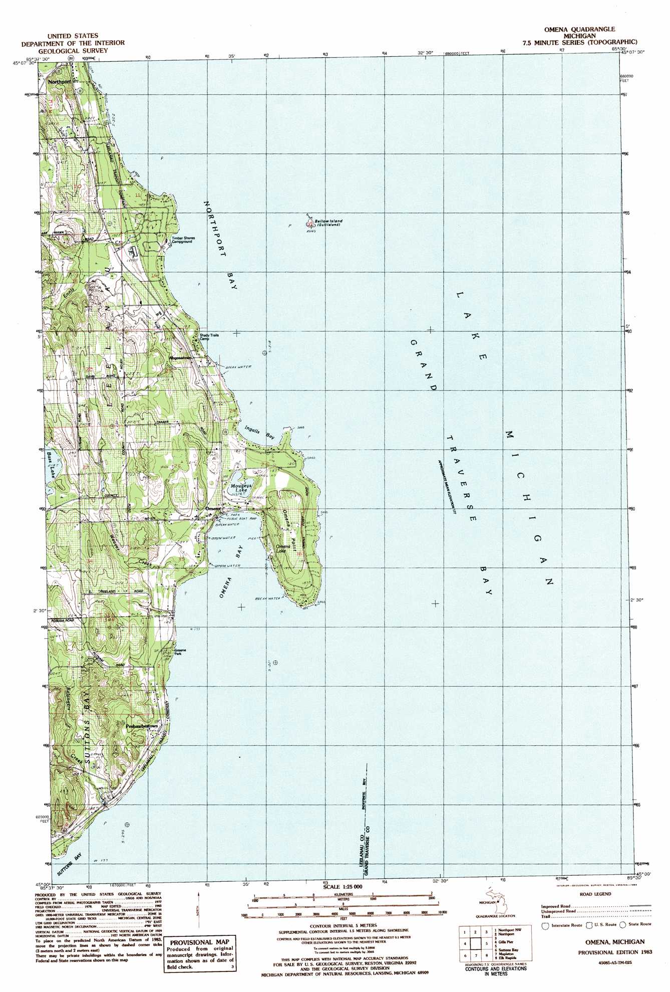
Omena Topo Map Michigan
To zoom in, hover over the map of Omena
USGS Topo Quad 45085a5 - 1:25,000 scale
| Topo Map Name: | Omena |
| USGS Topo Quad ID: | 45085a5 |
| Print Size: | ca. 21 1/4" wide x 27" high |
| Southeast Coordinates: | 45° N latitude / 85.5° W longitude |
| Map Center Coordinates: | 45.0625° N latitude / 85.5625° W longitude |
| U.S. State: | MI |
| Filename: | l45085a5.jpg |
| Download Map JPG Image: | Omena topo map 1:25,000 scale |
| Map Type: | Topographic |
| Topo Series: | 7.5´ |
| Map Scale: | 1:25,000 |
| Source of Map Images: | United States Geological Survey (USGS) |
| Alternate Map Versions: |
1:24,000 Topo Quads surrounding Omena
Charlevoix |
||||
Northport Nw |
Northport |
Atwood |
||
Leland |
Gills Pier |
Omena |
Central Lake |
|
Good Harbor Bay |
Suttons Bay |
Mapleton |
Elk Rapids |
Alden |
Maple City |
Traverse City Sw |
Traverse City Se |
Williamsburg |
Torch River |
> Back to 45085a1 at 1:100,000 scale
> Back to 45084a1 at 1:250,000 scale
> Back to U.S. Topo Maps home
Omena topo map: Gazetteer
Omena: Bays
Ingalls Bay elevation 177m 580′Northport Bay elevation 177m 580′
Omena Bay elevation 177m 580′
Omena: Capes
Omena Point elevation 204m 669′Omena: Islands
Bellow Island elevation 179m 587′Omena: Lakes
Bass Lake elevation 218m 715′Mougeys Lake elevation 181m 593′
Omena Lake elevation 178m 583′
Omena Lake elevation 178m 583′
Omena: Parks
Greene Park elevation 177m 580′Omena Presbyterian Church Historical Marker elevation 181m 593′
Omena: Populated Places
Ahgosatown elevation 183m 600′Omena elevation 184m 603′
Peshawbestown elevation 186m 610′
Omena: Post Offices
Omena Post Office elevation 179m 587′Omena: Streams
Belangers Creek elevation 177m 580′Ennis Creek elevation 178m 583′
Weaver Creek elevation 177m 580′
Omena digital topo map on disk
Buy this Omena topo map showing relief, roads, GPS coordinates and other geographical features, as a high-resolution digital map file on DVD: