Leland Topo Map Michigan
To zoom in, hover over the map of Leland
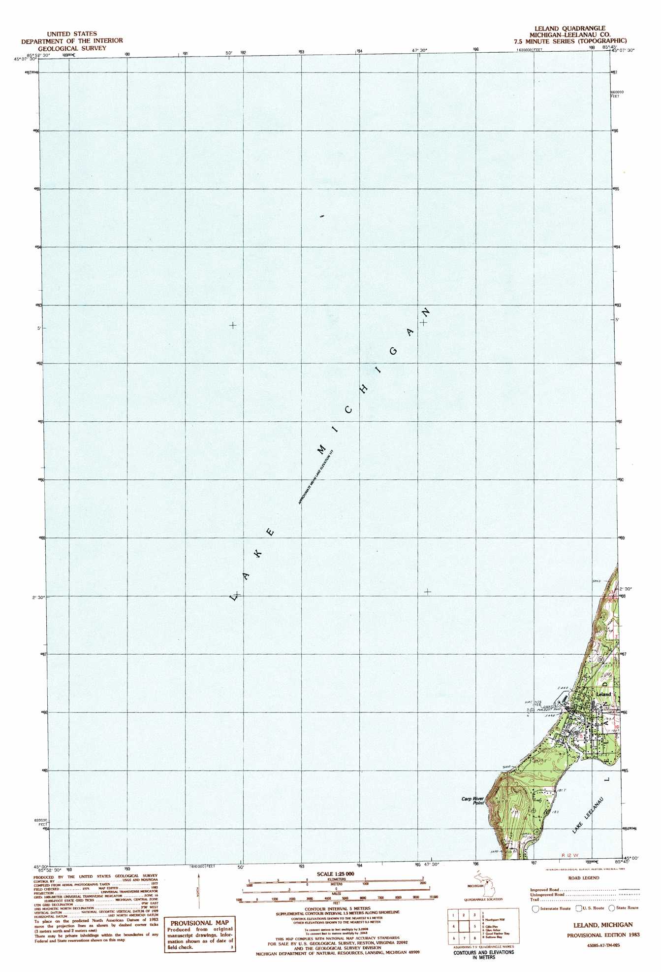
USGS Topo Quad 45085a7 - 1:25,000 scale
| Topo Map Name: | Leland |
| USGS Topo Quad ID: | 45085a7 |
| Print Size: | ca. 21 1/4" wide x 27" high |
| Southeast Coordinates: | 45° N latitude / 85.75° W longitude |
| Map Center Coordinates: | 45.0625° N latitude / 85.8125° W longitude |
| U.S. State: | MI |
| Filename: | l45085a7.jpg |
| Download Map JPG Image: | Leland topo map 1:25,000 scale |
| Map Type: | Topographic |
| Topo Series: | 7.5´ |
| Map Scale: | 1:25,000 |
| Source of Map Images: | United States Geological Survey (USGS) |
| Alternate Map Versions: |
Leland MI 1983, updated 1984 Download PDF Buy paper map |
1:24,000 Topo Quads surrounding Leland
Northport Nw |
Northport |
|||
South Manitou Island |
North Manitou Island |
Leland |
Gills Pier |
Omena |
Glen Haven |
Glen Arbor |
Good Harbor Bay |
Suttons Bay |
Mapleton |
Empire |
Burdickville |
Maple City |
Traverse City Sw |
Traverse City Se |
> Back to 45085a1 at 1:100,000 scale
> Back to 45084a1 at 1:250,000 scale
> Back to U.S. Topo Maps home
Leland topo map: Gazetteer
Leland: Capes
Carp River Point elevation 221m 725′Leland: Parks
Hancock Recreation Area elevation 190m 623′Leland Historic District (Fishtown) Historical Marker elevation 180m 590′
Leland: Populated Places
Leland elevation 181m 593′Leland: Post Offices
Leland Post Office elevation 181m 593′Leland: Streams
Leland River elevation 178m 583′Leland digital topo map on disk
Buy this Leland topo map showing relief, roads, GPS coordinates and other geographical features, as a high-resolution digital map file on DVD: