North Manitou Island Topo Map Michigan
To zoom in, hover over the map of North Manitou Island
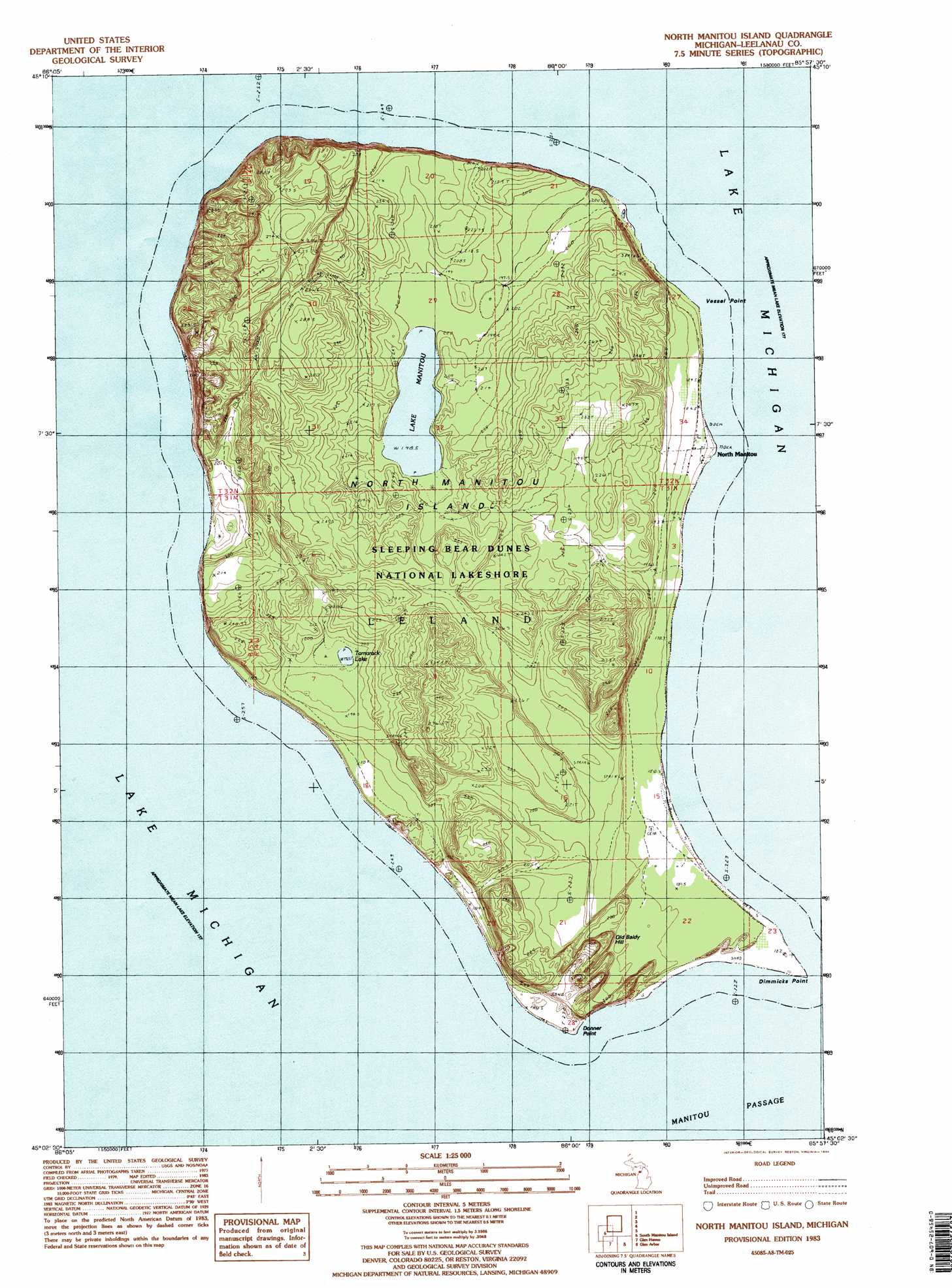
USGS Topo Quad 45085a8 - 1:25,000 scale
| Topo Map Name: | North Manitou Island |
| USGS Topo Quad ID: | 45085a8 |
| Print Size: | ca. 21 1/4" wide x 27" high |
| Southeast Coordinates: | 45° N latitude / 85.875° W longitude |
| Map Center Coordinates: | 45.0625° N latitude / 85.9375° W longitude |
| U.S. State: | MI |
| Filename: | l45085a8.jpg |
| Download Map JPG Image: | North Manitou Island topo map 1:25,000 scale |
| Map Type: | Topographic |
| Topo Series: | 7.5´ |
| Map Scale: | 1:25,000 |
| Source of Map Images: | United States Geological Survey (USGS) |
| Alternate Map Versions: |
1:24,000 Topo Quads surrounding North Manitou Island
Northport Nw |
||||
South Manitou Island |
North Manitou Island |
Leland |
Gills Pier |
|
Glen Haven |
Glen Arbor |
Good Harbor Bay |
Suttons Bay |
|
Empire |
Burdickville |
Maple City |
Traverse City Sw |
> Back to 45085a1 at 1:100,000 scale
> Back to 45084a1 at 1:250,000 scale
> Back to U.S. Topo Maps home
North Manitou Island topo map: Gazetteer
North Manitou Island: Bars
North Manitou Shoals elevation 177m 580′North Manitou Island: Capes
Dimmicks Point elevation 179m 587′North Manitou Island: Populated Places
North Manitou elevation 184m 603′North Manitou Island: Post Offices
North Manitou Island Post Office (historical) elevation 188m 616′North Manitou Island: Summits
Old Baldy Hill elevation 239m 784′North Manitou Island digital topo map on disk
Buy this North Manitou Island topo map showing relief, roads, GPS coordinates and other geographical features, as a high-resolution digital map file on DVD: