Washington Island Nw Topo Map Wisconsin
To zoom in, hover over the map of Washington Island Nw
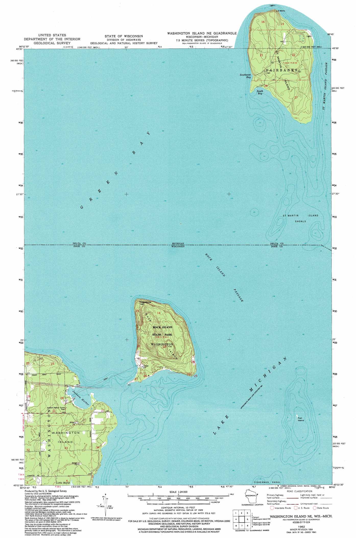
USGS Topo Quad 45086d7 - 1:24,000 scale
| Topo Map Name: | Washington Island Nw |
| USGS Topo Quad ID: | 45086d7 |
| Print Size: | ca. 21 1/4" wide x 27" high |
| Southeast Coordinates: | 45.375° N latitude / 86.75° W longitude |
| Map Center Coordinates: | 45.4375° N latitude / 86.8125° W longitude |
| U.S. States: | WI, MI |
| Filename: | o45086d7.jpg |
| Download Map JPG Image: | Washington Island Nw topo map 1:24,000 scale |
| Map Type: | Topographic |
| Topo Series: | 7.5´ |
| Map Scale: | 1:24,000 |
| Source of Map Images: | United States Geological Survey (USGS) |
| Alternate Map Versions: |
Washington Island NE WI 1982, updated 1983 Download PDF Buy paper map Washington Island NE WI 1982, updated 1994 Download PDF Buy paper map Washington Island NE WI 2011 Download PDF Buy paper map Washington Island NE WI 2013 Download PDF Buy paper map Washington Island NE WI 2016 Download PDF Buy paper map |
1:24,000 Topo Quads surrounding Washington Island Nw
Escanaba |
Peninsula Point |
Chippewa Point |
Fayette |
Devils Corner |
Fairport |
Point Detour |
|||
Washington Island Nw |
Washington Island Nw |
|||
Ellison Bay |
Washington Island Sw |
Washington Island Se |
||
Sister Bay |
Spider Island |
> Back to 45086a1 at 1:100,000 scale
> Back to 45086a1 at 1:250,000 scale
> Back to U.S. Topo Maps home
Washington Island Nw topo map: Gazetteer
Washington Island Nw: Bars
Saint Martin Island Shoals elevation 177m 580′Washington Island Nw: Bays
Jackson Harbor elevation 177m 580′South Bay elevation 177m 580′
South West Bay elevation 177m 580′
Washington Island Nw: Channels
Rock Island Passage elevation 177m 580′Saint Martin Island Passage elevation 177m 580′
Washington Island Nw: Crossings
Rock Island State Park Ferry elevation 178m 583′Washington Island Nw: Islands
Fish Island elevation 177m 580′Rock Island elevation 214m 702′
Saint Martin Island elevation 196m 643′
Washington Island Nw: Parks
Jackson Harbor Ridges State Natural Area elevation 179m 587′Johnson Harbor Dunes Park elevation 182m 597′
Rock Island State Park elevation 223m 731′
Rock Island Woods State Natural Area elevation 226m 741′
Washington Island Nw digital topo map on disk
Buy this Washington Island Nw topo map showing relief, roads, GPS coordinates and other geographical features, as a high-resolution digital map file on DVD: