Hiram Point Topo Map Michigan
To zoom in, hover over the map of Hiram Point
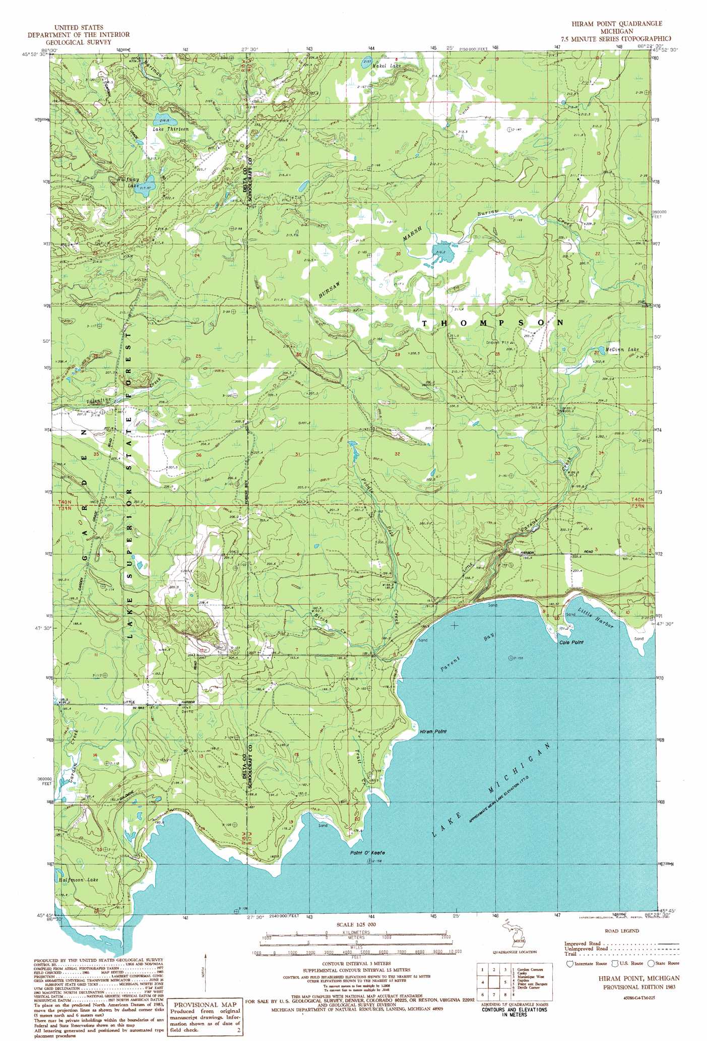
USGS Topo Quad 45086g4 - 1:24,000 scale
| Topo Map Name: | Hiram Point |
| USGS Topo Quad ID: | 45086g4 |
| Print Size: | ca. 21 1/4" wide x 27" high |
| Southeast Coordinates: | 45.75° N latitude / 86.375° W longitude |
| Map Center Coordinates: | 45.8125° N latitude / 86.4375° W longitude |
| U.S. State: | MI |
| Filename: | o45086g4.jpg |
| Download Map JPG Image: | Hiram Point topo map 1:24,000 scale |
| Map Type: | Topographic |
| Topo Series: | 7.5´ |
| Map Scale: | 1:24,000 |
| Source of Map Images: | United States Geological Survey (USGS) |
| Alternate Map Versions: |
Hiram Point MI 1983, updated 1987 Download PDF Buy paper map Hiram Point MI 2011 Download PDF Buy paper map Hiram Point MI 2014 Download PDF Buy paper map Hiram Point MI 2016 Download PDF Buy paper map |
1:24,000 Topo Quads surrounding Hiram Point
Waco Lake |
Gooseneck Lake |
Thunder Lake |
Hiawath |
Smith Lake |
Saint Jacques |
Garden Corners |
Cooks |
Manistique West |
Manistique East |
Nahma |
Gardner |
Hiram Point |
Point Aux Barques |
|
Fayette |
Devils Corner |
|||
Fairport |
Point Detour |
> Back to 45086e1 at 1:100,000 scale
> Back to 45086a1 at 1:250,000 scale
> Back to U.S. Topo Maps home
Hiram Point topo map: Gazetteer
Hiram Point: Bays
Little Harbor elevation 177m 580′Parent Bay elevation 177m 580′
Hiram Point: Capes
Cole Point elevation 177m 580′Hiram Point elevation 178m 583′
Point O'Keefe elevation 179m 587′
Hiram Point: Forests
Manistique River State Forest elevation 203m 666′Hiram Point: Lakes
Bursaw Marsh elevation 210m 688′Halfmoon Lake elevation 179m 587′
Halfway Lake elevation 217m 711′
Lake Thirteen elevation 216m 708′
Makel Lake elevation 215m 705′
McGinn Lake elevation 202m 662′
Hiram Point: Post Offices
Little Harbor Post Office (historical) elevation 185m 606′Hiram Point: Streams
Birch Creek elevation 177m 580′Parent Creek elevation 178m 583′
Poodle Pete Creek elevation 186m 610′
Trail Creek elevation 177m 580′
Hiram Point digital topo map on disk
Buy this Hiram Point topo map showing relief, roads, GPS coordinates and other geographical features, as a high-resolution digital map file on DVD: