Cooks Topo Map Michigan
To zoom in, hover over the map of Cooks
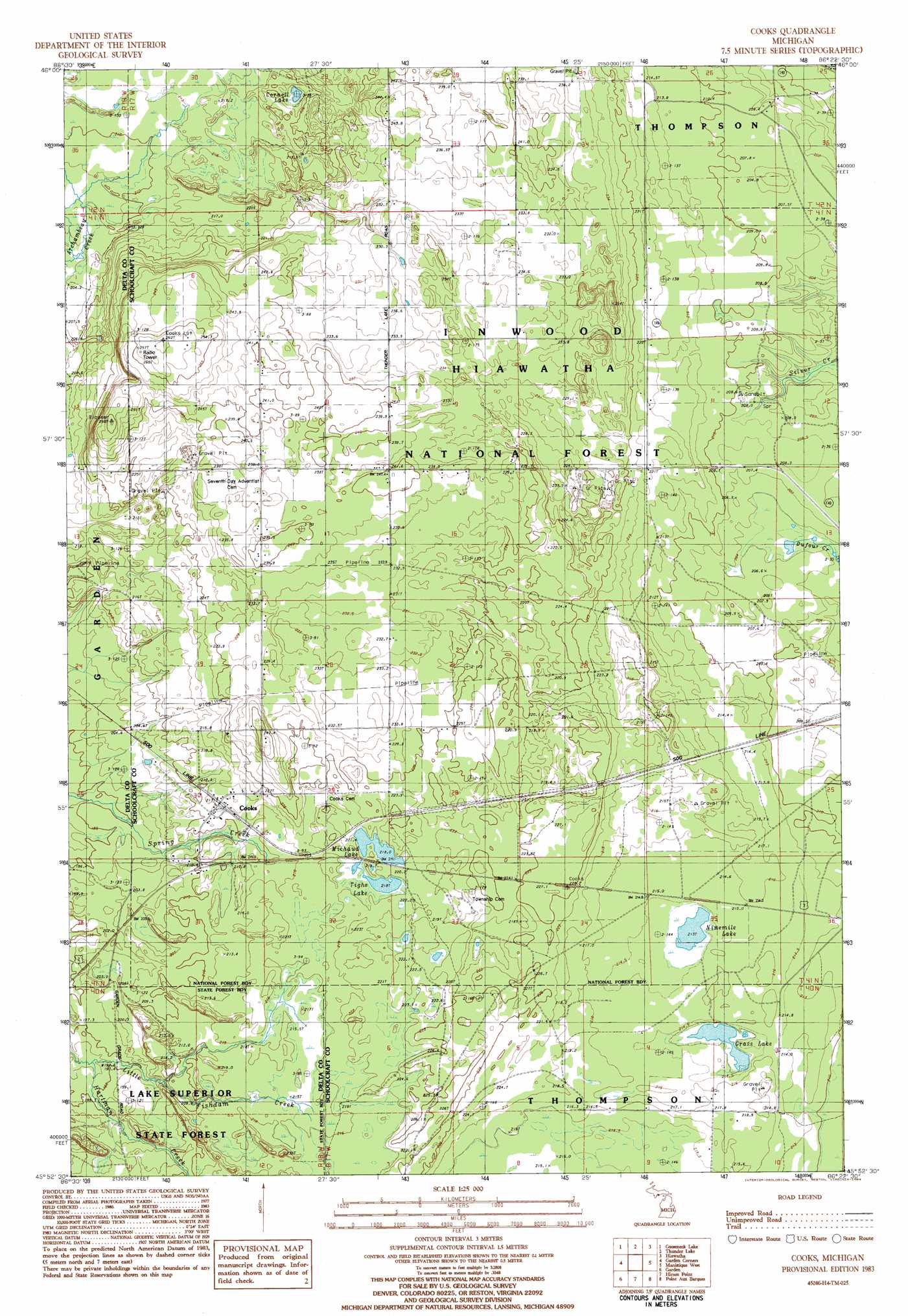
USGS Topo Quad 45086h4 - 1:24,000 scale
| Topo Map Name: | Cooks |
| USGS Topo Quad ID: | 45086h4 |
| Print Size: | ca. 21 1/4" wide x 27" high |
| Southeast Coordinates: | 45.875° N latitude / 86.375° W longitude |
| Map Center Coordinates: | 45.9375° N latitude / 86.4375° W longitude |
| U.S. State: | MI |
| Filename: | o45086h4.jpg |
| Download Map JPG Image: | Cooks topo map 1:24,000 scale |
| Map Type: | Topographic |
| Topo Series: | 7.5´ |
| Map Scale: | 1:24,000 |
| Source of Map Images: | United States Geological Survey (USGS) |
| Alternate Map Versions: |
Cooks MI 2011 Download PDF Buy paper map Cooks MI 2014 Download PDF Buy paper map Cooks MI 2016 Download PDF Buy paper map |
| FStopo: | US Forest Service topo Cooks is available: Download FStopo PDF Download FStopo TIF |
1:24,000 Topo Quads surrounding Cooks
The Lake |
Corner Lake |
Steuben |
Steuben Ne |
Marsh Creek Pool Nw |
Waco Lake |
Gooseneck Lake |
Thunder Lake |
Hiawath |
Smith Lake |
Saint Jacques |
Garden Corners |
Cooks |
Manistique West |
Manistique East |
Nahma |
Gardner |
Hiram Point |
Point Aux Barques |
|
Fayette |
Devils Corner |
> Back to 45086e1 at 1:100,000 scale
> Back to 45086a1 at 1:250,000 scale
> Back to U.S. Topo Maps home
Cooks topo map: Gazetteer
Cooks: Guts
Silver Creek elevation 197m 646′Cooks: Lakes
Cornell Lake elevation 224m 734′Grass Lake elevation 211m 692′
Michaud Lake elevation 217m 711′
Ninemile Lake elevation 213m 698′
Tighe Lake elevation 217m 711′
Cooks: Populated Places
Cooks elevation 213m 698′Elkhorn elevation 222m 728′
Springer elevation 217m 711′
Cooks: Post Offices
Cooks Post Office elevation 214m 702′Cooks: Streams
Hartman Creek elevation 192m 629′Cooks digital topo map on disk
Buy this Cooks topo map showing relief, roads, GPS coordinates and other geographical features, as a high-resolution digital map file on DVD: