Porterfield Topo Map Wisconsin
To zoom in, hover over the map of Porterfield
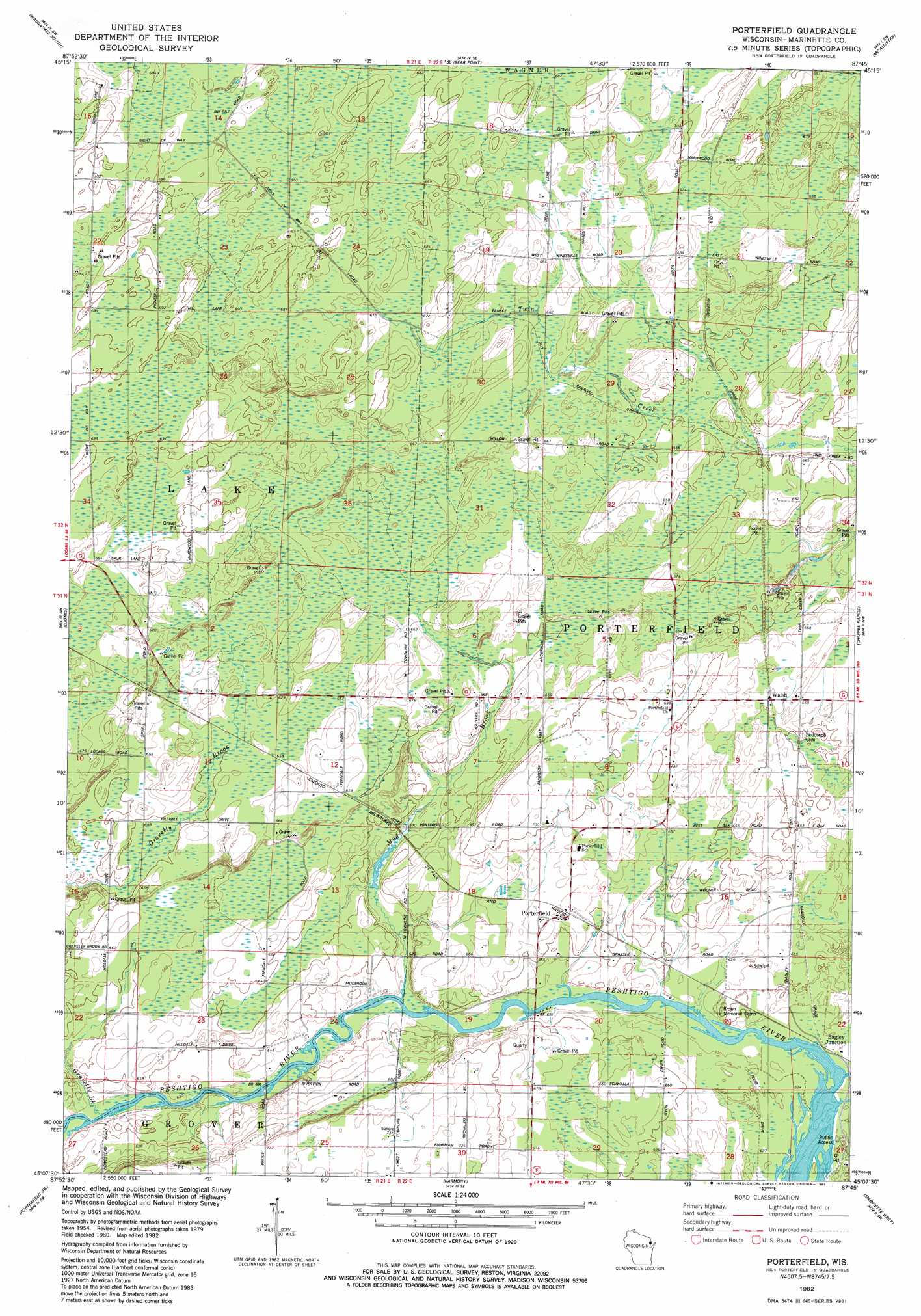
USGS Topo Quad 45087b7 - 1:24,000 scale
| Topo Map Name: | Porterfield |
| USGS Topo Quad ID: | 45087b7 |
| Print Size: | ca. 21 1/4" wide x 27" high |
| Southeast Coordinates: | 45.125° N latitude / 87.75° W longitude |
| Map Center Coordinates: | 45.1875° N latitude / 87.8125° W longitude |
| U.S. State: | WI |
| Filename: | o45087b7.jpg |
| Download Map JPG Image: | Porterfield topo map 1:24,000 scale |
| Map Type: | Topographic |
| Topo Series: | 7.5´ |
| Map Scale: | 1:24,000 |
| Source of Map Images: | United States Geological Survey (USGS) |
| Alternate Map Versions: |
Porterfield WI 1982, updated 1983 Download PDF Buy paper map Porterfield WI 2010 Download PDF Buy paper map Porterfield WI 2013 Download PDF Buy paper map Porterfield WI 2016 Download PDF Buy paper map |
1:24,000 Topo Quads surrounding Porterfield
Athelstane |
Wausaukee North |
Resort Lake |
Swanson |
Stephenson |
Mount Tom |
Wausaukee South |
Bear Point |
Mcallister |
Wallace |
Crivitz |
Loomis |
Porterfield |
Chappee Rapids |
Birch Creek |
Coleman |
Porterfiled Sw |
Harmony |
Marinette West |
Marinette East |
Lena |
Oconto West |
Oconto East |
Peshtigo Harbor |
> Back to 45087a1 at 1:100,000 scale
> Back to 45086a1 at 1:250,000 scale
> Back to U.S. Topo Maps home
Porterfield topo map: Gazetteer
Porterfield: Populated Places
Bagley Junction elevation 192m 629′Porterfield elevation 203m 666′
Walsh elevation 206m 675′
Porterfield: Streams
Gravelly Brook elevation 190m 623′Mud Brook elevation 191m 626′
Porterfield digital topo map on disk
Buy this Porterfield topo map showing relief, roads, GPS coordinates and other geographical features, as a high-resolution digital map file on DVD: