Stephenson Topo Map Michigan
To zoom in, hover over the map of Stephenson
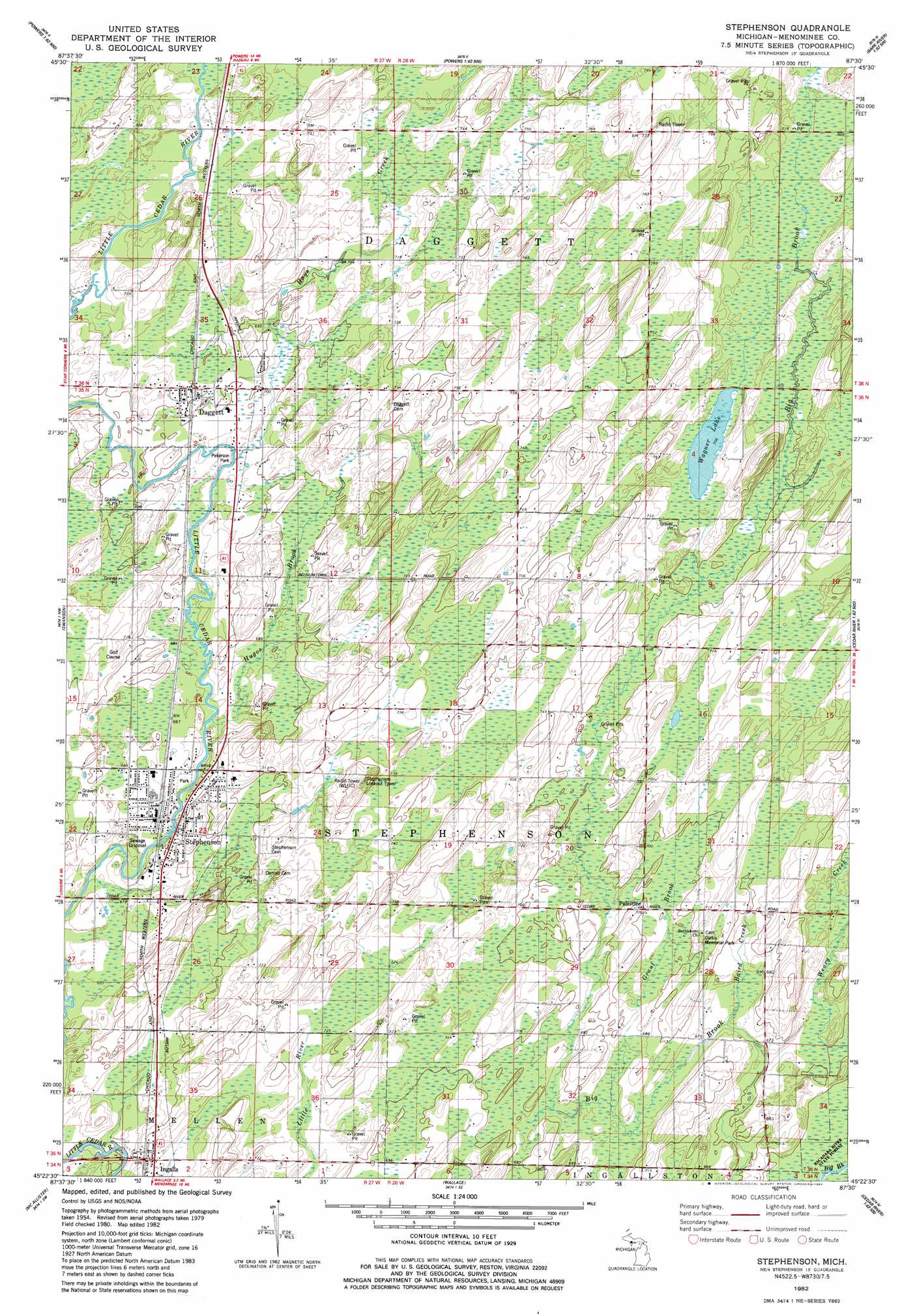
USGS Topo Quad 45087d5 - 1:24,000 scale
| Topo Map Name: | Stephenson |
| USGS Topo Quad ID: | 45087d5 |
| Print Size: | ca. 21 1/4" wide x 27" high |
| Southeast Coordinates: | 45.375° N latitude / 87.5° W longitude |
| Map Center Coordinates: | 45.4375° N latitude / 87.5625° W longitude |
| U.S. State: | MI |
| Filename: | o45087d5.jpg |
| Download Map JPG Image: | Stephenson topo map 1:24,000 scale |
| Map Type: | Topographic |
| Topo Series: | 7.5´ |
| Map Scale: | 1:24,000 |
| Source of Map Images: | United States Geological Survey (USGS) |
| Alternate Map Versions: |
Stephenson MI 1982, updated 1983 Download PDF Buy paper map Stephenson MI 2011 Download PDF Buy paper map Stephenson MI 2014 Download PDF Buy paper map Stephenson MI 2016 Download PDF Buy paper map |
1:24,000 Topo Quads surrounding Stephenson
Faithorn |
Cunard |
Hermansville |
Wilson |
Bark River |
Miscauno Island |
Banat |
Nadeau |
Gourley |
Bark River Se |
Resort Lake |
Swanson |
Stephenson |
North Lake |
Cedar River |
Bear Point |
Mcallister |
Wallace |
Arthur Bay |
|
Porterfield |
Chappee Rapids |
Birch Creek |
Chambers Island Nw |
Chambers Island |
> Back to 45087a1 at 1:100,000 scale
> Back to 45086a1 at 1:250,000 scale
> Back to U.S. Topo Maps home
Stephenson topo map: Gazetteer
Stephenson: Flats
Peterson Park elevation 208m 682′Stephenson: Lakes
Wagner Lake elevation 215m 705′Stephenson: Parks
Curtis Memorial Park elevation 223m 731′Stephenson: Populated Places
Daggett elevation 215m 705′Ingalls elevation 216m 708′
Palestine elevation 215m 705′
Stephenson elevation 205m 672′
Stephenson: Post Offices
Dagget Post Office elevation 213m 698′Ingalls Post Office elevation 217m 711′
Stephenson Post Office elevation 207m 679′
Stephenson: Streams
Baird Creek elevation 204m 669′Grant Brook elevation 207m 679′
Hays Creek elevation 208m 682′
Hugos Brook elevation 208m 682′
Ross Creek elevation 213m 698′
Stephenson digital topo map on disk
Buy this Stephenson topo map showing relief, roads, GPS coordinates and other geographical features, as a high-resolution digital map file on DVD: