Gourley Topo Map Michigan
To zoom in, hover over the map of Gourley
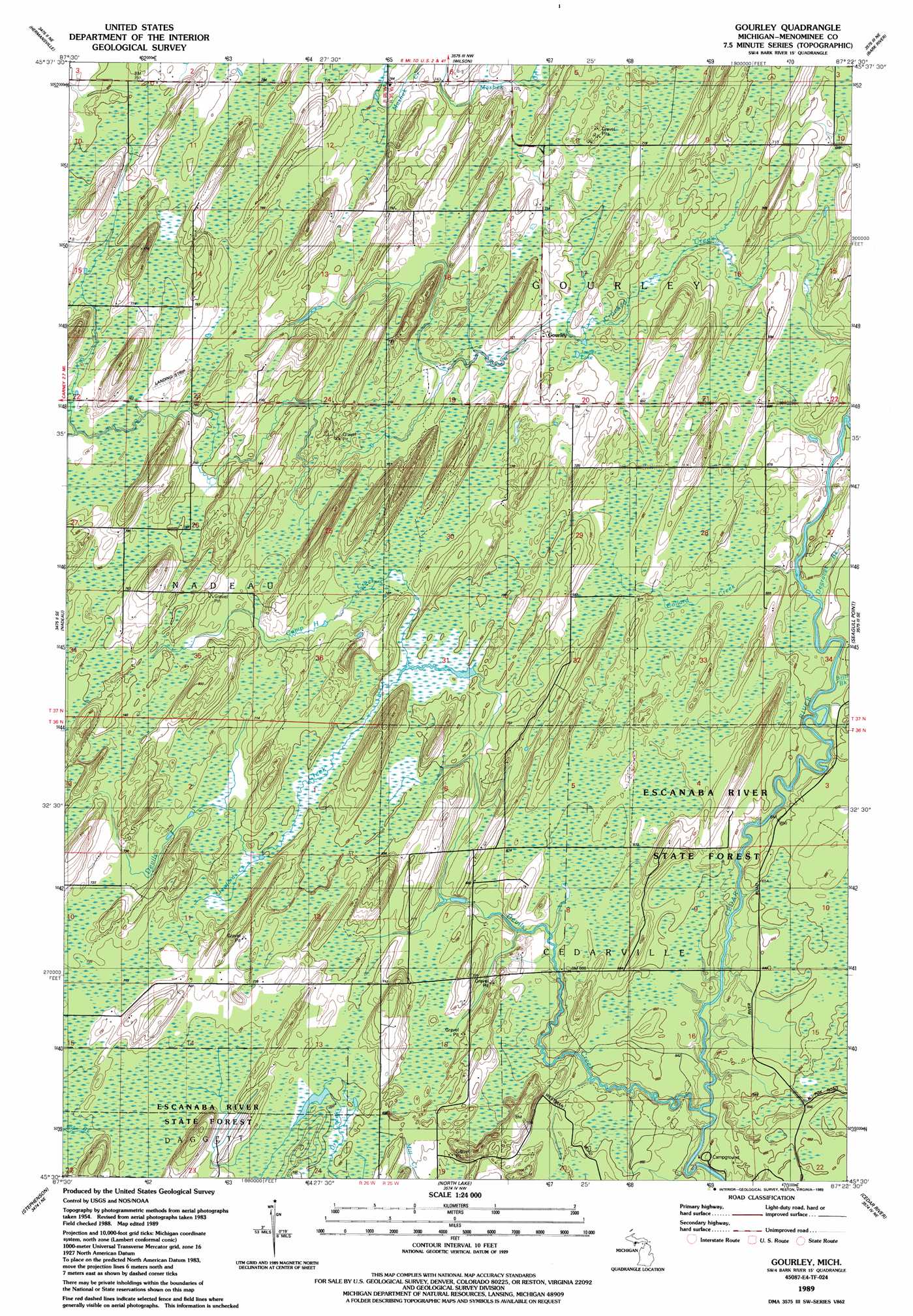
USGS Topo Quad 45087e4 - 1:24,000 scale
| Topo Map Name: | Gourley |
| USGS Topo Quad ID: | 45087e4 |
| Print Size: | ca. 21 1/4" wide x 27" high |
| Southeast Coordinates: | 45.5° N latitude / 87.375° W longitude |
| Map Center Coordinates: | 45.5625° N latitude / 87.4375° W longitude |
| U.S. State: | MI |
| Filename: | o45087e4.jpg |
| Download Map JPG Image: | Gourley topo map 1:24,000 scale |
| Map Type: | Topographic |
| Topo Series: | 7.5´ |
| Map Scale: | 1:24,000 |
| Source of Map Images: | United States Geological Survey (USGS) |
| Alternate Map Versions: |
Gourley MI 1989, updated 1989 Download PDF Buy paper map Gourley MI 2011 Download PDF Buy paper map Gourley MI 2014 Download PDF Buy paper map Gourley MI 2016 Download PDF Buy paper map |
1:24,000 Topo Quads surrounding Gourley
Waucedah |
Vega |
Whitney |
Schaffer |
Chandler |
Cunard |
Hermansville |
Wilson |
Bark River |
Ford River |
Banat |
Nadeau |
Gourley |
Bark River Se |
Henderson Lakes |
Swanson |
Stephenson |
North Lake |
Cedar River |
|
Mcallister |
Wallace |
Arthur Bay |
> Back to 45087e1 at 1:100,000 scale
> Back to 45086a1 at 1:250,000 scale
> Back to U.S. Topo Maps home
Gourley topo map: Gazetteer
Gourley: Lakes
Jasper Lake elevation 210m 688′Gourley: Populated Places
Gourley elevation 214m 702′Gourley: Post Offices
Gourley Post Office (historical) elevation 214m 702′Gourley: Streams
Brill Brook elevation 192m 629′Camp H Creek elevation 213m 698′
Collard Creek elevation 195m 639′
Crawford Creek elevation 214m 702′
Degraves Creek elevation 198m 649′
Devils Creek elevation 189m 620′
Mashek Creek elevation 218m 715′
Gourley digital topo map on disk
Buy this Gourley topo map showing relief, roads, GPS coordinates and other geographical features, as a high-resolution digital map file on DVD: