Banat Topo Map Michigan
To zoom in, hover over the map of Banat
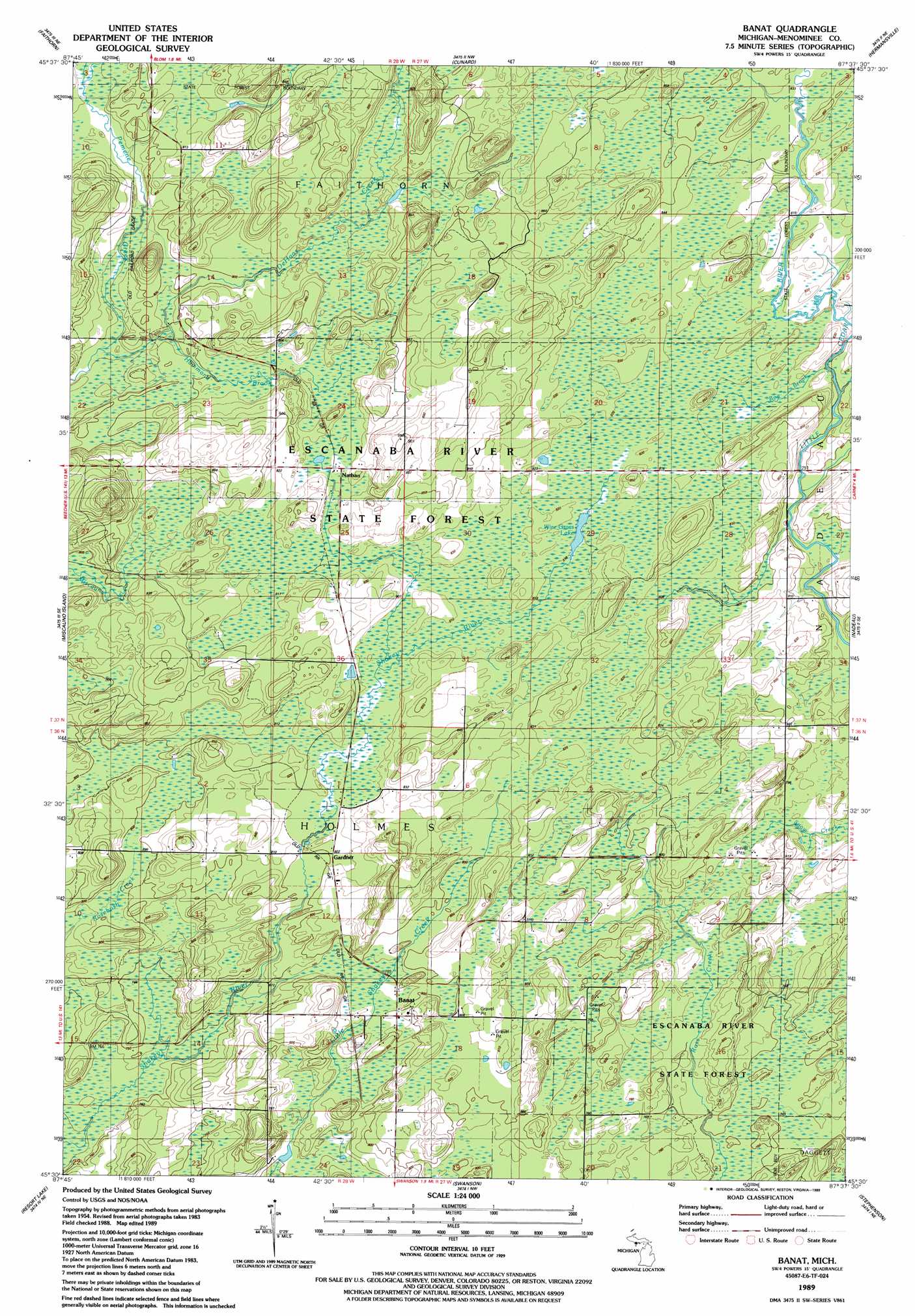
USGS Topo Quad 45087e6 - 1:24,000 scale
| Topo Map Name: | Banat |
| USGS Topo Quad ID: | 45087e6 |
| Print Size: | ca. 21 1/4" wide x 27" high |
| Southeast Coordinates: | 45.5° N latitude / 87.625° W longitude |
| Map Center Coordinates: | 45.5625° N latitude / 87.6875° W longitude |
| U.S. State: | MI |
| Filename: | o45087e6.jpg |
| Download Map JPG Image: | Banat topo map 1:24,000 scale |
| Map Type: | Topographic |
| Topo Series: | 7.5´ |
| Map Scale: | 1:24,000 |
| Source of Map Images: | United States Geological Survey (USGS) |
| Alternate Map Versions: |
Banat MI 1989, updated 1989 Download PDF Buy paper map Banat MI 2011 Download PDF Buy paper map Banat MI 2014 Download PDF Buy paper map Banat MI 2016 Download PDF Buy paper map |
1:24,000 Topo Quads surrounding Banat
Norway |
Vulcan |
Waucedah |
Vega |
Whitney |
Pembine |
Faithorn |
Cunard |
Hermansville |
Wilson |
Amberg |
Miscauno Island |
Banat |
Nadeau |
Gourley |
Wausaukee North |
Resort Lake |
Swanson |
Stephenson |
North Lake |
Wausaukee South |
Bear Point |
Mcallister |
Wallace |
Arthur Bay |
> Back to 45087e1 at 1:100,000 scale
> Back to 45086a1 at 1:250,000 scale
> Back to U.S. Topo Maps home
Banat topo map: Gazetteer
Banat: Lakes
Wire Grass Lake elevation 246m 807′Banat: Populated Places
Banat elevation 241m 790′Gardner elevation 244m 800′
Nathan elevation 251m 823′
Banat: Post Offices
Banat Post Office (historical) elevation 241m 790′Nathan Post Office (historical) elevation 251m 823′
Banat: Streams
Blom Creek elevation 237m 777′Bog Brook elevation 246m 807′
DeHaas Creek elevation 236m 774′
Hammond Brook elevation 232m 761′
Laurin Creek elevation 243m 797′
Banat digital topo map on disk
Buy this Banat topo map showing relief, roads, GPS coordinates and other geographical features, as a high-resolution digital map file on DVD: