Cornell Topo Map Michigan
To zoom in, hover over the map of Cornell
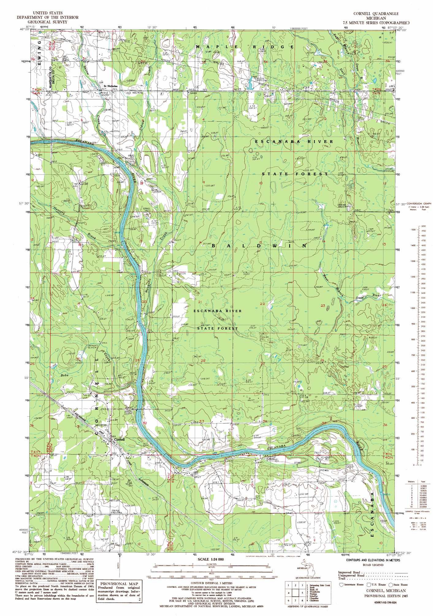
USGS Topo Quad 45087h2 - 1:24,000 scale
| Topo Map Name: | Cornell |
| USGS Topo Quad ID: | 45087h2 |
| Print Size: | ca. 21 1/4" wide x 27" high |
| Southeast Coordinates: | 45.875° N latitude / 87.125° W longitude |
| Map Center Coordinates: | 45.9375° N latitude / 87.1875° W longitude |
| U.S. State: | MI |
| Filename: | o45087h2.jpg |
| Download Map JPG Image: | Cornell topo map 1:24,000 scale |
| Map Type: | Topographic |
| Topo Series: | 7.5´ |
| Map Scale: | 1:24,000 |
| Source of Map Images: | United States Geological Survey (USGS) |
| Alternate Map Versions: |
Cornell MI 1985, updated 1985 Download PDF Buy paper map Cornell MI 2011 Download PDF Buy paper map Cornell MI 2014 Download PDF Buy paper map Cornell MI 2016 Download PDF Buy paper map |
1:24,000 Topo Quads surrounding Cornell
Anderson Lake |
Helena |
Mcfarland |
Diffin |
Trenary |
Arnold |
Swimming Hole Creek |
Rock |
Rock Se |
Baker Creek |
La Branche |
Woodlawn |
Cornell |
Perkins |
Rapid River |
Whitney |
Schaffer |
Chandler |
Gladstone |
Maywood |
Wilson |
Bark River |
Ford River |
Escanaba |
Peninsula Point |
> Back to 45087e1 at 1:100,000 scale
> Back to 45086a1 at 1:250,000 scale
> Back to U.S. Topo Maps home
Cornell topo map: Gazetteer
Cornell: Falls
Rose Falls (East) elevation 252m 826′Cornell: Populated Places
Cornell elevation 251m 823′Saint Nicholas elevation 260m 853′
Salva elevation 240m 787′
Cornell: Post Offices
Cornell Post Office elevation 249m 816′Cornell: Streams
Bobs Creek elevation 229m 751′Hunters Brook elevation 240m 787′
Indian Creek elevation 245m 803′
Mosquito Creek elevation 233m 764′
Squaw Creek elevation 244m 800′
Cornell digital topo map on disk
Buy this Cornell topo map showing relief, roads, GPS coordinates and other geographical features, as a high-resolution digital map file on DVD: