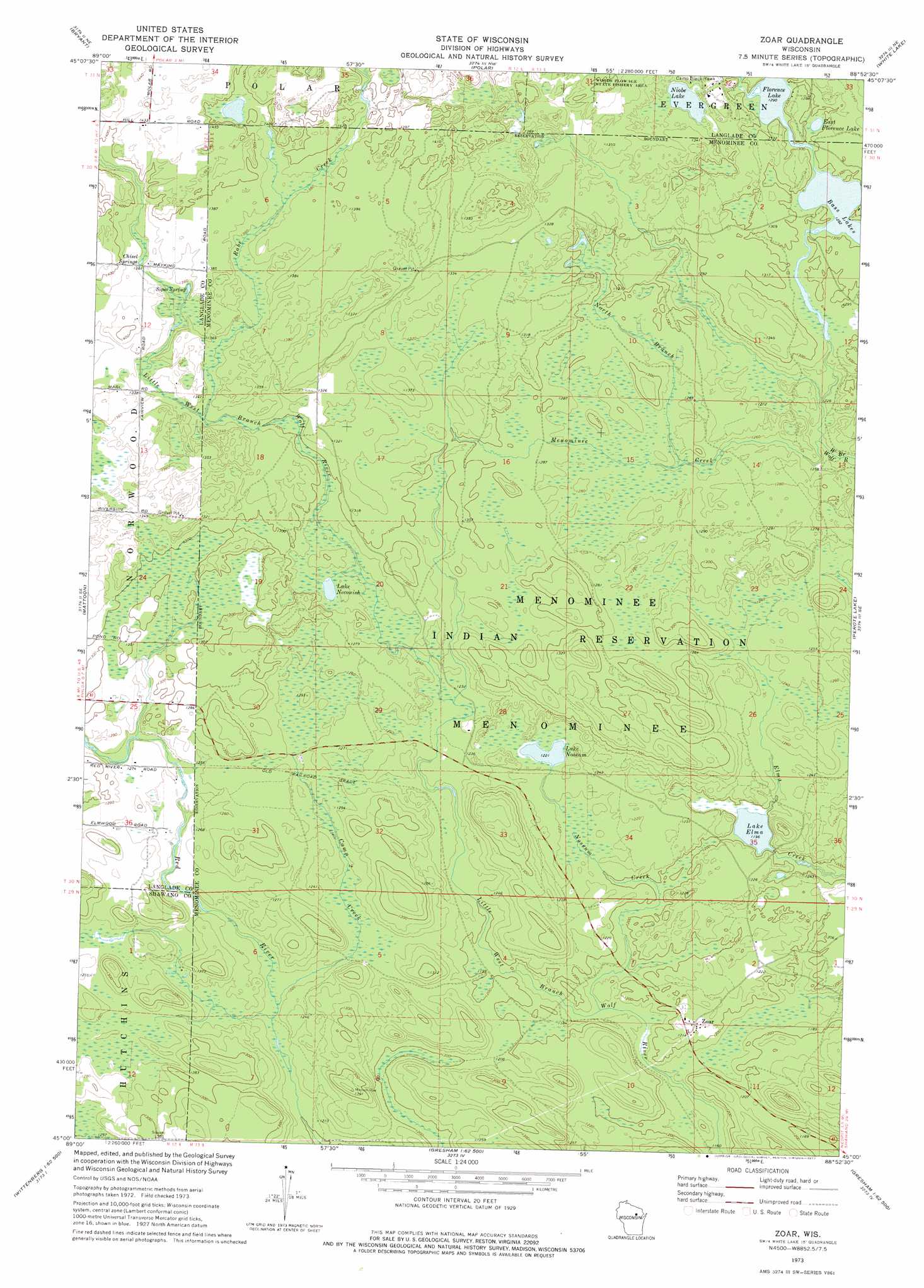
Zoar Topo Map Wisconsin
To zoom in, hover over the map of Zoar
USGS Topo Quad 45088a8 - 1:24,000 scale
| Topo Map Name: | Zoar |
| USGS Topo Quad ID: | 45088a8 |
| Print Size: | ca. 21 1/4" wide x 27" high |
| Southeast Coordinates: | 45° N latitude / 88.875° W longitude |
| Map Center Coordinates: | 45.0625° N latitude / 88.9375° W longitude |
| U.S. State: | WI |
| Filename: | o45088a8.jpg |
| Download Map JPG Image: | Zoar topo map 1:24,000 scale |
| Map Type: | Topographic |
| Topo Series: | 7.5´ |
| Map Scale: | 1:24,000 |
| Source of Map Images: | United States Geological Survey (USGS) |
| Alternate Map Versions: |
Zoar WI 1973, updated 1977 Download PDF Buy paper map Zoar WI 2010 Download PDF Buy paper map Zoar WI 2013 Download PDF Buy paper map Zoar WI 2015 Download PDF Buy paper map |
1:24,000 Topo Quads surrounding Zoar
Kempster |
Pearson |
Pickerel |
Lily |
Reservoir Pond |
Antigo |
Bryant |
Polar |
White Lake |
Langlade |
Aniwa |
Mattoon |
Zoar |
Perote Lake |
Markton |
Birnamwood |
Regina |
Burney Lake |
Neopit |
Keshena |
Wittenberg |
Shepley |
Bowler |
Gresham |
Thornton |
> Back to 45088a1 at 1:100,000 scale
> Back to 45088a1 at 1:250,000 scale
> Back to U.S. Topo Maps home
Zoar topo map: Gazetteer
Zoar: Dams
Lake Dam elevation 397m 1302′Zoar: Lakes
Bass Lakes elevation 391m 1282′East Florence Lake elevation 395m 1295′
Florence Lake elevation 393m 1289′
Lake Elma elevation 364m 1194′
Lake Neconish elevation 387m 1269′
Lake Noseum elevation 372m 1220′
Niobe Lake elevation 401m 1315′
Zoar: Populated Places
Zoar elevation 372m 1220′Zoar: Reservoirs
Upper Reservoir elevation 397m 1302′Zoar: Springs
Chisel Springs elevation 412m 1351′Red Springs elevation 384m 1259′
Sipes Spring elevation 408m 1338′
Zoar: Streams
Camp Creek elevation 371m 1217′Deer Creek elevation 418m 1371′
Menominee Creek elevation 378m 1240′
North Branch Menominee Creek elevation 383m 1256′
Noseum Creek elevation 357m 1171′
Rabe Creek elevation 420m 1377′
Sipes Creek elevation 402m 1318′
Zoar digital topo map on disk
Buy this Zoar topo map showing relief, roads, GPS coordinates and other geographical features, as a high-resolution digital map file on DVD: