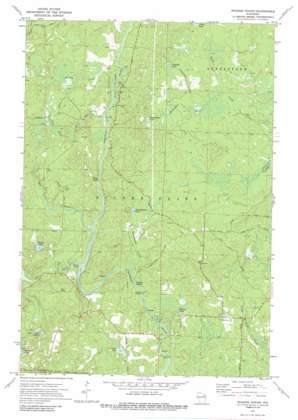
Roaring Rapids Topo Map Wisconsin
To zoom in, hover over the map of Roaring Rapids
USGS Topo Quad 45088d3 - 1:24,000 scale
| Topo Map Name: | Roaring Rapids |
| USGS Topo Quad ID: | 45088d3 |
| Print Size: | ca. 21 1/4" wide x 27" high |
| Southeast Coordinates: | 45.375° N latitude / 88.25° W longitude |
| Map Center Coordinates: | 45.4375° N latitude / 88.3125° W longitude |
| U.S. State: | WI |
| Filename: | o45088d3.jpg |
| Download Map JPG Image: | Roaring Rapids topo map 1:24,000 scale |
| Map Type: | Topographic |
| Topo Series: | 7.5´ |
| Map Scale: | 1:24,000 |
| Source of Map Images: | United States Geological Survey (USGS) |
| Alternate Map Versions: |
Roaring Rapids WI 1972, updated 1975 Download PDF Buy paper map Roaring Rapids WI 1972, updated 1988 Download PDF Buy paper map Roaring Rapids WI 2011 Download PDF Buy paper map Roaring Rapids WI 2013 Download PDF Buy paper map Roaring Rapids WI 2015 Download PDF Buy paper map |
| FStopo: | US Forest Service topo Roaring Rapids is available: Download FStopo PDF Download FStopo TIF |
1:24,000 Topo Quads surrounding Roaring Rapids
> Back to 45088a1 at 1:100,000 scale
> Back to 45088a1 at 1:250,000 scale
> Back to U.S. Topo Maps home
Roaring Rapids topo map: Gazetteer
Roaring Rapids: Dams
Hoyle and Johnson 3WR-1647 Dam elevation 311m 1020′Roaring Rapids: Lakes
Babson Pond elevation 310m 1017′Brandywine Lake elevation 344m 1128′
Campbell Lake elevation 353m 1158′
Crandall Lake elevation 308m 1010′
Homestead Lake elevation 347m 1138′
Rooney Lake elevation 364m 1194′
Taylor Lake elevation 353m 1158′
Three Little Lakes elevation 358m 1174′
Roaring Rapids: Parks
Marinette County Beech Forest State Natural Area elevation 378m 1240′Mc Clintock County Park elevation 359m 1177′
Roaring Rapids: Rapids
Jerry Chute elevation 321m 1053′Roaring Rapids elevation 325m 1066′
Wilson Rapids elevation 354m 1161′
Roaring Rapids: Streams
Brandywine Creek elevation 334m 1095′Camp Five Creek elevation 356m 1167′
Campbell Creek elevation 341m 1118′
Homestead Creek elevation 338m 1108′
Otter Creek elevation 354m 1161′
Rat River elevation 353m 1158′
Swamp Creek elevation 360m 1181′
Roaring Rapids digital topo map on disk
Buy this Roaring Rapids topo map showing relief, roads, GPS coordinates and other geographical features, as a high-resolution digital map file on DVD:


