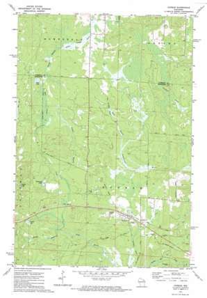
Dunbar Topo Map Wisconsin
To zoom in, hover over the map of Dunbar
USGS Topo Quad 45088f2 - 1:24,000 scale
| Topo Map Name: | Dunbar |
| USGS Topo Quad ID: | 45088f2 |
| Print Size: | ca. 21 1/4" wide x 27" high |
| Southeast Coordinates: | 45.625° N latitude / 88.125° W longitude |
| Map Center Coordinates: | 45.6875° N latitude / 88.1875° W longitude |
| U.S. State: | WI |
| Filename: | o45088f2.jpg |
| Download Map JPG Image: | Dunbar topo map 1:24,000 scale |
| Map Type: | Topographic |
| Topo Series: | 7.5´ |
| Map Scale: | 1:24,000 |
| Source of Map Images: | United States Geological Survey (USGS) |
| Alternate Map Versions: |
Dunbar WI 1972, updated 1974 Download PDF Buy paper map Dunbar WI 2010 Download PDF Buy paper map Dunbar WI 2013 Download PDF Buy paper map Dunbar WI 2015 Download PDF Buy paper map |
1:24,000 Topo Quads surrounding Dunbar
> Back to 45088e1 at 1:100,000 scale
> Back to 45088a1 at 1:250,000 scale
> Back to U.S. Topo Maps home
Dunbar topo map: Gazetteer
Dunbar: Airports
Dunbar Airport elevation 366m 1200′Dunbar: Cliffs
Blueberry Point elevation 366m 1200′Dunbar: Lakes
Dvorak Lake elevation 363m 1190′Pothole Lake elevation 374m 1227′
Sackerson Lake elevation 362m 1187′
Spur Lake elevation 375m 1230′
Dunbar: Populated Places
Dunbar elevation 356m 1167′Dunbar: Streams
Beaver Branch elevation 353m 1158′K C Creek elevation 347m 1138′
Spur Creek elevation 366m 1200′
Dunbar digital topo map on disk
Buy this Dunbar topo map showing relief, roads, GPS coordinates and other geographical features, as a high-resolution digital map file on DVD:


