Argonne Topo Map Wisconsin
To zoom in, hover over the map of Argonne
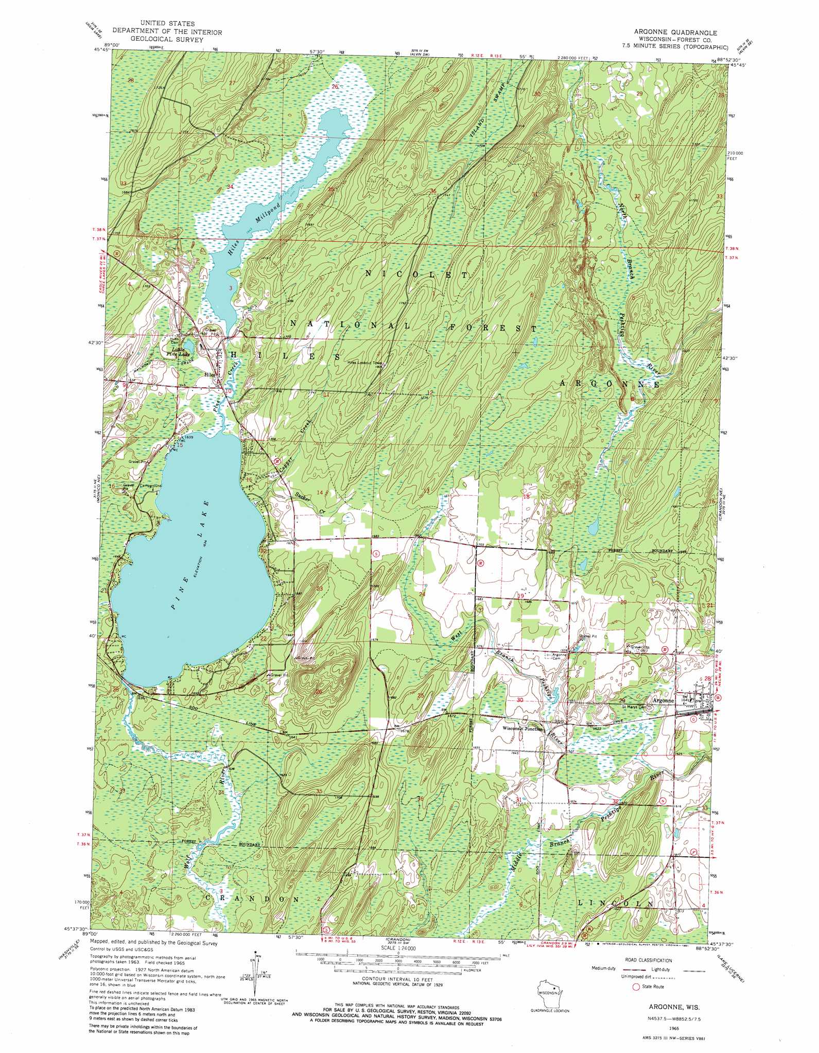
USGS Topo Quad 45088f8 - 1:24,000 scale
| Topo Map Name: | Argonne |
| USGS Topo Quad ID: | 45088f8 |
| Print Size: | ca. 21 1/4" wide x 27" high |
| Southeast Coordinates: | 45.625° N latitude / 88.875° W longitude |
| Map Center Coordinates: | 45.6875° N latitude / 88.9375° W longitude |
| U.S. State: | WI |
| Filename: | o45088f8.jpg |
| Download Map JPG Image: | Argonne topo map 1:24,000 scale |
| Map Type: | Topographic |
| Topo Series: | 7.5´ |
| Map Scale: | 1:24,000 |
| Source of Map Images: | United States Geological Survey (USGS) |
| Alternate Map Versions: |
Argonne WI 1965, updated 1966 Download PDF Buy paper map Argonne WI 1965, updated 1981 Download PDF Buy paper map Argonne WI 2011 Download PDF Buy paper map Argonne WI 2013 Download PDF Buy paper map Argonne WI 2015 Download PDF Buy paper map |
| FStopo: | US Forest Service topo Argonne is available: Download FStopo PDF Download FStopo TIF |
1:24,000 Topo Quads surrounding Argonne
Eagle River East |
Anvil Lake |
Alvin Nw |
Alvin |
Tipler |
Three Lakes |
Julia Lake |
Alvin Sw |
Alvin Se |
Long Lake |
Starks |
Monico Ne |
Argonne |
Crandon Ne |
Newald |
Monico |
Nashville |
Crandon |
Lake Lucerne |
Laona |
Elcho |
Post Lake |
Mole Lake |
Roberts Lake |
Wabeno |
> Back to 45088e1 at 1:100,000 scale
> Back to 45088a1 at 1:250,000 scale
> Back to U.S. Topo Maps home
Argonne topo map: Gazetteer
Argonne: Dams
Forster Muller Lumber Company 1891C238 Dam elevation 501m 1643′Argonne: Lakes
Hiles Millpond elevation 501m 1643′Little Marshall Lake elevation 502m 1646′
Little Pine Lake elevation 501m 1643′
Marshall Lake elevation 501m 1643′
Pine Lake elevation 498m 1633′
Argonne: Parks
Argonne Experimental Forest elevation 528m 1732′Argonne: Populated Places
Argonne elevation 500m 1640′Hiles elevation 507m 1663′
Wisconsin Junction elevation 501m 1643′
Argonne: Reservoirs
Coyote Creek Impoundment elevation 499m 1637′Hiles Mill Pond 17 elevation 501m 1643′
Argonne: Streams
Copper Creek elevation 498m 1633′Pine Creek elevation 498m 1633′
Sucker Creek elevation 500m 1640′
West Branch Peshtigo River elevation 491m 1610′
Wildcat Creek elevation 499m 1637′
Argonne: Swamps
Island Swamp elevation 520m 1706′Argonne digital topo map on disk
Buy this Argonne topo map showing relief, roads, GPS coordinates and other geographical features, as a high-resolution digital map file on DVD: