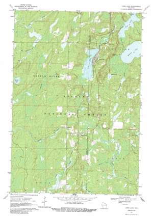
Long Lake Topo Map Wisconsin
To zoom in, hover over the map of Long Lake
USGS Topo Quad 45088g6 - 1:24,000 scale
| Topo Map Name: | Long Lake |
| USGS Topo Quad ID: | 45088g6 |
| Print Size: | ca. 21 1/4" wide x 27" high |
| Southeast Coordinates: | 45.75° N latitude / 88.625° W longitude |
| Map Center Coordinates: | 45.8125° N latitude / 88.6875° W longitude |
| U.S. State: | WI |
| Filename: | o45088g6.jpg |
| Download Map JPG Image: | Long Lake topo map 1:24,000 scale |
| Map Type: | Topographic |
| Topo Series: | 7.5´ |
| Map Scale: | 1:24,000 |
| Source of Map Images: | United States Geological Survey (USGS) |
| Alternate Map Versions: |
Long Lake WI 1970, updated 1972 Download PDF Buy paper map Long Lake WI 1970, updated 1988 Download PDF Buy paper map Long Lake WI 2011 Download PDF Buy paper map Long Lake WI 2013 Download PDF Buy paper map Long Lake WI 2015 Download PDF Buy paper map |
| FStopo: | US Forest Service topo Long Lake is available: Download FStopo PDF Download FStopo TIF |
1:24,000 Topo Quads surrounding Long Lake
> Back to 45088e1 at 1:100,000 scale
> Back to 45088a1 at 1:250,000 scale
> Back to U.S. Topo Maps home
Long Lake topo map: Gazetteer
Long Lake: Lakes
Bastile Lake elevation 490m 1607′Beaver Pond elevation 462m 1515′
Fay Lake elevation 456m 1496′
Halsey Lake elevation 457m 1499′
Long Lake elevation 461m 1512′
Long Lake: Parks
Bastile Lake State Natural Area elevation 490m 1607′Long Lake: Populated Places
Long Lake elevation 475m 1558′Popple River elevation 465m 1525′
Long Lake: Streams
Coldwater Creek elevation 461m 1512′Halsey Lake Outlet elevation 456m 1496′
Halsey Lake Slough elevation 457m 1499′
Kingstone Creek elevation 471m 1545′
Little Popple River elevation 460m 1509′
Long Lake Outlet elevation 456m 1496′
Martin Creek elevation 457m 1499′
Long Lake digital topo map on disk
Buy this Long Lake topo map showing relief, roads, GPS coordinates and other geographical features, as a high-resolution digital map file on DVD:


