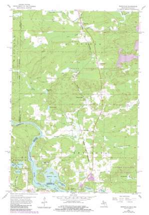
Randville Topo Map Michigan
To zoom in, hover over the map of Randville
USGS Topo Quad 45088h1 - 1:24,000 scale
| Topo Map Name: | Randville |
| USGS Topo Quad ID: | 45088h1 |
| Print Size: | ca. 21 1/4" wide x 27" high |
| Southeast Coordinates: | 45.875° N latitude / 88° W longitude |
| Map Center Coordinates: | 45.9375° N latitude / 88.0625° W longitude |
| U.S. States: | MI, WI |
| Filename: | o45088h1.jpg |
| Download Map JPG Image: | Randville topo map 1:24,000 scale |
| Map Type: | Topographic |
| Topo Series: | 7.5´ |
| Map Scale: | 1:24,000 |
| Source of Map Images: | United States Geological Survey (USGS) |
| Alternate Map Versions: |
Randville MI 1955, updated 1957 Download PDF Buy paper map Randville MI 1955, updated 1979 Download PDF Buy paper map Randville MI 1955, updated 1983 Download PDF Buy paper map Randville MI 2011 Download PDF Buy paper map Randville MI 2014 Download PDF Buy paper map Randville MI 2016 Download PDF Buy paper map |
1:24,000 Topo Quads surrounding Randville
> Back to 45088e1 at 1:100,000 scale
> Back to 45088a1 at 1:250,000 scale
> Back to U.S. Topo Maps home
Randville topo map: Gazetteer
Randville: Airports
Lilienthal Airport elevation 375m 1230′Randville: Channels
Twin Falls Flowage elevation 335m 1099′Randville: Lakes
Badwater Lake elevation 335m 1099′Bradford Lake elevation 372m 1220′
Browning Lake elevation 383m 1256′
Deer Lake elevation 343m 1125′
Dyer Lake elevation 348m 1141′
East Lake elevation 355m 1164′
Harding Lake elevation 303m 994′
Little Badwater Lake elevation 335m 1099′
Sonnies Pond elevation 343m 1125′
South Lake elevation 355m 1164′
Spring Lake elevation 338m 1108′
Randville: Populated Places
Granite Bluff elevation 364m 1194′Merriman elevation 358m 1174′
Randville elevation 384m 1259′
Randville: Post Offices
Granite Bluff Post Office (historical) elevation 365m 1197′Randville Post Office (historical) elevation 384m 1259′
Randville: Streams
Badwater Creek elevation 340m 1115′Browning Creek elevation 353m 1158′
Gestner Branch elevation 380m 1246′
Tom Kings Creek elevation 363m 1190′
Randville digital topo map on disk
Buy this Randville topo map showing relief, roads, GPS coordinates and other geographical features, as a high-resolution digital map file on DVD:


