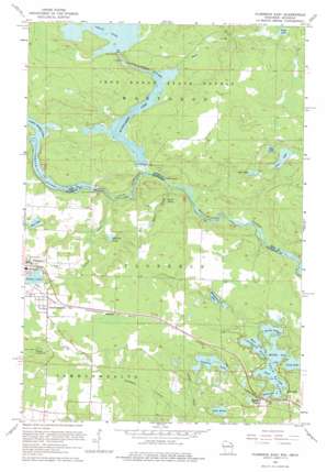
Florence East Topo Map Wisconsin
To zoom in, hover over the map of Florence East
USGS Topo Quad 45088h2 - 1:24,000 scale
| Topo Map Name: | Florence East |
| USGS Topo Quad ID: | 45088h2 |
| Print Size: | ca. 21 1/4" wide x 27" high |
| Southeast Coordinates: | 45.875° N latitude / 88.125° W longitude |
| Map Center Coordinates: | 45.9375° N latitude / 88.1875° W longitude |
| U.S. States: | WI, MI |
| Filename: | o45088h2.jpg |
| Download Map JPG Image: | Florence East topo map 1:24,000 scale |
| Map Type: | Topographic |
| Topo Series: | 7.5´ |
| Map Scale: | 1:24,000 |
| Source of Map Images: | United States Geological Survey (USGS) |
| Alternate Map Versions: |
Commonwealth WI 1949 Download PDF Buy paper map Florence East WI 1962, updated 1964 Download PDF Buy paper map Florence East WI 2011 Download PDF Buy paper map Florence East WI 2013 Download PDF Buy paper map Florence East WI 2015 Download PDF Buy paper map |
1:24,000 Topo Quads surrounding Florence East
> Back to 45088e1 at 1:100,000 scale
> Back to 45088a1 at 1:250,000 scale
> Back to U.S. Topo Maps home
Florence East topo map: Gazetteer
Florence East: Dams
Brule Island Dam elevation 348m 1141′Brule Island Dam elevation 343m 1125′
Michigamme Falls Dam elevation 351m 1151′
Peavy Falls Dam elevation 388m 1272′
Florence East: Islands
Bass Island elevation 355m 1164′Eagle Island elevation 355m 1164′
Robbins Island elevation 366m 1200′
Florence East: Lakes
Baird Lake elevation 384m 1259′Bass Lake elevation 355m 1164′
Bass Lake elevation 355m 1164′
Cosgrove Lake elevation 360m 1181′
Fisher Lake elevation 389m 1276′
Gages Lake elevation 387m 1269′
Jule Lake elevation 391m 1282′
Lake Anna elevation 355m 1164′
Lilly Lake elevation 355m 1164′
Long Lake elevation 355m 1164′
Lost Lake elevation 387m 1269′
Marlow Lake elevation 358m 1174′
Middle Lake elevation 355m 1164′
Montgomery Lake elevation 365m 1197′
Mud Lake elevation 389m 1276′
Mud Lake elevation 390m 1279′
North Lake elevation 355m 1164′
Railroad Lake elevation 355m 1164′
Spread Eagle Chain of Lakes elevation 355m 1164′
West Lake elevation 355m 1164′
Florence East: Populated Places
Commonwealth elevation 403m 1322′Hematite elevation 407m 1335′
Spread Eagle elevation 365m 1197′
Florence East: Reservoirs
Michigamme Lake elevation 350m 1148′Peavy Pond elevation 392m 1286′
Florence East: Streams
Baird Creek elevation 341m 1118′Brule River elevation 343m 1125′
Brule River elevation 343m 1125′
Deadman Creek elevation 339m 1112′
First Creek elevation 340m 1115′
Fisher Creek elevation 343m 1125′
Gages Creek elevation 362m 1187′
Michigamme River elevation 343m 1125′
Paint River elevation 361m 1184′
Florence East digital topo map on disk
Buy this Florence East topo map showing relief, roads, GPS coordinates and other geographical features, as a high-resolution digital map file on DVD:


