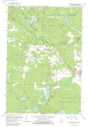
Florence West Topo Map Wisconsin
To zoom in, hover over the map of Florence West
USGS Topo Quad 45088h3 - 1:24,000 scale
| Topo Map Name: | Florence West |
| USGS Topo Quad ID: | 45088h3 |
| Print Size: | ca. 21 1/4" wide x 27" high |
| Southeast Coordinates: | 45.875° N latitude / 88.25° W longitude |
| Map Center Coordinates: | 45.9375° N latitude / 88.3125° W longitude |
| U.S. States: | WI, MI |
| Filename: | o45088h3.jpg |
| Download Map JPG Image: | Florence West topo map 1:24,000 scale |
| Map Type: | Topographic |
| Topo Series: | 7.5´ |
| Map Scale: | 1:24,000 |
| Source of Map Images: | United States Geological Survey (USGS) |
| Alternate Map Versions: |
Stager WI 1947 Download PDF Buy paper map Florence West WI 1962, updated 1964 Download PDF Buy paper map Florence West WI 1962, updated 1979 Download PDF Buy paper map Florence West WI 2011 Download PDF Buy paper map Florence West WI 2013 Download PDF Buy paper map Florence West WI 2015 Download PDF Buy paper map |
1:24,000 Topo Quads surrounding Florence West
> Back to 45088e1 at 1:100,000 scale
> Back to 45088a1 at 1:250,000 scale
> Back to U.S. Topo Maps home
Florence West topo map: Gazetteer
Florence West: Lakes
Archie Pond elevation 408m 1338′Bass Lake elevation 390m 1279′
Bessie Babbet Lake elevation 390m 1279′
Dead Mans Lake elevation 393m 1289′
Duck Lake elevation 407m 1335′
Grass Lake elevation 387m 1269′
Keyes Lake elevation 387m 1269′
Loon Lake elevation 385m 1263′
Merrick Lake elevation 408m 1338′
Olson Lake elevation 414m 1358′
Paint River Pond elevation 363m 1190′
Sea Lion Lake elevation 384m 1259′
Sevenmile Lake elevation 407m 1335′
Stager Lake elevation 393m 1289′
Florence West: Parks
American Legion Park elevation 397m 1302′Stager Lake Park elevation 393m 1289′
Florence West: Populated Places
Florence elevation 398m 1305′Ridgetop elevation 400m 1312′
Stager elevation 408m 1338′
Tyran elevation 396m 1299′
Florence West: Rapids
Horserace Rapids elevation 370m 1213′Florence West: Streams
McGoverns Creek elevation 388m 1272′Montagne Creek elevation 381m 1250′
Seven Springs Creek elevation 364m 1194′
Sevenmile Creek elevation 395m 1295′
South Slough elevation 377m 1236′
Stager Creek elevation 364m 1194′
Florence West digital topo map on disk
Buy this Florence West topo map showing relief, roads, GPS coordinates and other geographical features, as a high-resolution digital map file on DVD:


