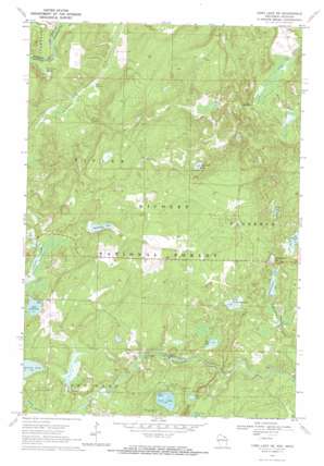
Long Lake Ne Topo Map Wisconsin
To zoom in, hover over the map of Long Lake Ne
USGS Topo Quad 45088h5 - 1:24,000 scale
| Topo Map Name: | Long Lake Ne |
| USGS Topo Quad ID: | 45088h5 |
| Print Size: | ca. 21 1/4" wide x 27" high |
| Southeast Coordinates: | 45.875° N latitude / 88.5° W longitude |
| Map Center Coordinates: | 45.9375° N latitude / 88.5625° W longitude |
| U.S. States: | WI, MI |
| Filename: | o45088h5.jpg |
| Download Map JPG Image: | Long Lake Ne topo map 1:24,000 scale |
| Map Type: | Topographic |
| Topo Series: | 7.5´ |
| Map Scale: | 1:24,000 |
| Source of Map Images: | United States Geological Survey (USGS) |
| Alternate Map Versions: |
Long Lake NE WI 1970, updated 1972 Download PDF Buy paper map Long Lake NE WI 2011 Download PDF Buy paper map Long Lake NE WI 2013 Download PDF Buy paper map Long Lake NE WI 2015 Download PDF Buy paper map |
| FStopo: | US Forest Service topo Long Lake NE is available: Download FStopo PDF Download FStopo TIF |
1:24,000 Topo Quads surrounding Long Lake Ne
> Back to 45088e1 at 1:100,000 scale
> Back to 45088a1 at 1:250,000 scale
> Back to U.S. Topo Maps home
Long Lake Ne topo map: Gazetteer
Long Lake Ne: Guts
Wisconsin Slough elevation 435m 1427′Long Lake Ne: Lakes
Birch Lake elevation 450m 1476′Hemlock Lake elevation 452m 1482′
Lake of Dreams elevation 462m 1515′
Lauterman Lake elevation 443m 1453′
Little Porcupine Lake elevation 448m 1469′
Lost Lake elevation 454m 1489′
Mud Lake elevation 449m 1473′
Perch Lake elevation 451m 1479′
Porcupine Lake elevation 469m 1538′
Reisner Lake elevation 454m 1489′
Silverdollar Lake elevation 449m 1473′
Spruce Lake elevation 446m 1463′
Long Lake Ne: Parks
Wisconsin Slough State Natural Area elevation 435m 1427′Long Lake Ne: Rapids
Chipmunk Rapids elevation 442m 1450′Long Lake Ne: Springs
Trout Springs elevation 434m 1423′Long Lake Ne: Streams
Chipmunk Creek elevation 452m 1482′East Fork LeRoy Creek elevation 419m 1374′
Long Lake Ne: Trails
Lauterman Trail elevation 456m 1496′Long Lake Ne digital topo map on disk
Buy this Long Lake Ne topo map showing relief, roads, GPS coordinates and other geographical features, as a high-resolution digital map file on DVD:


