Alexander Lake Topo Map Wisconsin
To zoom in, hover over the map of Alexander Lake
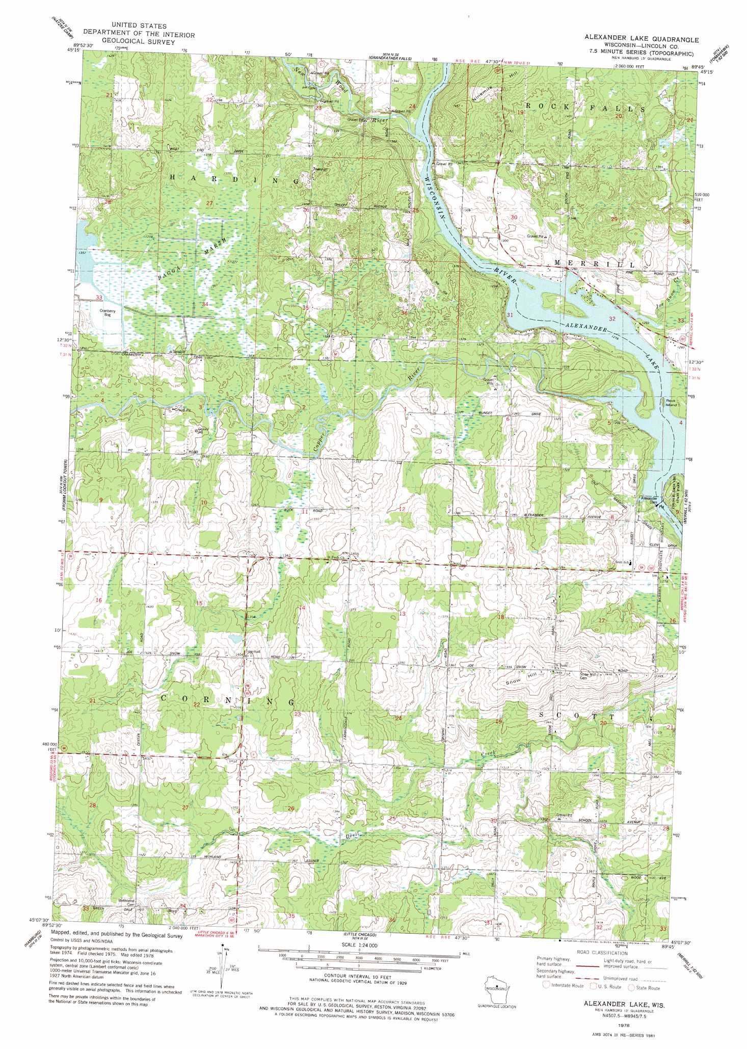
USGS Topo Quad 45089b7 - 1:24,000 scale
| Topo Map Name: | Alexander Lake |
| USGS Topo Quad ID: | 45089b7 |
| Print Size: | ca. 21 1/4" wide x 27" high |
| Southeast Coordinates: | 45.125° N latitude / 89.75° W longitude |
| Map Center Coordinates: | 45.1875° N latitude / 89.8125° W longitude |
| U.S. State: | WI |
| Filename: | o45089b7.jpg |
| Download Map JPG Image: | Alexander Lake topo map 1:24,000 scale |
| Map Type: | Topographic |
| Topo Series: | 7.5´ |
| Map Scale: | 1:24,000 |
| Source of Map Images: | United States Geological Survey (USGS) |
| Alternate Map Versions: |
Alexander Lake WI 1978, updated 1979 Download PDF Buy paper map Alexander Lake WI 2010 Download PDF Buy paper map Alexander Lake WI 2013 Download PDF Buy paper map Alexander Lake WI 2015 Download PDF Buy paper map |
1:24,000 Topo Quads surrounding Alexander Lake
Spirit |
Spirit Falls |
Coffee Creek |
Tomahawk |
Harrison |
Wood Lake |
Natzke Camp |
Grandfather Falls |
Irma |
Bloomville |
Goodrich |
Fromm Lookout Tower |
Alexander Lake |
Merrill |
Pine Dells |
Athens |
Hamburg |
Little Chicago |
Brokaw |
Nutterville |
Wien |
Edgar |
Marathon |
Wausau West |
Wausau East |
> Back to 45089a1 at 1:100,000 scale
> Back to 45088a1 at 1:250,000 scale
> Back to U.S. Topo Maps home
Alexander Lake topo map: Gazetteer
Alexander Lake: Dams
Alexander Dam elevation 389m 1276′Alexander WP200 Dam elevation 389m 1276′
Alexander Lake: Islands
Rock Island elevation 390m 1279′Alexander Lake: Reservoirs
Alexander Flowage 2520 elevation 389m 1276′Alexander Lake elevation 389m 1276′
Alexander Lake: Streams
Copper River elevation 389m 1276′Garrison Creek elevation 408m 1338′
Joe Snow Creek elevation 390m 1279′
New Wood River elevation 389m 1276′
Alexander Lake: Summits
Ninemile Hill elevation 454m 1489′Snow Hill elevation 452m 1482′
Alexander Lake: Swamps
Bagga Marsh elevation 415m 1361′Alexander Lake digital topo map on disk
Buy this Alexander Lake topo map showing relief, roads, GPS coordinates and other geographical features, as a high-resolution digital map file on DVD: