Gleason Topo Map Wisconsin
To zoom in, hover over the map of Gleason
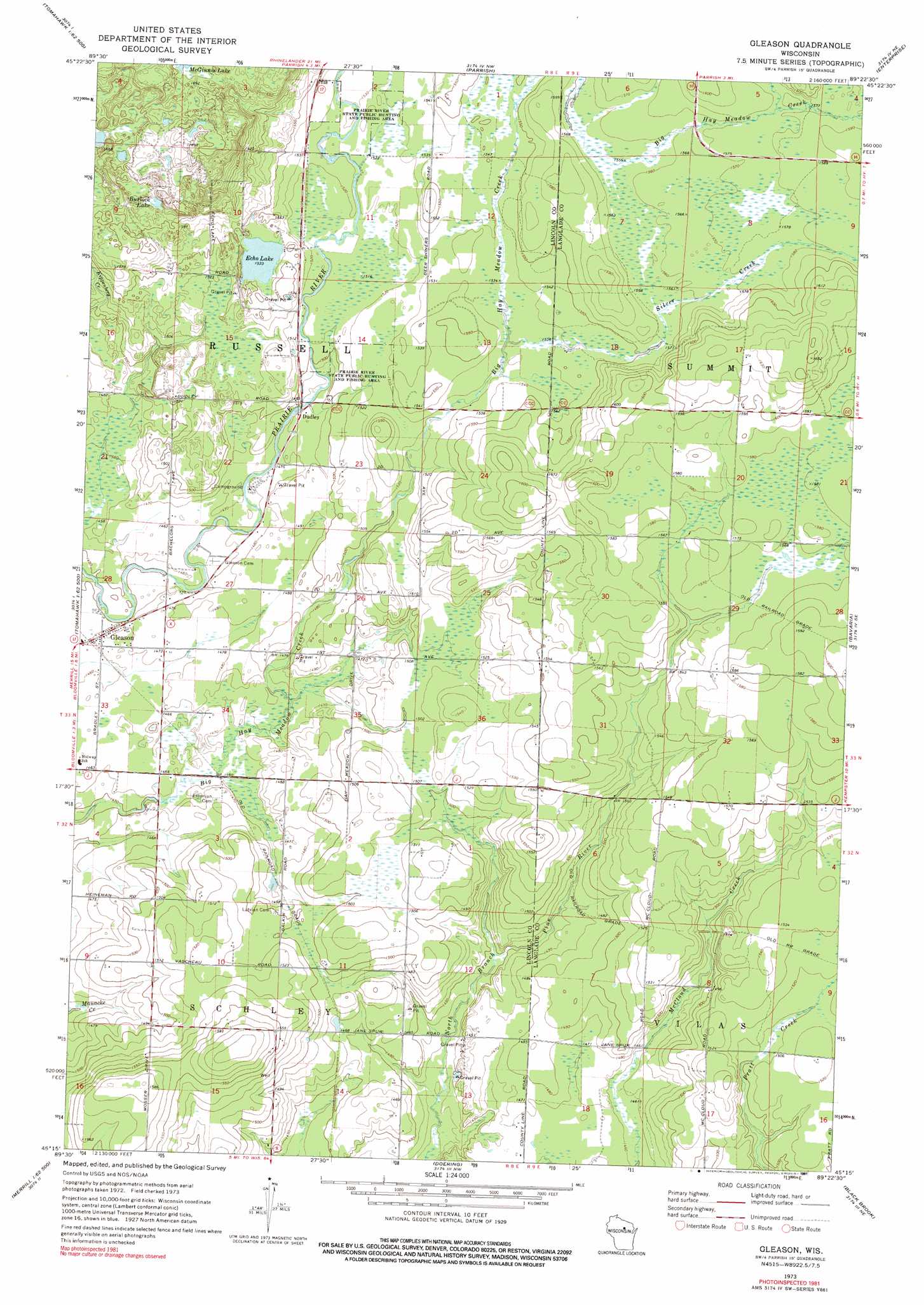
USGS Topo Quad 45089c4 - 1:24,000 scale
| Topo Map Name: | Gleason |
| USGS Topo Quad ID: | 45089c4 |
| Print Size: | ca. 21 1/4" wide x 27" high |
| Southeast Coordinates: | 45.25° N latitude / 89.375° W longitude |
| Map Center Coordinates: | 45.3125° N latitude / 89.4375° W longitude |
| U.S. State: | WI |
| Filename: | o45089c4.jpg |
| Download Map JPG Image: | Gleason topo map 1:24,000 scale |
| Map Type: | Topographic |
| Topo Series: | 7.5´ |
| Map Scale: | 1:24,000 |
| Source of Map Images: | United States Geological Survey (USGS) |
| Alternate Map Versions: |
Gleason WI 1973, updated 1976 Download PDF Buy paper map Gleason WI 1973, updated 1991 Download PDF Buy paper map Gleason WI 2010 Download PDF Buy paper map Gleason WI 2013 Download PDF Buy paper map Gleason WI 2015 Download PDF Buy paper map |
1:24,000 Topo Quads surrounding Gleason
Heafford Junction |
Woodboro |
Lake Julia |
George Lake |
Monico |
Tomahawk |
Harrison |
Parrish |
Enterprise |
Elcho |
Irma |
Bloomville |
Gleason |
Bavaria |
Kempster |
Merrill |
Pine Dells |
Doering |
Black Brook |
Antigo |
Brokaw |
Nutterville |
Kalinke |
Hogarty |
Aniwa |
> Back to 45089a1 at 1:100,000 scale
> Back to 45088a1 at 1:250,000 scale
> Back to U.S. Topo Maps home
Gleason topo map: Gazetteer
Gleason: Airports
Haymeadow Airport elevation 455m 1492′Gleason: Lakes
Burlock Lake elevation 494m 1620′Echo Lake elevation 467m 1532′
McGinnis Lake elevation 512m 1679′
Gleason: Populated Places
Dudley elevation 450m 1476′Gleason elevation 447m 1466′
Gleason: Streams
Silver Creek elevation 466m 1528′Gleason digital topo map on disk
Buy this Gleason topo map showing relief, roads, GPS coordinates and other geographical features, as a high-resolution digital map file on DVD: